Most Oregon road trip plans start with a number: seven days, ten days, two weeks. The number comes first because it’s easy to publish, but it skips the question that decides the trip. Which part of Oregon are you driving, and what separates it from the next part?
The answer is usually the Cascades. The coast, the Willamette Valley and the western Columbia River Gorge sit on one side of the range. Central Oregon, the southern Cascades and the eastern high desert sit on the other, with a set of mountain highways between them. Portland is a common place to land, in the northwest corner, but it isn’t the only starting point. This guide plans an Oregon road trip by region, season and crossing first, and by day count last.
Oregon Road Trip at a Glance
| Region | What the Trip Offers | Seasonal Consideration | Best Suited To | Main Planning Issue |
|---|---|---|---|---|
| Oregon Coast | A coastal drive that works in sections | Check road and weather conditions for your dates | Shorter trips, one-section stays | Time for stops and road status |
| Willamette Valley and western Gorge | Valley towns and the Gorge, close to Portland | Winter storms have closed I-84 in the Gorge | A base near Portland | Route choice and trip shape |
| Central Oregon and Bend | An inland base east of the range | Mountain crossings can close in storms, and one is seasonal | Inland destinations | Crossing the range and services |
| Crater Lake and the southern Cascades | A national park in the southern range | The park is open year-round, but Rim Drive and the North Entrance Road close for the season | Trips that include a national park | A long spur and Rim Drive status |
| Eastern Oregon high desert | Steens Mountain and the Alvord Desert | Seasonal gates on the Steens Mountain Loop Road | A deliberate extension | Distance, services and road status |
None of these is the best region. They’re different planning problems.
Why Day-Count Itineraries Can Mislead
A day count assumes distance is the cost. In Oregon, the cost is often the crossing and the spur. Published driving times from Portland to Crater Lake range from about four to five hours, and Bend to Crater Lake from about two to two and a half hours, depending on route and source. Those gaps are why a seven-day plan can look fine on paper and leave you spending the week in the car.
The same number of days can support very different trips. A drive-through trip covers ground. An exploration trip stays put. A route that depends on a seasonal road may not be open when you arrive. Services and overnight locations decide where you can stop. And the return leg changes the math if you must get back to where you began.
The Cascades Divide: Choose Your Oregon Planning Region
The Cascades are a planning boundary, not a rule that every road behaves the same way. Think of three areas: west of the Cascades, the routes that cross them, and Central and Eastern Oregon.
Crossings matter because choosing one can decide your next destination, your overnight and your fallback. That’s the idea of a commitment point, which our Beartooth Highway guide applies to a road with few exits. A closure on a crossing can force a large change to the day’s route, so the crossing belongs in the plan before the stops do.
The range isn’t a clean line between year-round access in the west and seasonal access in the east. Some crossings are main highways that close in storms, and one popular crossing is a seasonal scenic road.
West of the Cascades: Coast, Valley and Gorge
Oregon Coast
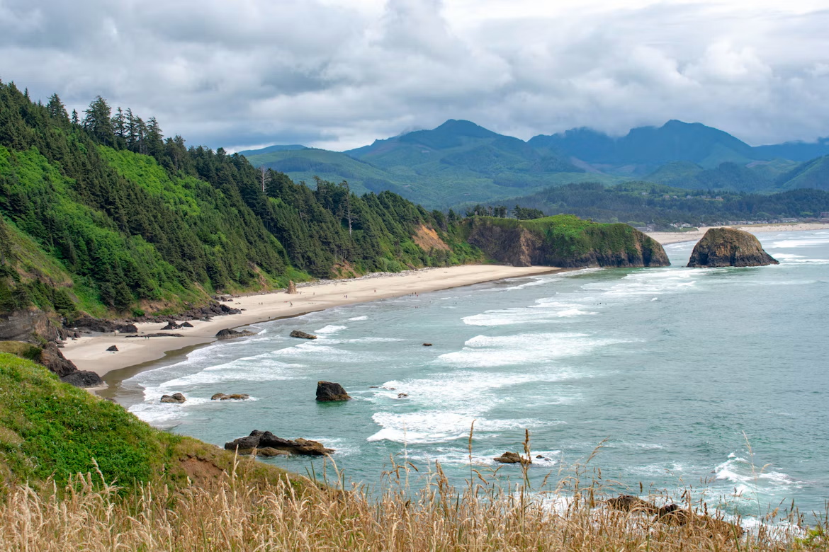
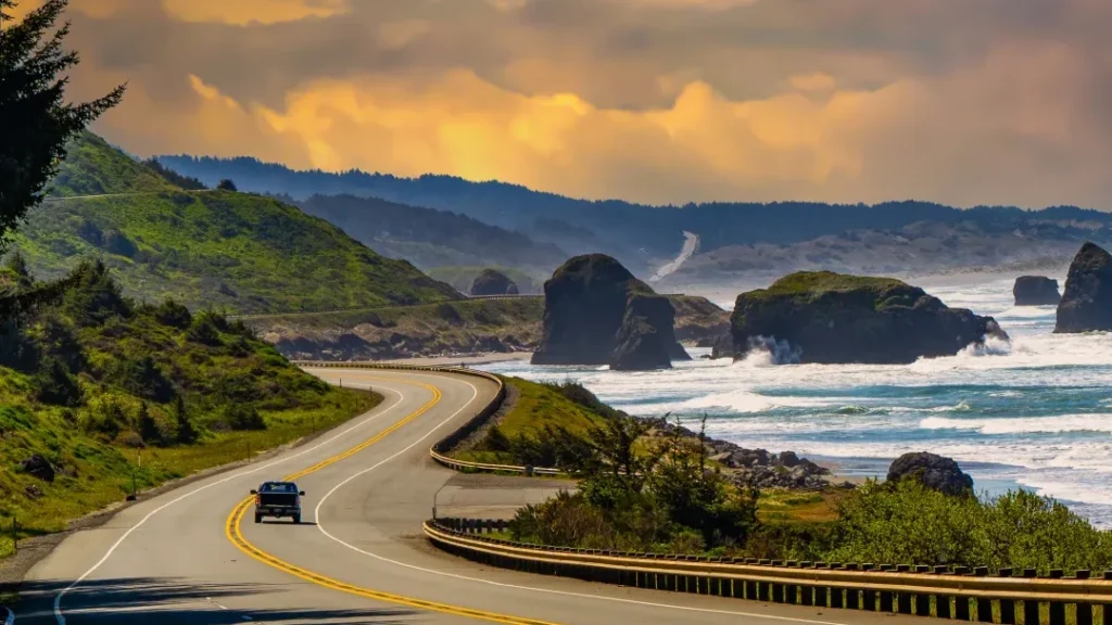
A coast trip works well in sections. You can base in one stretch and explore it, instead of driving the whole coast, and the time for stops is usually the limit, not the miles. Check road conditions and any seasonal restrictions for the section you plan to drive. Our Oregon Coast road trip guide covers the route, the stops and the planning in depth.
Willamette Valley and the Western Columbia River Gorge
The valley and the western Gorge sit close to Portland and fit easily into a western trip or a start to a longer one. The planning questions are route choice and trip shape, not an attraction list. Winter storms have closed Interstate 84 through the Gorge, which shows that even the busiest corridor needs a status check. Our Columbia River Gorge guide covers the drive, parking and permits.
Crossing the Cascades: Treat Passes as Commitment Points
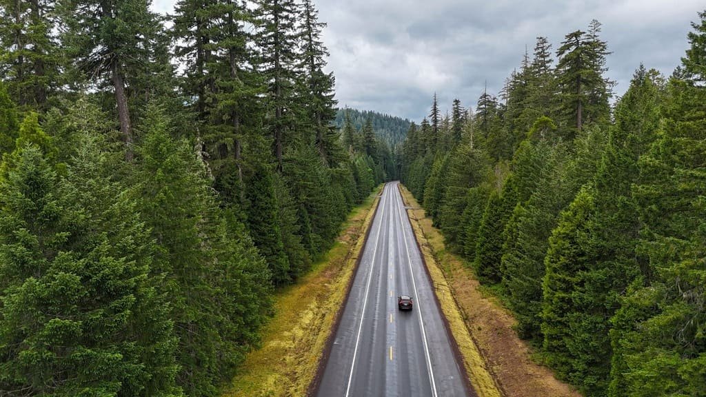
These four crossings show the range of what a crossing can mean. The Oregon Department of Transportation’s TripCheck is the official source for all of them, and the National Park Service reports park roads.
| Crossing | Connects | Seasonal or Weather Consideration | If It’s Unavailable |
|---|---|---|---|
| US-26 over Mount Hood | The Portland area and Central Oregon | Winter storms have closed sections of the highway | Another route, with its own conditions |
| US-20 over Santiam Pass | The Willamette Valley and the Sisters and Bend area | Storms have closed it, with ODOT advising extra time on all Cascade highways | Another crossing |
| OR-242 over McKenzie Pass | McKenzie Bridge and Sisters | A seasonal scenic highway that ODOT closes from about November to mid-June each year | US-20 or another main highway |
| OR-138, OR-62 and OR-230 | The southern Cascades and Crater Lake | Winter storms have closed them for stretches | Another approach to the park |
McKenzie Pass is the clearest case of a seasonal crossing. ODOT says the highway closes each winter, that the gates can close each side separately, and that the pass has no services or cell coverage. Other crossings are main highways that close in storms. Our road conditions guide explains how to match the source to the road.
Central and Eastern Oregon: Beyond the Coast and Bend
Central and Eastern Oregon deserve their own planning, not a tack-on to a Portland itinerary. Distances are longer, services thin out, and seasonal access differs.
Central Oregon and Bend
Bend works as a base or transition point for inland destinations east of the range. The questions are route shape, the distance to each destination, services and overnight locations, and the season. Published estimates put Portland to Bend at a little over three hours.
Crater Lake as a Route Decision
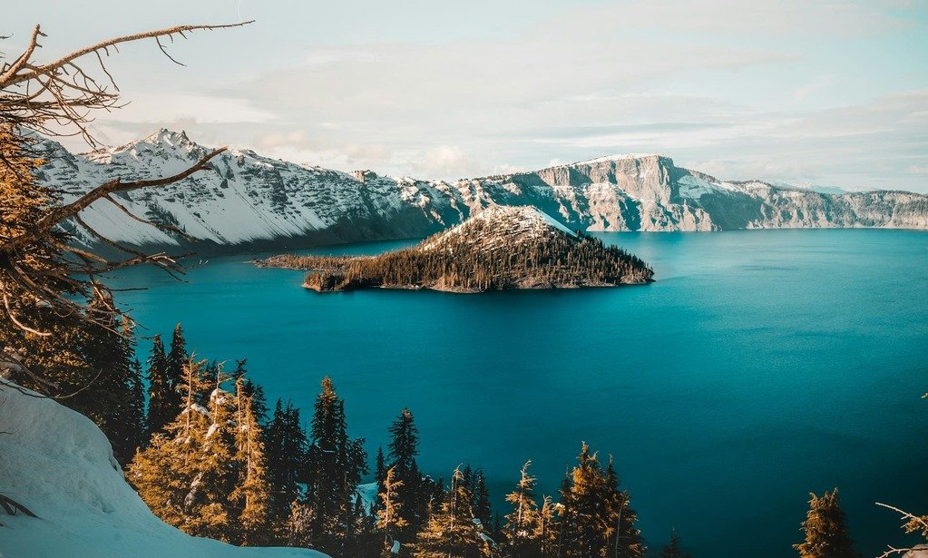
Reaching Crater Lake National Park and driving the full Rim Drive are two separate questions. The NPS says the park is open year-round, and that Highway 62 and the road to Rim Village are plowed through the winter. Rim Drive and the North Entrance Road close for the season with the first big snowstorm or on November 1, whichever comes first. The NPS gives no set reopening dates. It says plowing typically begins on West Rim Drive in mid-April and all roads are ready by mid-July, depending on snow, weather and crews. Check the park’s current conditions page, and don’t assume the full Rim Drive is open because the park is.
The park fits naturally into a southern Oregon trip, where a regional airport such as Medford is roughly an hour and a half away by published estimates. From Portland it’s a long spur of about four to five hours each way, so adding it can mean a lot of backtracking.
Eastern Oregon’s High Desert: Steens Mountain and the Alvord Desert
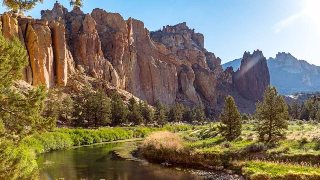
Steens Mountain and the Alvord Desert show how the planning problem changes beyond Bend. The Bureau of Land Management says the Steens Mountain Loop Road ranges from 4,200 to 9,500 feet and isn’t fully open year-round because of snow. Four seasonal gates open and close with snow conditions, and the BLM’s general timeline has the full loop open from early July to mid-October. It recommends high-clearance or four-wheel-drive vehicles for the steep, rocky portion near South Steens Campground. The Alvord Desert lies below the mountain’s east face, and the BLM’s Burns District and TripCheck are the places to check conditions.
These destinations work better as a deliberate extension than as a casual add-on, because distances, services and road status all need planning. If your route continues into the far southeast, the clock changes: under federal rules, most of Malheur County, including Ontario, is on Mountain Time.
The Best Time for an Oregon Road Trip: A Seasonal Planning Matrix
No season is best for everything. The matrix shows what to ask, not when to go.
| Season | Regional Planning Consideration | Access or Service Question | What to Verify |
|---|---|---|---|
| Spring | Seasonal roads and facilities are reopening, and elevation matters | Are the high roads and facilities you need open yet? | Status of each crossing, Rim Drive and the Steens gates |
| Summer | More roads are available, but conditions still vary | Is the specific segment open, and could fire or smoke change it? | TripCheck, the NPS and wildfire information |
| Fall | Operating periods end and storms arrive | What’s still open, and what could close early? | Closing dates for roads and services |
| Winter | Main highways stay open most of the time, with closures in storms | Is a crossing viable, and what’s the fallback? | Current road and weather conditions, and chain requirements |
For partial-access planning in spring and fall, see our shoulder-season guide, and for winter conditions, our winter road trip guide. Fall color timing has its own guide.
Oregon Trip Load: How Much Route Complexity Are You Taking On?
Trip Load measures what a driving day demands beyond its mileage. Oregon Trip Load is a Miles & Mapped planning framework, not an industry metric. It has five elements:
- Range crossings. How much does the itinerary depend on crossing the Cascades?
- Season. How likely are road or facility schedules to constrain your route?
- Distance between regions. How much driving does it take to combine your destinations?
- Services. Are fuel, charging, food and lodging available where and when you need them?
- Wildfire exposure. Could smoke, closures or changing conditions affect the route?
The factors interact. A coast-focused trip with nearby alternatives has a modest load. A trip that combines Crater Lake, Bend and a remote high-desert destination carries a high one, because each leg adds a crossing, a season question and a service gap. There’s no score. Our service-gap planning guide covers fuel, charging and food gaps, and our wildfire season guide covers fire and smoke. Our planning guide describes the wider method.
Where to Start, Which Way to Travel and How to Get Back
Portland is a natural starting point for western Oregon, but it isn’t the only one. A Portland-based loop returns you to the airport, a regional loop can start and end somewhere else, and a one-way trip can finish in another city.
That raises Return Load, a Miles & Mapped framework for the time, mileage, cost and friction of getting back to where you started. A loop can add return mileage you didn’t plan to drive, especially from Portland to Crater Lake and back. A one-way trip can reduce that, while adding rental availability, drop-off terms, airport transfers and flight logistics. Neither is better in general. Compare real quotes, and use our one-way vs. loop guide to weigh them.
Check Status Before Every Important Crossing
Verify status before you commit to a crossing or a remote section. Use the controlling source for each road:
- ODOT TripCheck for state highways and traffic, though it doesn’t cover every road
- The NPS for park roads, such as Crater Lake’s Rim Drive
- The BLM for roads it manages, such as the Steens Mountain Loop Road
- Official weather and wildfire information for changing conditions
A navigation app isn’t the authority on a closure. A road can be open while a facility is closed, and a park can be open while a scenic road isn’t. ODOT has noted that a highway open at departure can close within the hour when a fire changes. Recheck before each crossing, and use our wildfire guide and our shoulder-season guide where they apply.
How Many Days Do You Need for an Oregon Road Trip?
Use ranges, not promises. The right length depends on the footprint, the stops, road conditions and how much of the trip is driving.
| Trip | What It Realistically Covers |
|---|---|
| A few days | One region, such as a coast section or Portland, the Gorge and Mount Hood |
| About a week | Two connected regions, with one crossing |
| Ten days to two weeks | A longer route that adds Central Oregon and Crater Lake |
| Longer | A route that adds Eastern Oregon as a deliberate extension |
A seven- or ten-day trip isn’t enough to cover the whole state. Confirm the driving between your overnights with live routing.
Common Oregon Road-Trip Planning Mistakes
- Choosing a day count before the regions.
- Assuming the Cascades have one uniform seasonal pattern.
- Adding Crater Lake without counting the route implications.
- Assuming park access means the full Rim Drive is open.
- Combining the coast, Bend and Eastern Oregon without counting the distance.
- Ignoring services and overnight locations.
- Skipping an official status check before a major crossing.
- Forgetting the return leg on a loop or one-way route.
FAQs
What is the best time for an Oregon road trip? It depends on the region and the roads you need. Summer opens the most roads, but check each segment, and fire and smoke can change plans.
How many days do you need for an Oregon road trip? It depends on how many regions you want and whether you cross the Cascades. See the planning ranges above.
Can you see Oregon in a seven-day road trip? You can see a few regions, not the whole state. Choose one or two connected regions and one crossing.
Is ten days enough for an Oregon road trip? It can cover the coast, the Gorge, Central Oregon and Crater Lake at a realistic pace, but not the whole state.
Can you drive the full Rim Drive at Crater Lake? Only when it’s open. The NPS says Rim Drive closes for the season with the first big snowstorm or on November 1, and reopening depends on snow and weather.
Is Eastern Oregon worth adding to a road trip? It suits a deliberate extension with time for distance and services. It works poorly as a quick add-on.
How do you check road conditions in Oregon? Use ODOT TripCheck for state highways, the NPS for park roads and the BLM for its roads. Our road conditions guide explains how.
PLAN YOUR TRIP YOUR WAY
Build a day-by-day itinerary around your time, pace, interests, and budget.
A workable Oregon road trip itinerary depends on the region, the season, the crossings, the services and the return, not only the days you have. Start with the Miles & Mapped trip planner.