The Great River Road runs through ten states, and that’s the first thing that makes planning a Great River Road trip harder than it looks. It isn’t one highway. It’s a series of designated roads, marked by green and white pilot’s wheel signs, that follow the Mississippi River from Minnesota toward the Gulf of Mexico. Each state decides which roads carry the route, and each one looks different.
That’s why the first planning decision isn’t the route. It’s the segment. Some travelers have a weekend and want one regional stretch. Others have a couple of weeks and want to drive much of it, which brings direction, overnight stops, services and the return trip into the plan. This guide covers how the route works, how to find a reliable map, and how to choose a segment, a direction and a trip shape that fits the time you have.
Great River Road Trip at a Glance
| Planning Factor | What to Know |
|---|---|
| States | Ten: Minnesota, Wisconsin, Iowa, Illinois, Missouri, Kentucky, Tennessee, Arkansas, Mississippi and Louisiana |
| Designation | A National Scenic Byway. The Federal Highway Administration (FHWA) lists eight of the states as All-American Road, and Mississippi and Missouri as National Scenic Byway |
| Route character | Designated roads in each state, not one continuous highway |
| Navigation | A pilot’s wheel on a sign, per the Mississippi River Parkway Commission (MRPC) |
| Length, FHWA | 2,069 miles in its data table. Its description of the byway says 3,000 miles |
| Length, MRPC | About 3,000 miles |
| Travel time, FHWA | Allow six days to drive it or ten days to enjoy it |
| Travel time, MRPC | About 36 hours of straight driving north to south. Most people allow four to five days |
| Trip shapes | End to end, one segment and back, or a loop that uses river crossings |
| Always verify | Each state’s route information and current road conditions |

Why the Great River Road’s Length and Travel Time Can Differ
How long is the Great River Road? The two official sources don’t agree, and neither says why. FHWA’s America’s Byways page lists 2,069 miles in its data field while its own description of the byway says 3,000 miles. The MRPC says about 3,000 miles. The time estimates differ too. FHWA says to allow six days to drive it and ten to enjoy it, and the MRPC says about 36 hours behind the wheel, with four to five days typical.
This guide shows each figure separately and doesn’t average them. The sources don’t explain the gap, so guessing at it wouldn’t help you plan. What helps is separating four different questions:
- the designated route’s overall length
- the time to drive it without sightseeing
- the time for a practical trip with stops, meals and overnight stays
- the time for a single segment
Total mileage doesn’t produce a useful itinerary on its own. You may follow different designated roads in each state, make detours and spend time in river towns. There’s no universal minimum number of days.
How the Great River Road Works: Ten States and the Pilot’s Wheel
The route is made of roads each state designates. The pilot’s wheel on a sign marks them, and the road names and numbers change from state to state. Wisconsin’s official Great River Road site describes about 250 miles along Wisconsin State Highway 35, marked by a green and white pilot’s wheel, while noting that in some places a county road runs closer to the river. Minnesota’s route runs about 565 miles, according to a report from the state’s MRPC committee. Those two examples are enough to show why one description can’t cover the whole route.
Use the signs, and cross-check them against official maps and each state’s route information. A navigation app won’t necessarily follow the designated route, so don’t assume it will without checking.
How to Find a Great River Road Map
Map searches are common for this route, and the useful map depends on what you want. A route map shows the designated road. A road-status source tells you whether it’s open. They answer different questions.
Start with the official sources, in this order:
- The Mississippi River Parkway Commission’s Great River Road site, which offers a free 10-state travel map you can order and links to state information. Check its maps page for interactive versions.
- Each state’s own Great River Road site, such as Wisconsin’s.
- The FHWA’s America’s Byways page, which includes a map and the official designations.
- The relevant state transportation agency for current conditions.
A general digital map can help with directions between towns, but it isn’t a reliable source for the designated route. If you plan to use one, compare it with the signs and an official map as you go.
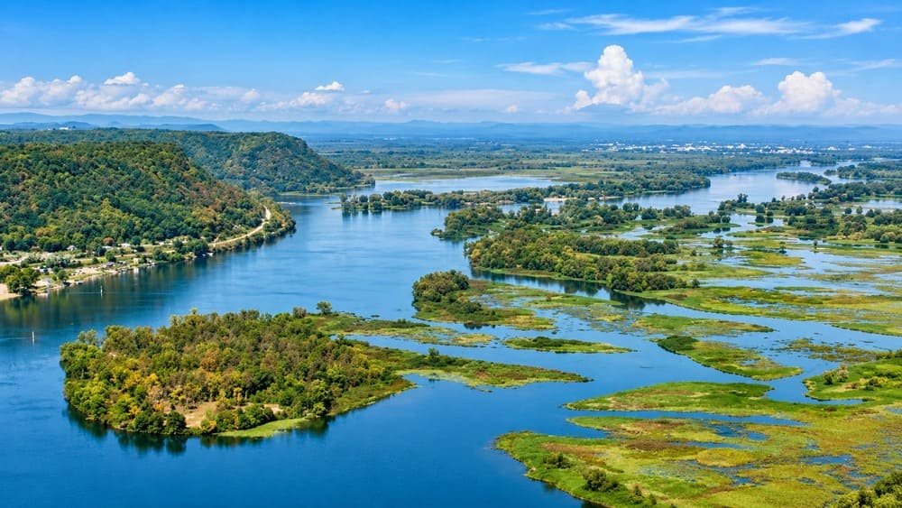
Choose Your Great River Road Segment
Upper, middle and lower river are our planning divisions, not official MRPC classifications. Use them to narrow your choice before you look at any state’s detail.
| Planning Segment | General Area | What to Consider | Trip Type It May Suit | Where to Find Official Information |
|---|---|---|---|---|
| Upper river | Minnesota, Wisconsin and Iowa | The route’s designated roads differ by state, and river crossings connect the two banks | A weekend or a regional loop | MRPC state pages and each state’s site |
| Middle river | Illinois, Missouri, Kentucky and Tennessee | The route’s character changes by state, so check each state’s roads | A longer regional trip | MRPC state pages and each state’s site |
| Lower river | Arkansas, Mississippi and Louisiana | River conditions and each state’s route information | A trip focused on the southern states | MRPC state pages and each state’s site |
Decide whether you want a shorter regional experience or a longer multi-state journey, and choose the segment that matches. Don’t try to cover every state in a short trip.
Choose the Trip Shape
Drive the Route End to End
An end-to-end drive is a point-to-point trip, so the return journey has to be planned separately. Return Load, the Miles & Mapped framework from our one-way vs. loop guide, is the time, mileage, cost and friction of getting back to where you started. For a route this long, the return can cost more than the drive did.
Think about where you start and finish, how many days you have, where you’ll sleep and how you’ll follow the designated route through each state. Completing the route and exploring it are different trips, and they take different amounts of time.
Choose One Segment and Return
A single segment fits a limited schedule or a fixed home base. You pick a region, drive it, and return to the starting area. The trade-off is revisiting roads against spending the saved time in one region. Wisconsin’s segment alone is about 250 miles, and Minnesota’s is about 565, so a single state can fill a trip.
Create a Loop Using River Crossings
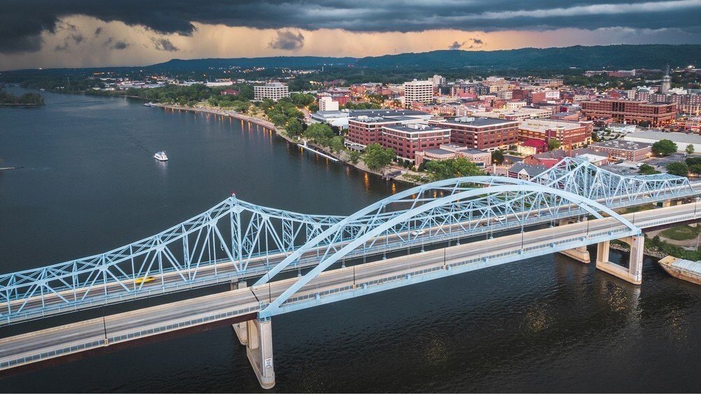
A loop can cross the Mississippi and use roads on both banks. The loop itself won’t follow the Great River Road continuously, so be clear about where you leave the designated route and where you rejoin it. Local tourism material from Prairie du Chien, Wisconsin, describes loops that cross into Iowa and come back, which shows the idea.
Verify any crossing before you plan around it. A map connection doesn’t prove a crossing is usable. The Iowa 9 and WIS 82 bridge at Lansing, for example, was closed for replacement in 2025 and 2026, with a ferry in service and the US-18 bridge at Prairie du Chien and Marquette, roughly 30 miles south, as the nearest highway bridge. Check each crossing’s current status with the state transportation agencies before committing.
Which Direction Should You Drive?
Neither direction is better in general. Choose it from logistics:
- where you live or which airport you arrive at
- which segment matters most to you
- where you want to end
- how much time you have
- how you’ll get back
- where the practical overnight stops fall
For example, a traveler who lives in the Midwest and wants the upper river might start at home and drive south, finishing at a bridge or airport near the southern end of the segment. A traveler flying in might choose the direction that ends nearest a convenient flight home. The point is to fit the route to the trip, not to race to complete it.
Great River Road Trip Load
Great River Road Trip Load is a Miles & Mapped planning framework, not an industry metric. It describes how much planning a route demands beyond its mileage. It has five elements:
- Signed-route navigation. How much attention does it take to follow the designated route across changing state roads?
- Distance between river towns. How much time does it take to move between your overnight stops and destinations?
- Services. Are fuel, charging, food and lodging available where and when you need them?
- Flood and closure exposure. Could high water, detours or road closures affect the route?
- Time per segment. How much of your time is driving, and how much is exploring?
The elements interact. A short regional trip with several alternatives carries a different burden from a long point-to-point journey that depends on several crossings and overnight locations. There’s no score. Our guide to planning a road trip covers the wider method, our service-gap guide covers services, and our road conditions guide covers status checks.
Check Road Status, Flooding and Seasonal Conditions
The route crosses ten states, so no single road-information service covers all of it. Use the source for the road in question:
- The state transportation agency for the road. FHWA’s national traffic information page links each state’s official source.
- Each state’s Great River Road information for the designated route.
- The National Weather Service for weather, and its National Water Prediction Service for river levels and flood forecasts at gauges along the Mississippi.
- Navigation apps for routing, not as the authority on closures.
A route’s designation doesn’t guarantee that every segment is open or unaffected by high water. River levels are a signal, but the road authority is the source for whether a road is closed. This guide makes no claim about how often any state floods. Our road conditions guide and our shoulder-season guide explain how to check partial access in spring and fall.
Services Across Long Stretches
Plan fuel, charging, food and lodging for the segment you’re driving, not by a universal distance. Confirm the services at your intended stops and their operating hours, and have an alternative for any overnight or essential stop. A detour can change the order of your day, and some services matter more than others. This guide invents no fuel intervals and doesn’t claim any part of the route has long service gaps. Our service-gap planning guide covers the method.
How Long Does It Take to Drive the Great River Road?
The official answers are above. FHWA says to allow six days to drive it, or ten to enjoy it, and the MRPC says about 36 hours of straight driving, with most travelers allowing four to five days. Here’s what that means for planning.
| Trip | What It Realistically Covers |
|---|---|
| A weekend | One regional segment, or part of one state’s route |
| About a week | Several states’ segments, or a long single stretch |
| FHWA’s six to ten days, or longer | The full route, at the pace of a drive-through or an exploration |
These are planning ranges drawn from the official figures, not recommendations. They assume you’re driving the designated route and stopping along it. A route this long can’t be covered in any set number of days, so choose the segment first and let the time follow.
Pairing the Great River Road With the Natchez Trace Parkway
Some travelers combine part of the Great River Road with the Natchez Trace Parkway, which begins at Natchez, Mississippi, on the river. They’re separate routes, and combining them changes the shape, the mileage and the return. Treat it as a deliberate pairing, not an assumption that they connect in every itinerary. Our Natchez Trace Parkway guide covers that route.
Common Great River Road Planning Mistakes
- Treating the route as one continuous highway.
- Following a general navigation app without checking the designated route.
- Assuming every state uses the same highway designation.
- Treating the FHWA and MRPC length figures as interchangeable.
- Choosing a day count before choosing a segment.
- Ignoring the return leg.
- Building a loop without verifying the crossings.
- Assuming the route’s designation guarantees current access.
- Failing to check essential services.
FAQs
How long is the Great River Road? The sources differ. FHWA’s data table lists 2,069 miles, and its description says 3,000 miles. The MRPC says about 3,000 miles.
How many states does the Great River Road pass through? Ten: Minnesota, Wisconsin, Iowa, Illinois, Missouri, Kentucky, Tennessee, Arkansas, Mississippi and Louisiana.
Where does the Great River Road start and end? The MRPC and FHWA describe it as running from Minnesota toward the Gulf of Mexico. Check each state’s official information for exact points.
Is the Great River Road one highway? No. It’s a designated route made up of different roads in each state, marked by pilot’s wheel signs.
Where can I find a Great River Road map? Start with the MRPC’s site, which offers a free 10-state map, then the state sites and FHWA’s page. A route map isn’t a road-status source.
How long does it take to drive the Great River Road? FHWA says allow six days to drive it, or ten to enjoy it. The MRPC says about 36 hours of straight driving and four to five days for most travelers.
Can I drive only part of the Great River Road? Yes. Many travelers choose one segment, such as a single state’s section.
Can I use Google Maps to follow the Great River Road? We haven’t verified that a navigation app follows the designated route. Use the signs and an official map, and treat an app as a routing aid.
PLAN YOUR TRIP YOUR WAY
Build a day-by-day itinerary around your time, pace, interests, and budget.
Choose the segment, then plan the direction, the signs, the time, the services and the return. Start with the Miles & Mapped trip planner.