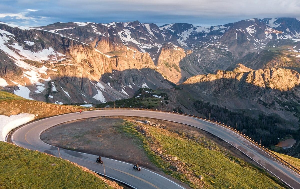
Beartooth Highway runs about 68 miles between Red Lodge and Cooke City, Montana, and climbs to 10,947 feet at Beartooth Pass. Many travelers use it as a way into Yellowstone’s northeast entrance. It is also a seasonal mountain road that can close on short notice, and between its two ends there are few good places to change your mind.
That makes the planning question different from most scenic drives. Along with when the road opens and what to see, you need to know what your trip looks like if the road isn’t available on the day you built around it. Beartooth Highway is only as usable as the sections your itinerary depends on. This guide covers how to check each section, how to measure the load a Beartooth day puts on a trip, where your last easy chances to change plans are, and what each fallback costs.
Beartooth Highway Road Trip at a Glance
| Item | What to know |
|---|---|
| Route | US-212 between Red Lodge, MT, and Cooke City, MT, about 68 miles |
| High point | Beartooth Pass, 10,947 feet |
| Drive time | The Forest Service says the drive takes at least two to three hours without stops, and the road is often windy |
| Season | Seasonal and weather dependent. Montana DOT closes the highway every winter |
| Junction | WY 296 (Chief Joseph Scenic Byway) joins the highway in Wyoming and leads toward Cody |
| Status sources | Montana DOT, Wyoming DOT, and Yellowstone’s park roads page, depending on the section |
| Year-round access to Cooke City | Yellowstone’s road from the North Entrance at Gardiner to the Northeast Entrance is generally open year-round, weather permitting |
For the road itself (stops, viewpoints and route details), see our Beartooth Highway route page. This guide covers how to plan around it.
Why Beartooth needs a Plan B
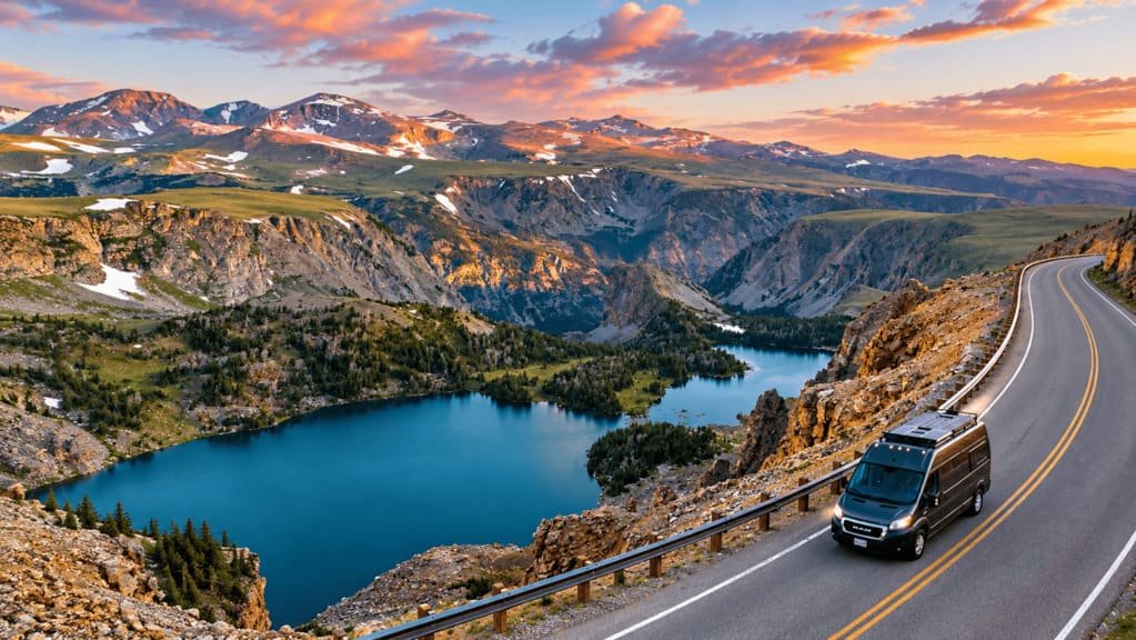
On most scenic drives, the road is the plan. On Beartooth, it is usually a link: you’re getting from Red Lodge to the northeast side of Yellowstone, or the reverse. When a link fails, everything attached to it moves, including tonight’s lodging, tomorrow’s park entrance and any reservation tied to either.
The closure risk is not limited to the winter gate. The Forest Service says to expect winter temperatures and a chance of snow in late spring and early fall, and that snow usually stays at the higher elevations until early to mid-July. Wyoming DOT has closed the Wyoming section ahead of forecast snow and strong wind, and Yellowstone says weather causes occasional closures after the road opens for the season. Our guides to Trail Ridge Road and Going-to-the-Sun Road cover other high-mountain roads, and each has its own timing logic. Beartooth’s planning problem is what happens to the rest of the trip when this road isn’t available.
Why the season is a range, not a date
The Forest Service describes a season that depends on weather and advises checking in advance when you travel close to the open and close dates, because conditions can change quickly. Opening day moves from year to year, and the road doesn’t always open in one piece. In some years a short segment out of Red Lodge has been drivable while crews cleared the rest.
So there is no permanent open or closed answer to rely on. A road that is open as far as a closure gate is not open to Cooke City. Check the current status before you leave and again before you commit to the climb.
How to check Beartooth Highway status
Three parts of the road have different status sources. This split follows the official announcements, and you should confirm it against each agency’s current page.
| Section | What it covers | Where to check |
|---|---|---|
| Red Lodge to the Montana/Wyoming line | The Montana side, climbing out of Red Lodge | Montana DOT travel information |
| Across the plateau in Wyoming | Beartooth Pass and the Wyoming section, including the WY 296 junction | Wyoming DOT road conditions |
| Montana/Wyoming line to Cooke City | The western Montana end, which Yellowstone says it maintains | Yellowstone park roads page |
The Forest Service also lists a ranger district for each part of the corridor on its Beartooth Scenic Byway page, along with a link to the National Weather Service forecast for the pass.
To read them together, ask whether every section your day uses is open, not whether “Beartooth” is open. Agencies update at different times, so a page that says open can lag a page that says closed. When sources disagree, plan on the more cautious one and confirm with a call to the relevant ranger district. Check again at your commitment point.
What is Beartooth Trip Load?
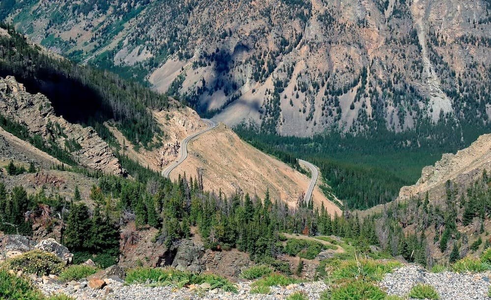
Trip Load measures what a driving day demands beyond its mileage. Return Load and Spur Load apply the same thinking to other parts of a trip. Beartooth Trip Load is a Miles & Mapped planning framework, not an industry metric, and it has four layers:
- Season window. How wide is the range of dates in which this road is likely to be usable, and how close is your trip to either edge?
- Weather exposure. At this elevation, how much can conditions change during the day, and what does a change do to the road?
- Commitment points. Where can you still change plans, and where does changing plans stop being easy?
- Fallback cost. If the road isn’t available, what does the alternative cost in time, lodging, entrances and experience?
A Beartooth day can carry a high Trip Load even when the mileage looks modest, because altitude, weather, limited services and few exits all add to the planning burden. There is no score to calculate. The point is to ask all four questions before you commit a day to the road. For the mileage side of the same idea, see how many miles to drive in a day.
Know your commitment points
A commitment point is a place where you can still change plans easily, and after which you can’t. Beartooth has three.
Red Lodge. This is your last easy chance before the climb. If the status is uncertain here, you can change the day without having spent any of it. Check status the morning you leave, not the night before.
The WY 296 junction. In Wyoming, the Chief Joseph Scenic Byway meets the highway and leads toward Cody. Once you pass over Beartooth Pass toward this junction, the practical way to change plans is to turn back or to take WY 296. Confirm the junction’s position on a current map.
Cooke City. This is the end of the drive, and the start of the Northeast Entrance road. If you arrive and your next move depends on a road that has since closed, this is where changing plans gets expensive.
Ask two questions at each point. What is my last easy opportunity to change the plan? And once I’m past it, what does changing the plan cost? The second question is the fallback cost, which is more than extra miles. It can mean a different overnight, a different entrance, a day lost, or a reversed route.
What happens if Beartooth is closed?
The fallback is rarely just a parallel road. It changes the shape of the trip. The table shows the main options, with costs as planning shorthand and not measured values.
| Fallback | What it preserves | What it changes | Planning cost |
|---|---|---|---|
| Chief Joseph (WY 296) to Cooke City, reached through Cody | Cooke City and the northeast entrance | You approach from the Wyoming side, so the day and the overnight change | Moderate |
| Cody-side approach to Yellowstone | The Yellowstone trip | A different entrance and a different overnight | Higher |
| Approach Cooke City from Gardiner | Cooke City, through Yellowstone | A much longer way around, through the park | Higher |
| Rework the overnight | The core trip | Timing and accommodation | Moderate |
| Skip the scenic drive | The Yellowstone trip | You lose the drive itself | Low logistics, high experience cost |
Two points matter here. First, the Beartooth and the Chief Joseph Scenic Byway are both seasonal. Yellowstone’s park roads page lists them together as roads outside the Northeast Entrance, and weather can close either after the season starts. WY 296 is a fallback for a closure of part of the Beartooth during the season, and it doesn’t help in months when both are closed. Second, Yellowstone’s road from Gardiner to Cooke City is generally open year-round, weather permitting, and it is the reason Cooke City stays reachable when the Beartooth is not. The route between the two is long, so treat it as a last fallback and check its status as well.
If Beartooth closes while you’re on the trip
- Don’t assume it will reopen on your schedule.
- Check the authoritative source for the closed section.
- Find your current commitment point, and decide whether you’re before or past it.
- Recalculate tonight’s overnight before you move.
- Choose the fallback that suits your direction, not the one that looks shortest on a map.
- Don’t improvise from a navigation app alone. Apps can route through a closed road.
Which direction should you drive?
Treat direction as a logistics decision, because that is where it matters. Questions to ask:
- Where did you sleep last night, and where will you sleep tonight?
- Where are you going next, and which entrance or town does the rest of the trip need?
- Which direction puts the better fallback behind you?
- Which end is closer to fuel and services if something changes?
- Where does your lodging become a commitment you can’t easily move?
Rankings that say one direction has better views are a matter of preference. They don’t help with the question that matters most, which is what you do if the road doesn’t open. If your trip ends somewhere other than where it started, the one-way vs. loop guide covers the return leg.
Beartooth Highway and Yellowstone’s Northeast Entrance
Travelers combine Beartooth with Yellowstone because the highway ends at the park’s northeast entrance, in the Cooke City and Silver Gate area. That relationship is why the fallback has to be decided before you travel.
Yellowstone can be open while Beartooth is not. Yellowstone’s park roads page lists the Beartooth and Chief Joseph roads separately from the park’s own roads, and its status for the park doesn’t tell you whether the highway is usable. If Beartooth is unavailable, you may need to rethink how you reach or leave the northeast side of the park. This guide stops there, and a full Yellowstone guide will cover the rest.
Fuel, services, altitude, and vehicle preparation
Fuel before you start. Fill up in Red Lodge or Cooke City, because the road between them runs through mountain country. Confirm current services before you go.
Weather and altitude. The Forest Service advises warm clothes, and the pass is high enough that conditions can differ sharply from the towns at either end. Check the forecast for the pass, not for Red Lodge.
Connectivity. Mountain terrain can limit cell coverage, so download offline maps and write down your fallback before you leave.
Bears. The Forest Service notes that hikes leaving the pass lead into bear country, so carry bear spray and know how to use it if you get out of the car.
Vehicle. Check suitability before you commit. The Forest Service lists the Cooke City campgrounds as hard-sided campers only. Our RV road trip planning guide covers route compatibility in more detail.
Where should you stay?
| Base | Best for | Planning consideration |
|---|---|---|
| Red Lodge | Starting the drive | Good staging before the climb, and the easiest place to change plans |
| Cooke City | Combining Beartooth with the northeast side of Yellowstone | Your options depend on the road’s status |
| Silver Gate | Staying close to the northeast entrance | Same dependence on route status |
Cody is another base worth considering, since the WY 296 fallback runs through it. Check availability and services for any of these before you build the trip around them.
Common mistakes
- Treating “Is Beartooth open?” as a question with a fixed answer.
- Checking one status source and assuming it covers the whole road.
- Booking a non-refundable overnight that depends on the road being open.
- Assuming the Chief Joseph Scenic Byway works as a fallback when both roads are closed.
- Choosing a direction by view and ignoring where the fallback sits.
- Starting the climb without a written plan for what you’ll do if you turn back.
FAQs
Is Beartooth Highway open? There is no permanent answer, because the road is seasonal and weather-dependent. Check the current status for each section before you leave and again before you commit to the climb.
How long does Beartooth Highway take to drive? The Forest Service says at least two to three hours without stops. Plan more if you stop at overlooks or lakes.
Can you drive Beartooth Highway in winter? No. Montana DOT closes the highway every winter. Yellowstone’s road from Gardiner to Cooke City is generally open year-round, weather permitting.
Is the Chief Joseph Scenic Byway an alternative? During the season, it can be a fallback for a closed part of the Beartooth, but it is seasonal as well. Weather can close either road.
Which direction should you drive Beartooth Highway? Either direction works. Choose based on where you slept, where you’re going next, and where your fallback is.
Do you need a Plan B for Beartooth Highway? Yes, because the road can close on short notice and the trip often depends on it.
Is Beartooth Highway suitable for an RV? It depends on the vehicle and your comfort with mountain driving. Check the current guidance, and see our RV planning guide for how to assess route compatibility.
PLAN YOUR TRIP YOUR WAY
Build a day-by-day itinerary around your time, pace, interests, and budget.
Decide the fallback before you decide the date. The Miles & Mapped trip planner can help you lay out the drive, the overnight on each side, and the alternatives before you book anything.