
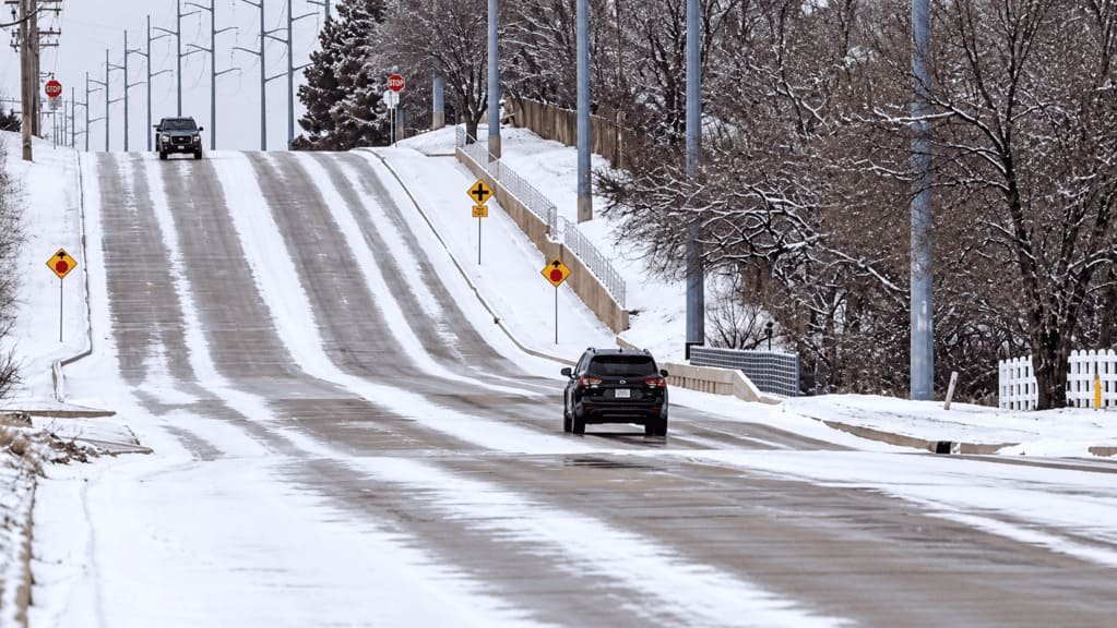
There isn’t one national source for road status. In July 2000, the FCC designated 511 as the national traveler information number, but the Federal Highway Administration says the ruling left nearly all implementation to state and local agencies and set no federal requirements. What a 511 system covers depends on the state, and no 511 system covers every road you’ll drive.
That makes the first question about the road, not the page. Before you check anything, ask who controls the road you’re about to drive, because that agency is the one that can tell you whether it’s open. Check the agency that controls the road, not just the destination. This guide shows how to match the source to the road, what each source can and can’t tell you, and what to do when sources disagree.
Check Road Conditions: Sources at a Glance
| You’re driving on | Start with | It can tell you | It often misses |
|---|---|---|---|
| Interstate or state highway | State DOT or 511 | Closures, construction, weather-related conditions | Roads the DOT doesn’t manage |
| National park road | The park (NPS) | Road status, seasonal closures, alerts | State highways outside the park |
| National forest road or byway | The Forest Service ranger district | Forest road access and conditions | State-managed sections |
| County road | County public works | Local closures and maintenance | Often no live status page |
| Road on tribal land | The tribal government (BIA or the state, depending on the road) | Access and local conditions | Detail beyond the reservation |
| Ferry | The ferry operator | Schedules, reservations, service changes | Roads leading to the terminal |
| Tunnel, bridge or toll road | The operator or transportation authority | Restrictions and closures | Conditions on approach roads |
| Private access road | The property owner or operator | Access and seasonal limits | Everything else |
The Four Questions to Ask
A road can be open and still not work for your trip. Four questions separate the cases.
- Can I get there? This is open, closed or restricted.
- What is the road like? Snow, ice, flooding, construction, rockfall and wildfire all change a road without closing it.
- Can my vehicle use it? Size, weight, trailers, chain requirements and seasonal limits matter here. Zion National Park, for example, enforces size and weight limits on the Zion-Mt. Carmel Highway, and the limits cover the whole stretch between Canyon Junction and the East Entrance, not only the tunnel. Our RV road trip guide covers route compatibility.
- Can I reach what I’m going to see? A park entrance, trailhead, campground, visitor center or ferry terminal can be closed while the road to it is open.
The last question extends a rule from our winter road trip guide: park open does not mean road open, and road open does not mean the destination is open.
When sources differ, a simple order helps. Trust the agency that controls the road first, then the authority for your destination, then the weather authority. A navigation app is useful for routing and traffic, but it isn’t the final word on closures.
State Highways and Interstates: Start with 511
State DOTs publish traveler information through 511 phone lines, websites and apps. Iowa DOT, for one, describes its system as covering weather-related road conditions, construction, commercial vehicle restrictions and road closures. Other states cover different things, so read what yours includes. Read the map legend and any definitions before you rely on a color or a label, because a closure, a restriction and a caution advisory mean different things for your plan. If your trip crosses a state line, switch to the next state’s system at the line.
Federal Highway publishes a national page that links to each state’s official traveler information. Use it if your state isn’t in the table near the end of this guide.
A DOT system covers the roads the DOT manages. It usually won’t tell you about a park’s internal roads, a county road or a ferry, even when those appear on the same trip.
National Park Roads
National parks post their own road status. Olympic National Park’s current road conditions page lists the status of its park roads, and Yellowstone’s park roads page lists seasonal roads and notes that weather can close them after they open.
Park roads are often seasonal, so the state highway to a park can be open while the park road past the entrance isn’t. That’s why our Olympic Peninsula guide treats each spur as a separate status check. The Olympic Peninsula is a different case from Beartooth: one destination loop that uses several road systems.
The loop highway is a state road, the spurs into the park are park roads, a ferry may start or end the trip, and the far northwest tip is on Makah land, which has its own permit and conditions. Each belongs to a different agency, and a status check for the loop doesn’t cover the spurs. Guides like Trail Ridge Road and Going-to-the-Sun Road send you to the park rather than restating conditions.
National Forest Roads and Scenic Byways
National forest roads are the Forest Service’s responsibility, usually through a ranger district. Scenic byways are where sources multiply, because one road can cross several jurisdictions.
Beartooth Highway is the clearest example. A single road-trip itinerary can require more than one status check, and Beartooth shows why: the route crosses jurisdictions, so checking one page isn’t enough. A drive from Red Lodge to Cooke City can involve a Montana DOT check, a Wyoming DOT check and Yellowstone’s park roads page, and the Forest Service lists a ranger district for each part of the corridor.
The pattern is one itinerary, three relevant authorities, three checks and one decision. If the Montana section is open and the Wyoming section is closed for snow, the itinerary isn’t open, regardless of what the first page says. The decision to start the climb depends on all three. Our Beartooth Highway guide walks through the method, including where to check and where to turn around.
County, Tribal and Private Roads
County roads are managed by the county, and many have no live status page. If the road matters to your plan, call the county public works office or the nearest ranger or visitor center.
Roads on tribal land can be owned or maintained by the tribe, the Bureau of Indian Affairs, a state DOT or a county, sometimes in combination. The Federal Highway Administration’s road safety audit of the Standing Rock Sioux Reservation, for one, lists the tribe, the BIA and two state DOTs as owners of its roads. Check the tribal government’s own site for access and conditions.
Private access roads belong to the owner, such as a lodge, campground or ranch. Ask them.
Bridges, Funnels and Ferries
These have their own operators, and each has its own limits. Ferries are the clearest case. Washington State Ferries takes vehicle reservations on some routes, such as Port Townsend to Coupeville, and not others, and reservations are one way, so you book each direction. A ferry schedule also affects which spur or town makes sense on a given day.
For a tunnel or a historic bridge, check the operator for size, weight and escort rules before you commit a large vehicle to it.
Weather is a Separate Layer
Weather explains why a road changes, and the road agency tells you what the status is. Use the National Weather Service (weather.gov) for forecasts and warnings, and check them for the place you’ll be driving, not the nearest town. A mountain pass can be in different weather from the town at its foot. The Forest Service’s Beartooth page, for example, links a forecast for the pass itself.
Apps vs. Official Sources
Navigation apps are routing tools. Official agencies are the authority on road status. An app can tell you there’s a route without telling you the route is open.
Park staff say so directly. Yellowstone’s site warns that vehicle navigation systems and GPS units can send drivers to dead ends or onto roads closed at certain times of year. Mojave National Preserve staff said that mapping services may show roads as open when they aren’t, and advised checking the National Park Service and Caltrans for current conditions. Apps remain useful for traffic and routing, so use them as one layer and check the agency for the status.
What to Do When Sources Disagree
Suppose the DOT says a road is open, the park alert says caution, and your map shows a route. Don’t average them. Work through it in order:
- Find which authority controls that specific segment.
- Prefer that agency’s current status.
- Check the timestamp. An old update isn’t a current one.
- Where jurisdictions overlap, look for a second authoritative source.
- If it’s still unclear, treat the road as uncertain and use your fallback.
Averaging the sources doesn’t work, because the sources aren’t equal. A park’s alert about its own road outranks a map’s route line, and a DOT’s status for a state highway outranks a news post about it. The goal is to find the source with authority over the road, not to collect more websites.
When to Check Road Conditions
Think of this as a workflow, not a rule. The timing can shift with the trip and the season.
- While you’re researching: identify the authorities for each segment and bookmark them.
- About two days before: look for major closures, storms, construction and access changes.
- The evening before: check the specific segments you’ll drive.
- The morning you leave: check current conditions again.
- At a commitment point: check before you enter a section where turning around gets expensive or difficult. Our Beartooth guide uses commitment points for this.
Build a Route Status Sheet
A road status sheet turns the checks into one page. Make one row for each segment of the route.
| Segment | Road and authority | Status source | Last checked | Vehicle issue | Weather issue | Fallback |
|---|---|---|---|---|---|---|
| Example: mountain highway | State DOT | State traveler information | Evening before | None noted | Pass forecast | Alternate route |
Fill in the authority and source columns while you plan, and the last-checked column each time you look. The vehicle and weather columns are for the things that can turn a good road into a bad day: size limits, chains, snow, heat or wind. The fallback column matters most. Decide it before you need it. Our Miles & Mapped planner is built for planning the route, and the sheet covers the status checks that sit beside it.
State road-condition resources
These are the official traveler-information sources for our first-wave states, as listed on the Federal Highway Administration’s state pages. Use them as a starting directory, and check each one before you rely on it.
| State | Official source | Notes |
|---|---|---|
| California | Caltrans QuickMap and highway conditions | Real-time traffic, construction and winter weather information |
| Arizona | AZ511 | Statewide traveler information |
| Utah | UDOT Traffic | Traffic, construction, travel times and road weather |
| Colorado | COtrip | Includes road work, winter driving, weather warnings and chain law layers |
| Oregon | TripCheck | Road conditions and cameras |
| Washington | WSDOT travel information | Links to construction, weather, ferries and pass conditions |
| Florida | FL511 | Statewide travel information |
| Texas | DriveTexas | Statewide highway conditions map |
| Tennessee | TDOT SmartWay | The state’s intelligent transportation system |
| New York | 511NY | Statewide travel information |
Common mistakes
- Checking one source and assuming it covers the whole trip.
- Checking the destination and not the road to it.
- Treating a navigation app as the authority on closures.
- Relying on a state 511 system for roads the state doesn’t manage.
- Reading an old update as current.
- Checking once, days ahead, and never again.
- Picking a fallback only after the road is closed.
FAQs
Is there one website for road conditions across the U.S.? No. The Federal Highway Administration’s national page links to each state’s official traveler information, and park, forest, county and tribal roads have their own sources.
What is 511? It’s the national three-digit number the FCC designated for traveler information in 2000. States and local agencies decide what their systems cover, and many offer websites and apps too.
Can I rely on Google Maps or Waze for road closures? They’re useful for routing and traffic. For closure status, check the agency that controls the road, because park and forest staff have warned that mapping services can show closed roads as open.
How often should I check road conditions before a road trip? Check when you plan, again a couple of days out, the evening before, the morning you leave and at any point where turning around is hard. Treat that as a workflow and not a rule.
Do national park roads appear on state 511 systems? Not necessarily. A state system covers state-managed roads, and a park manages its own. The Federal Highway Administration’s state pages link to some parks’ road status pages.
Who do I contact if I can’t find a road status? Contact whoever controls the road: the county for county roads, the ranger district for forest roads, the park for park roads, or the tribe for tribal roads.
What if two sources disagree? Find which authority controls that segment, prefer its current status, check the timestamp, and treat the road as uncertain if doubt remains.
PLAN YOUR TRIP YOUR WAY
Build a day-by-day itinerary around your time, pace, interests, and budget.
The route comes first, and the status checks follow. Start with the Miles & Mapped trip planner, then use this guide to confirm each road with the agency that controls it.


1 thought on “How to Check Road Conditions Before a Road Trip: Match the Source to the Road”