
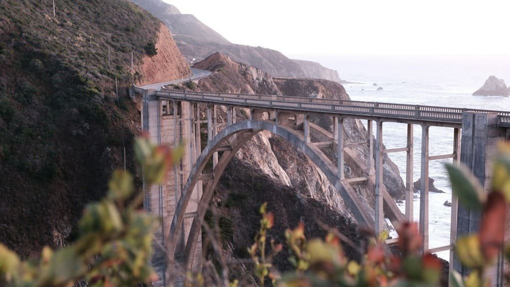
The Pacific Coast Highway runs along roughly 450 to 500 miles of California coastline between San Francisco and Los Angeles, and it’s the drive most people picture when they think “California road trip.” Cliffside curves through Big Sur, redwood groves, Spanish mission towns, and beach cities string together into one of the most photographed routes in the country.
This Pacific Coast Highway Road Trip guide covers what the drive actually takes to plan: how long it runs, how many days you need, where the road tends to close, what each leg of the trip is really like, and what it costs. If you’re deciding whether to drive it in 3 days or 7, or wondering whether Highway 1 or the inland 101 makes more sense for part of the trip, that’s what this article is for.
Quick Facts: Pacific Coast Highway Road Trip
| Total distance (SF to LA) | ~450–500 miles |
| Nonstop drive time | 9–12 hours |
| Recommended trip length | 5–7 days |
| Minimum trip length | 3 days |
| Best time to go | Spring (March–May) and fall (September–November) |
| Best direction | Southbound (keeps you in the outside/ocean-view lane) |
| RV/trailer friendly | Yes, with caution through Big Sur’s narrow curves |
Why Take the Pacific Coast Highway
Most of the PCH’s reputation comes from a single 90-mile stretch through Big Sur, where the road narrows to two lanes and clings to cliffs several hundred feet above the water. The rest earns its place too: Monterey and Carmel-by-the-Sea for coastal towns with real character, San Simeon for Hearst Castle, Santa Barbara for Spanish colonial architecture and a walkable downtown.
The honest tradeoff is speed. Inland I-5 covers the same SF–LA distance in about 6 hours; Highway 1 takes two to three times as long once you factor in the curves, the 25–40 mph sections through Big Sur, and the stops that make the drive worth doing.
How Many Days You Need
- 3 days covers the highlights but means long driving days and little room for detours. Workable if this is a stop on a bigger California trip rather than the main event.
- 5 days is the sweet spot for most travelers — enough time to actually get out of the car in Big Sur, Carmel, and Santa Barbara without feeling behind schedule.
- 7 days lets you add Hearst Castle tours, Channel Islands day trips, or a wine-country detour through Solvang without cutting anything else.
Route Breakdown: Leg by Leg
Distances below are approximate and run southbound from San Francisco.
| Leg | Distance | Drive Time | Notes |
|---|---|---|---|
| San Francisco → Half Moon Bay | ~30 miles | 45 min | Easy warm-up stretch, mostly coastal |
| Half Moon Bay → Santa Cruz | ~45 miles | 1 hr | Beach towns, some inland detour options |
| Santa Cruz → Monterey/Carmel | ~45 miles | 1 hr | Worth slowing down for — 17-Mile Drive, aquarium |
| Monterey → Big Sur (northern) | ~30 miles | 1 hr | Bixby Bridge, McWay Falls |
| Big Sur crossing (full) | ~90 miles | 2.5–3 hr | Currently affected by closure — check status before departure |
| San Simeon/Cambria → San Luis Obispo | ~50 miles | 1 hr | Hearst Castle turnoff |
| San Luis Obispo → Santa Barbara | ~100 miles | 2 hr | Route moves inland here; coast disappears for stretches |
| Santa Barbara → Los Angeles | ~95 miles | 2–2.5 hr | Traffic-affected approaching LA, especially afternoons |
The Pismo Beach–to–Santa Barbara stretch is the one most worth driving through rather than stopping along, unless Solvang’s Danish-village detour appeals to you specifically. Big Sur is the opposite: it’s the segment worth building your whole schedule around.
Best Stops Worth the Detour
Not every pullout earns the time it takes to stop. These do:
- Bixby Bridge (Big Sur): The most photographed span on the route. Go early morning to beat the crowds — pullout parking is limited.
- McWay Falls (Julia Pfeiffer Burns State Park): A flat 0.6-mile walk to an 80-foot waterfall that drops onto the beach — low effort, high payoff.
- 17-Mile Drive (Pebble Beach): A gated scenic loop with a $12–15 per-vehicle toll. Worth it as a preview if Big Sur is still ahead; skippable if you’re short on time.
- Elephant Seal Vista Point (San Simeon): Free, wheelchair-accessible boardwalk overlooking a year-round seal colony, largest during the December–March breeding season.
- Hearst Castle (San Simeon): Ticketed tours only, no general admission. Runs 1–2 hours; summer weekend slots sell out.
- Solvang (~25 min inland off Highway 101): A Danish-themed town worth the lunch detour, since the direct route through this stretch offers little scenery of its own.
Suggested 5-Day Itinerary
Southbound, with two nights around Big Sur/Monterey, where the pace naturally slows.
| Day | Overnight Base | What the Day Covers |
|---|---|---|
| 1 | Monterey or Carmel-by-the-Sea | Drive from San Francisco through Half Moon Bay and Santa Cruz; explore Monterey’s waterfront and/or the 17-Mile Drive |
| 2 | Big Sur | Bixby Bridge, McWay Falls, and Julia Pfeiffer Burns State Park — stay close since this stretch rewards not rushing |
| 3 | Cambria or San Luis Obispo | South through Ragged Point, the elephant seal vista point, and Hearst Castle if booked |
| 4 | Santa Barbara | San Luis Obispo, optionally detouring to Solvang, then an evening exploring downtown |
| 5 | Arrive Los Angeles | Final leg through Ventura and Malibu — allow extra time on weekday afternoons |
A 3-day version compresses to one night each in Monterey/Big Sur and Santa Barbara, skipping Cambria and inland detours. A 7-day version adds a full extra day in Big Sur.
Where to Stay Along the Route
Most travelers get more out of the trip by moving their base 2–3 times rather than day-tripping the whole coast from one hotel:
- Monterey/Carmel-by-the-Sea: Most practical base for the northern half — wide hotel range, walkable downtown, closest to Big Sur.
- Big Sur itself: Limited rooms that book out months ahead in summer, but staying overnight means catching the coastline at sunrise and sunset with far less traffic.
- Cambria or San Luis Obispo: Cambria has more coastal character; San Luis Obispo has more variety and sits closer to the 101 merge.
- Santa Barbara: The natural last stop before LA — walkable, easy final-day drive, worth an evening rather than passing through.
What to Prepare Before You Go
- Fuel/EV charging: Gas stations thin out through Big Sur — fill up in Monterey or Cambria first. EV drivers should plan charging in those same towns; fast chargers are sparse on Highway 1 through Big Sur itself.
- Cell coverage: Big Sur has long dead zones. Download offline maps before leaving Monterey’s coverage.
- Parking: Pullouts at Bixby Bridge and McWay Falls fill fast midday in summer — go early or late.
- Accessibility: Some stops (the elephant seal vista point, select Big Sur viewpoints) are paved and wheelchair-accessible; others require uneven trails or stairs. Check individual park sites if mobility is a factor.
Best Time to Drive the PCH
Spring and fall give the clearest views, cooler temperatures, and lighter traffic than summer. Coastal fog is common in Big Sur and Monterey from late spring through midsummer, sometimes burning off by afternoon and sometimes not — worth building slack into a photography-focused schedule.
Winter storms bring the highest risk of landslide closures through Big Sur, where sections have shut for weeks at a time in past years. Driving between December and March calls for a buffer day and a same-morning Caltrans check.
What It Costs
Costs vary widely by travel style, but as a rough per-person range for a 5-day trip:
| Category | Budget | Mid-range |
|---|---|---|
| Gas (450–500 mi, round-trip factored) | $80–120 | $80–120 |
| Lodging (4 nights) | $400–600 | $900–1,500 |
| Food | $150–250 | $300–500 |
| Attractions (Hearst Castle, aquarium, state parks) | $50–100 | $100–200 |
Hearst Castle tours run separately from general park admission and sell out during peak season, so book ahead if it’s on your list. Several Big Sur-area state parks charge day-use parking fees rather than entrance fees, typically in the $10 range.
Who Should Drive It — and Who Might Skip It
- Good fit: photographers, couples wanting a slower-paced trip, first-time California visitors, anyone comfortable with narrow, curving roads.
- Consider skipping or shortening: travelers prone to motion sickness on winding roads, anyone on a tight schedule who needs predictable drive times, or families with a strict itinerary — Big Sur’s road conditions can add unplanned time even when nothing is closed.
Common Mistakes to Avoid
- Underestimating drive time. Map apps often assume highway speeds; 25–35 mph is realistic through Big Sur’s curviest sections.
- Not checking road status first. Closures happen with little warning — winter landslides, late-summer wildfires like the current one near Gorda.
- Driving northbound. You’ll be in the inside lane for most ocean views. Southbound keeps the water on your side.
- Skipping 101 as a backup. When Highway 1 closes through Big Sur, 101 runs parallel further inland and can save the day without losing the whole trip.
Frequently Asked Questions
How long is the Pacific Coast Highway? The full PCH designation runs roughly 650 miles, but most road trippers mean the San Francisco–to–Los Angeles segment: 450–500 miles.
Can you drive the PCH in a day? Technically yes, at 9–12 hours nonstop, but you’d see almost none of it. At least 3 days is worth planning for.
Is Highway 1 currently open through Big Sur? As of this guide’s last update, no — a stretch near Gorda is closed for wildfire activity. Check the Caltrans and Monterey County links above before departure.
Is the PCH safe for RVs? Yes, with caution. The road is well-maintained, but Big Sur’s tight curves call for a slower pace and more following distance than a typical highway.
Should I book Big Sur lodging in advance? Yes, especially for summer. Rooms are limited and the closest options book out months ahead — Monterey and Cambria have more last-minute availability.
Do I need Hearst Castle tickets ahead of time? For summer weekends, yes. Tours are ticketed separately from general admission and popular slots sell out days or weeks ahead.
Plan This Route Your Way
Build a day-by-day itinerary around your time, pace, interests, and budget.
See the full Pacific Coast Highway route page for a stop-by-stop breakdown with drive times between each point.