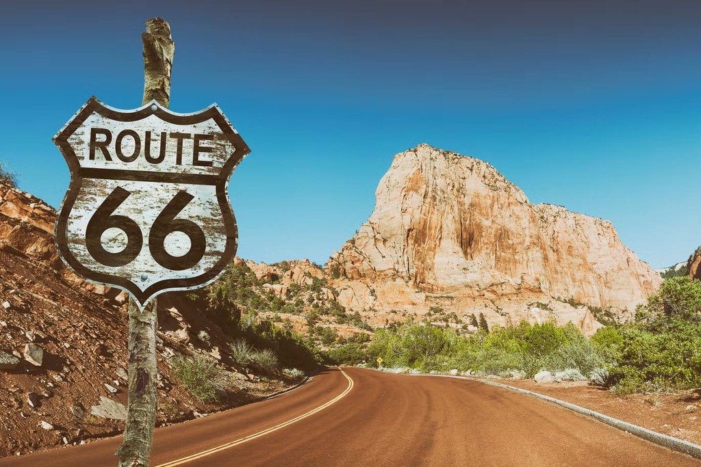
Route 66 ran 2,448 miles from Chicago to Santa Monica when it was commissioned in 1926, but it hasn’t existed as one continuous road since 1985 — interstates replaced most of it, historic alignments survive in pieces, and GPS apps won’t default to the old route unless you tell them to. That makes Route 66 a different kind of planning problem than most road trips: before you can decide how many days you need, you need to decide how closely you want to follow the historic road versus how efficiently you want to cross the country.
2026 adds a real reason to plan this trip now rather than someday — it’s the Route 66 Centennial, with events running across all eight states through the year and a culminating 100th-anniversary milestone on November 11. This guide covers how the route actually works today, what kind of Route 66 trip fits you, a state-by-state breakdown, and what’s left of this year’s Centennial calendar.
Route 66 Road Trip at a Glance
| Planning Factor | What to Know |
|---|---|
| Historic route | Chicago → Santa Monica |
| States crossed | 8 |
| Historic length | 2,448 miles (per the original Route 66 Centennial Commission Act congressional report) |
| Route character | Historic alignments + modern highway connectors |
| Planning challenge | Not one continuous modern road — see below |
| Recommended trip | No single correct length — depends on how closely you follow historic alignments (full breakdown below) |
| Navigation | Offline maps + a dedicated Route 66 alignment map/guide |
| Best approach | Decide how closely you want to follow the historic road before you plan days or stops |
The 2026 Centennial: What Travelers Need to Know
Route 66 officially became part of the U.S. highway system in 1926, and November 11, 2026 marks its 100th anniversary. The centennial has brought celebrations, road trips, car shows, and special events across all eight Route 66 states throughout the year.
Most of the major spring and summer events have already wrapped up, including the National Centennial Kickoff in Springfield, Missouri, Arizona’s Fun Run, and the cross-country Centennial Caravan. A handful of events are still coming up in October and November, including Route 66 festivals in Kingman and San Bernardino, events in Gallup, and Arizona’s Route 66 UltraRun.
The big date is November 11, with centennial celebrations planned in Tulsa, Oklahoma, and Springfield, Illinois. Since November 11 is also Veterans Day, National Park Service sites will offer free admission that day.
If you’re planning to be on Route 66 around the centennial celebrations, book your accommodation early, especially in Tulsa and Springfield. Even outside the main events, you’ll find new exhibits, maps, and commemorative projects celebrating the Mother Road’s 100-year history.
Route 66 Isn’t One Road Anymore
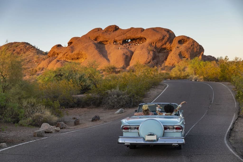
This is the single most important thing to understand before planning anything else: Route 66 was officially decommissioned in 1985, after being replaced piecemeal by the Interstate Highway System over the preceding two decades. No single interstate took its place — instead, I-55, I-44, I-40, and I-15 each absorbed different stretches, sometimes built directly on top of the old roadbed and sometimes bypassing it entirely.
The practical result: there’s no single road you can simply get on and follow from Chicago to Santa Monica. What exists today is a patchwork — preserved historic alignments (often signed as “Historic Route 66”), stretches that are now frontage roads running alongside the interstate, business loops through old Route 66 towns, and a few genuine gaps where the original road is gone, closed, or unsuitable for a standard vehicle.
The National Park Service puts the figure at roughly 85% of the original roadway surviving in some drivable form, but “drivable” and “clearly signed and GPS-friendly” aren’t the same thing.
What Kind of Route 66 Trip Are You Planning?
There’s no universally correct way to drive it — the real planning decision is how closely you want to follow the historic road versus how efficiently you want to cross the country.
The historic route. Prioritizes surviving original alignments and historic roadside sites over speed, including slower or rougher sections where access is currently suitable — some historic segments are unpaved, closed, or otherwise unsuited to a standard vehicle, so this style depends more than the others on checking current conditions before committing to a given stretch. This is the slowest option and the most authentic, best suited to travelers who want the driving itself to be the point rather than a means of reaching the next stop.
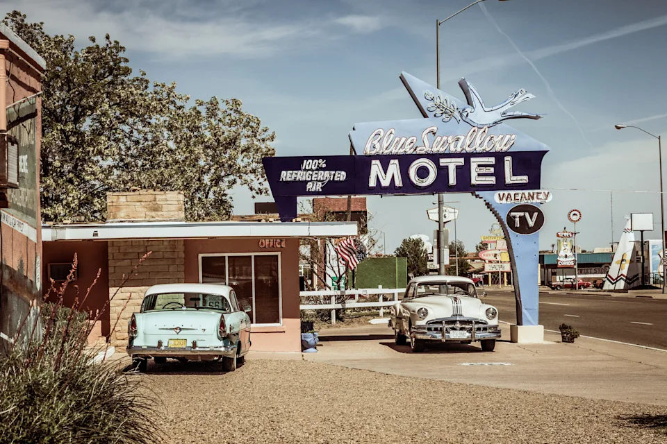
The classic attractions route. Built around the iconic diners, motels, neon signs, and roadside museums that show up in nearly every Route 66 photo essay, using historic alignments where they’re convenient to reach those stops and modern roads to connect the highlights efficiently in between. This is probably the most photogenic version of the trip without requiring the historic route’s patience for rough or unclear sections.
The balanced route. Mixes meaningful historic sections with practical interstate stretches between them, picking up the old alignment where it adds something and returning to the highway where it doesn’t — probably the most common and most forgiving approach for a first Route 66 trip, since it doesn’t demand expert-level alignment knowledge to execute well.
The time-efficient route. Uses modern highways for the bulk of the distance and treats Route 66 as a series of selected stops along the way rather than a continuous drive to be followed start to finish. This is the reasonable choice if Route 66 is one leg of a larger cross-country trip rather than the entire point of the journey.
How to Navigate Route 66 Today
Standard GPS apps are built to find the fastest route, and because the historic alignment isn’t a single continuous route number in most map databases, your phone will often default to the parallel interstate without telling you it’s doing so. A few practical habits help: download offline maps before you leave cell coverage on remote stretches, use a dedicated Route 66 alignment map or guidebook alongside your regular navigation app rather than relying on either alone, and don’t blindly follow an old alignment onto gravel or a closed section just because it shows up on a historic map — verify current road conditions, especially in rural Arizona, New Mexico, and the Texas Panhandle.
Route 66 The Complete Road Trip Guide
View on AmazonA dedicated Route 66 alignment map or guidebook is worth the investment specifically because it marks which stretches are drivable, which are gravel or deteriorated, and which have been absorbed entirely into the interstate with no surviving alternative — information that doesn’t reliably show up in a standard navigation app. Treat your phone’s GPS as the tool for getting between towns efficiently, and the alignment guide as the tool for deciding where to leave the interstate in the first place.
Vehicle fit matters here too. A regular passenger car can handle almost the entire route comfortably. RVs may need to bypass a few narrow or rough historic sections using nearby frontage roads. EV drivers should plan charging stops around towns, as some remote stretches still have limited fast-charging options. For motorcyclists, the slower historic sections are often the highlight—the road itself is part of the experience.
Route 66 State by State
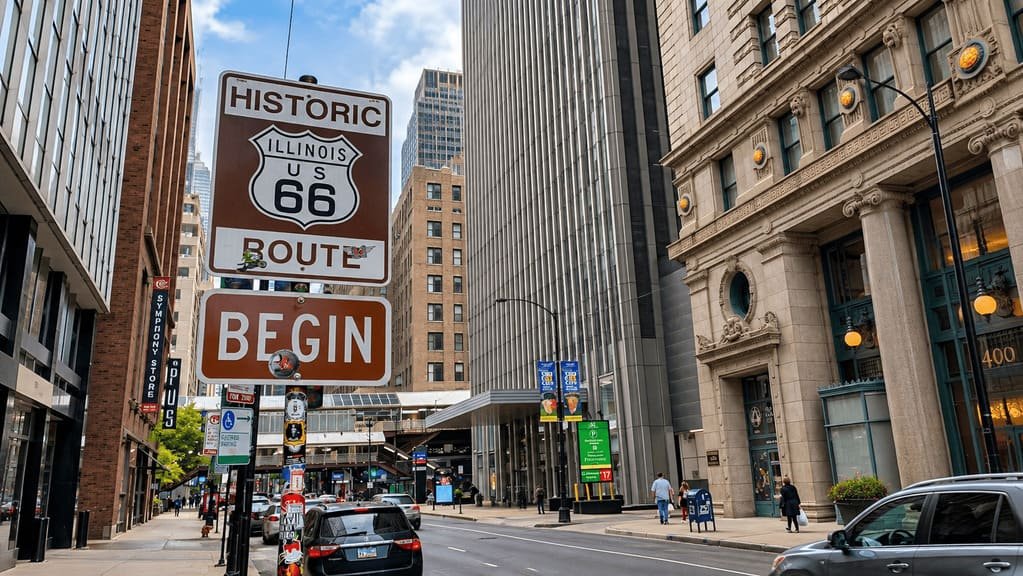
Illinois — where it begins. Chicago’s Route 66 start point and the stretch through Illinois’s small river towns are well-preserved and easy for a first-timer to follow, with clear “Historic Route 66” signage through most of the state. It’s a good place to get comfortable with alignment-chasing before the trip gets more remote and less consistently signed further west — treat the first day or two here as a low-stakes warm-up for the navigation habits that matter more later on.
Missouri — historic road and roadside culture. Home to some of the most distinctive surviving original pavement and roadside Americana on the entire route, including stretches around Springfield, which bills itself the “Birthplace of Route 66” — by the city’s own account, this ties to the April 30, 1926 telegram proposing “66” as the route’s number, a few months before the official November designation. St. Louis adds a genuine urban stretch with multiple historic alignments through the metro area worth researching in advance rather than improvising.
Kansas — the short state. Route 66 crosses only about 13 miles of Kansas near Galena, making it by far the shortest state on the route — a planning footnote more than a destination in its own right, worth combining with neighboring Missouri or Oklahoma rather than treating as a standalone stop or overnight.
Oklahoma — an unusually deep concentration of Route 66 communities. Tulsa, the hometown of Cyrus Avery (the highway commissioner widely credited with pushing for the Chicago-to-LA route in the first place), anchors a stretch with an especially high density of preserved Route 66 towns, museums, and roadside sites. That history is part of why Tulsa is hosting the November 11 centennial finale rather than any other city along the route.
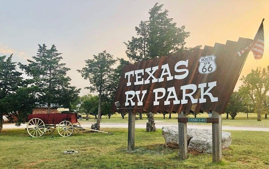
Texas — iconic roadside stops. The Panhandle stretch through Amarillo is shorter than Oklahoma’s but carries some of the most recognizable roadside attractions on the entire route — worth the detour even on a time-efficient trip that’s otherwise sticking close to the interstate.
New Mexico — where alignments matter most. Multiple historic realignments through New Mexico, including a pre-1937 southern loop through Santa Fe versus the later, straighter path that bypassed it, mean your experience here depends heavily on which alignment you actively choose to follow rather than just driving whatever a GPS app defaults to.
Arizona — long, well-preserved historic stretches. Arizona contains some of the longest and most recognizable surviving stretches of historic Route 66, including the Seligman-to-Kingman corridor — it deserves more time than a quick pass-through, and it’s also the stretch that hosted the Centennial Fun Run earlier this year.
California — the long approach to the end. The desert crossing through the Mojave is long, remote, and genuinely demands fuel and water planning specific to that stretch, before the route finally reaches Los Angeles and the Santa Monica endpoint. Decide in advance how you want to handle the symbolic ending — the original 1926 terminus was downtown LA at 7th Street and Broadway, with Santa Monica becoming the popularly recognized finish line later, so “the end of Route 66” is itself a matter of which era’s version you’re chasing.
How Many Days Do You Need?
There isn’t one correct number — it depends entirely on which of the four trip styles above you’re building toward.
A fast crossing prioritizing major highlights over historic alignments can be done in under two weeks.
A balanced road trip, mixing meaningful historic sections with efficient modern connectors, generally runs around two to three weeks.
A deep Route 66 trip, built around historic alignments, small towns, and roadside museums, reasonably takes three to four weeks or more.
Before settling on a number, it’s worth asking what you’re actually trying to see. As planning starting points rather than fixed thresholds: around 7 days, prioritize one or two selected sections rather than the whole route; around 14 days, a balanced cross-country trip becomes realistic; at 21+ days, you have room for the deeper historic-alignment experience. However many days you land on, pace them using actual driving hours rather than raw mileage — see our driving-time planning guide for why a 300-mile Route 66 day with stops looks nothing like a 300-mile interstate day.
Which Direction Should You Drive?
Neither direction is inherently correct — the decision comes down to your starting airport, rental availability, season, and what you want the trip’s narrative arc to feel like.
Chicago → Santa Monica follows the traditional east-to-west narrative most Route 66 media and guidebooks are written around, and ends at the ocean, which some travelers find a more satisfying finish.
Santa Monica → Chicago can make more sense depending on flight pricing and one-way rental availability out of LA versus Chicago — reversing the direction also changes when you encounter the desert sections and how the trip builds toward its endpoint.
Choose based on logistics and preference, not because one direction is “the real way” to do it.
What Happens When You Reach the End?
Finishing a point-to-point route like this raises the same question covered in our one-way vs. loop guide: do you fly home, arrange a one-way rental return, drive back, or extend into another route entirely? Route 66 is close to a textbook case for that decision, since the start and end points are about as far apart as a U.S. road trip gets — worth deciding before you book rather than after you’ve already reached Santa Monica.
Common Mistakes
- Treating Route 66 as one continuous modern highway. It hasn’t been that since 1985.
- Assuming GPS will automatically follow historic Route 66. It usually won’t, by default.
- Trying to see every attraction. The route has far more stops than any single trip can reasonably include.
- Underestimating the distance between worthwhile stops, especially in the more remote stretches of New Mexico and Arizona.
- Spending too much time on interstate sections when historic alignments nearby would’ve been more worth the detour.
- Ignoring seasonal and weather conditions, particularly summer desert heat in the Mojave crossing.
- Booking accommodation too rigidly months ahead, which removes the flexibility to linger somewhere unexpectedly good.
- Not deciding how closely to follow historic alignments before planning days — this decision should come first, not last.
- Treating the centennial calendar as the entire Route 66 experience. The events are a bonus, not the trip itself.
- Trying to complete the route on an artificially tight schedule that turns a historic road trip into a rushed highway crossing.
Frequently Asked Questions
Can you still drive the entire Route 66? You can drive substantial portions of historic Route 66, but not the entire original alignment as one continuous modern road — the National Park Service estimates roughly 85% of the original roadway survives in some drivable form, connected by interstate stretches where the historic road is gone or absorbed.
How long does it take to drive Route 66? There’s no single right answer — a fast crossing fits under two weeks, a balanced trip runs two to three weeks, and a deep historic-alignment trip can take three to four weeks or more.
What is the Route 66 Centennial? 2026 marks 100 years since November 11, 1926, when the federal highway numbering system that created Route 66 was officially adopted — a national Centennial Commission is coordinating events across all eight states throughout the year.
Is the Route 66 Centennial over? As of this update, most of the major spring and summer events have passed; the biggest remaining milestone is November 11, 2026 itself, with culminating events in Tulsa and Springfield, Illinois.
Which direction should you drive Route 66? Neither is inherently better — choose based on your starting airport, flight and rental pricing, and which endpoint you’d rather finish at.
Is Route 66 RV-friendly? Mostly, though a handful of narrower historic segments may call for the frontage-road alternative instead — check specific sections in advance rather than assuming every historic alignment fits a larger vehicle.
What’s the shortest meaningful Route 66 trip? A focused 7-day trip covering one or two strong sections (Oklahoma and Texas, or Arizona’s Seligman-to-Kingman stretch, for example) gives a real sense of the route without attempting the whole crossing.
What date is the exact 100th anniversary of Route 66? November 11, 2026 — the date the federal highway numbering system that created Route 66 was formally adopted in 1926, with Tulsa and Springfield, Illinois hosting the main culminating celebrations.
Which states are best for seeing historic Route 66? Oklahoma and Arizona are both known for extensive, well-preserved, visitor-oriented Route 66 resources, though every state on the route has its own distinct preserved sections worth building into a trip.
Do you need a special map to drive Route 66? Standard navigation apps work fine for the modern connecting roads, but a dedicated historic Route 66 map or guide is genuinely useful for identifying which surviving alignments exist and where the original route diverges from whatever your GPS considers the fastest path.
PLAN YOUR TRIP YOUR WAY
Build a day-by-day itinerary around your time, pace, interests, and budget.
Decide how closely you want to follow the historic alignments, how many days you actually have, and which direction fits your travel logistics — then use the Miles & Mapped planner to build the route around those choices instead of a generic one-size-fits-all itinerary.