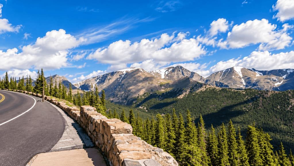
Trail Ridge Road is the highest continuous paved road in the United States, climbing to 12,183 feet as it crosses the Continental Divide inside Rocky Mountain National Park. Over 48 miles between Estes Park and Grand Lake, it moves from forest to alpine tundra and back down again, with eleven miles of the route running entirely above treeline.
The road itself isn’t complicated to drive — a two-lane highway with a low speed limit and wide pull-offs. What actually takes planning is timing. Rocky Mountain National Park’s 2026 timed-entry system, a short operating season that depends on snow, and real elevation to account for all affect when you should drive it, more than the drive itself does. Get the timing right and the drive is straightforward. Get it wrong and you can spend part of your day stuck at an entrance station instead of on the road.
Quick Facts
| Fact | Details |
|---|---|
| Location | Rocky Mountain National Park, Colorado |
| Length | 48 miles one-way (Estes Park to Grand Lake) |
| Highest point | 12,183 feet, the highest continuous paved road in the US |
| Road type | Paved, two-lane, National Scenic Byway |
| Operating season | Weather-dependent, typically late May to mid-October |
| Timed entry (2026) | Required 9am–2pm, May 22–October 12 |
| Recommended time | Half day to a full day, depending on stops |
Do You Need a Reservation?
For 2026, Rocky Mountain National Park requires a Timed Entry reservation to enter the park between 9 am and 2 pm, daily, from May 22 through October 12. Reservations are booked in 2-hour entry windows through Recreation.gov for a $2 processing fee.
Outside that window, no reservation is needed at all. Enter before 9 am or after 2 pm and you can drive straight in. For many visitors, an early start isn’t just a way to beat crowds — it removes the need to plan around the reservation system entirely.
Important: This is a different permit from the Bear Lake Road Corridor reservation, which covers a separate part of the park on a different schedule (5 am–6 pm, through October 18). A Bear Lake reservation doesn’t cover Trail Ridge Road, and a Trail Ridge/general park reservation doesn’t cover Bear Lake Road. Check which one you actually need before booking.
Route Breakdown
Estes Park to Treeline
The climb out of Estes Park moves through montane forest and a series of switchbacks, gaining elevation steadily with pull-offs offering early views back over the valley. Deer Ridge Junction marks the point where Trail Ridge Road splits off from the road toward Beaver Meadows, and it’s a natural spot to reset your trip odometer if you’re tracking mileage. The forest here thins gradually rather than all at once, so watch for the tree line to shift from full-size pines to smaller, wind-shaped krummholz before the trees stop entirely.
Alpine Tundra
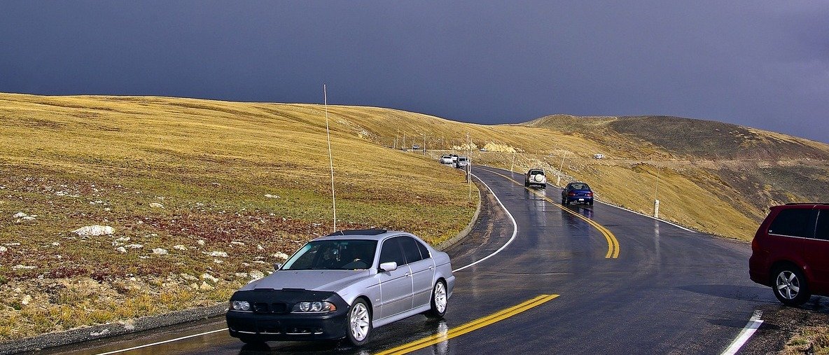
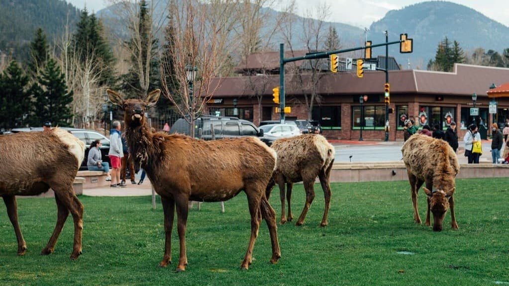
Above treeline, the landscape changes completely — open, exposed tundra with views stretching for miles along the Continental Divide. This is the section most people picture when they think of Trail Ridge Road, and it’s where the road reaches its 12,183-foot high point, between Lava Cliffs and Gore Range overlooks, just before the Alpine Visitor Center. The air is noticeably thinner and colder here even on a warm summer day, and wind can be strong and constant. Wildlife sightings are common along this stretch too — elk and bighorn sheep both use the tundra, and it’s worth slowing down rather than treating it as a straight shot between overlooks.
Milner Pass to Grand Lake
The road crosses the Continental Divide itself at Milner Pass before descending through forest again toward Grand Lake on the park’s west side. This descent is generally quieter than the climb out of Estes Park, with fewer crowds and a more gradual drop in elevation, and it’s a good stretch for a slower pace if you started your day early on the east side.
Best Stops
- Rainbow Curve — An early overlook with sweeping views back down the valley toward Estes Park, good for a first stop before the climb gets serious. The parking area is small and fills up on busy mornings.
- Rock Cut — A paved, short walk onto open tundra, one of the easiest ways to actually stand in the alpine zone without a real hike. The Tundra Communities Trail here is about a third of a mile round trip on pavement, with interpretive signs about the fragile plant life. Budget 20–30 minutes.
- Forest Canyon Overlook — A dramatic canyon view and one of the better photography stops along the route, with the Big Thompson River visible far below.
- Alpine Visitor Center — The highest visitor center in the National Park System, with facilities, exhibits, and a small store. Parking fills up fast in summer, especially midday, so plan around that if you’re aiming for a break here.
- Milner Pass — The Continental Divide crossing, marked and easy to stop at, with Poudre Lake right alongside the road.
How Long Do You Need?
- Drive only — Roughly two hours one-way if you don’t stop, though that’s not how most people experience it.
- Drive with viewpoints — Plan on 3–4 hours for the stops most visitors actually want: Rainbow Curve, Rock Cut, Forest Canyon Overlook, and the Alpine Visitor Center.
- Drive with a hike — Add significantly more time if you’re doing a trail like the Tundra Communities Trail near Rock Cut. A short road doesn’t mean a short day — parking, altitude, and changing weather all add time that raw mileage doesn’t show.
What Time of Day Should You Go?
- Before 9 am — No timed-entry reservation needed under the 2026 rule, plus cooler temperatures, better light, and easier parking at popular stops like the Alpine Visitor Center. This is generally the strongest option if your schedule allows it.
- 9 am–2 pm — Works fine if you already have the appropriate Timed Entry reservation, but you’re driving during the busiest window of the day.
- After 2 pm — Also reservation-free under the 2026 rule, though you’re working with less daylight margin if you want to add a hike or linger at stops.
Early isn’t automatically the right call for everyone — weather at this elevation can turn quickly regardless of what time you start, so check conditions the morning of, not the night before.
Altitude: What to Know at 12,183 Feet
Driving to high elevation, even while sitting in a car, can affect people differently. Some visitors notice a headache, dizziness, unusual fatigue, or shortness of breath, especially if they’ve come from much lower elevation and haven’t had time to adjust. Others feel nothing at all.
Give yourself time rather than rushing the drive, stay hydrated, and pay attention to how you feel at the higher stops. If symptoms feel more than mild, descend to a lower elevation and reassess — seek medical help if anything feels serious. This isn’t something to diagnose from a blog post, just something to take seriously if it comes up.
Best Time of Year
- Early season (late May–June) — The road typically opens by Memorial Day weekend, but the exact date shifts year to year depending on snowpack — some years it opens in mid-May, other years crews are still clearing drifts into early June. Don’t lock in a trip around a specific opening date months in advance, and build in a backup plan if you’re visiting right around when it usually opens.
- Peak summer (July–August) — Usually the most reliable period for full access, though afternoon thunderstorms are common at elevation and can cause temporary closures, sometimes with little warning. An early start helps here too, since storms tend to build later in the day.
- Early fall (September–early October) — Often excellent conditions and changing color at lower elevations, with thinner crowds than midsummer, but the closure date becomes more of a factor as the season goes on and an early snowstorm can shut the road down well ahead of its typical schedule.
- Late fall and winter — Trail Ridge Road closes for the season, typically by mid-October, and isn’t a winter driving option. The lower sections near both entrances stay open, but the alpine stretch is gated off until the following spring.
Where to Stay
Estes Park, on the east side, works well for an early start and is the more common base for first-time visitors combining Trail Ridge Road with the rest of the park’s east side.
Grand Lake, on the west side, offers a quieter base and makes sense if you’re approaching from the west or want to combine the drive with that side of the park.
Which side you’re staying on affects how early you can realistically start, so factor that into your timing plan.
What to Prepare Before You Go
- Fuel up before you start — there’s no gas on Trail Ridge Road itself
- Download offline maps in case of spotty cell coverage
- Check the current road status before you leave
- Check the weather the morning of, not the night before
- Bring water and pack layers — temperatures at 12,000 feet differ sharply from the valley floor
- Bring sun protection — UV exposure is stronger at elevation
- Confirm whether you need a timed-entry reservation for your planned arrival time
- Allow more time than you think for stops
Who Should (and Shouldn’t) Drive It
Good fit: scenic-drive travelers, photographers, first-time Rocky Mountain National Park visitors, families who enjoy stopping at viewpoints, and anyone building it into a larger Colorado road trip.
May not be ideal for: travelers uncomfortable with exposed mountain roads and drop-offs, anyone with very limited time who wants more than a quick pass-through, or a trip with no flexibility to adjust for sudden weather or a temporary closure.
Common Mistakes
- Assuming the road is open just because it’s summer.
- Confusing the Trail Ridge Road timed-entry permit with the separate Bear Lake Road Corridor reservation.
- Arriving during the 9 am–2 pm window without the required reservation.
- Assuming the drive only takes a couple of hours because the road isn’t especially long.
- Underestimating the effects of altitude.
- Not checking the weather immediately before heading out.
- Running low on fuel with no stations on the route itself.
- Trying to fit in too many hikes alongside the drive.
- Treating the seasonal opening date as fixed months in advance.
FAQs
How long does it take to drive Trail Ridge Road? About two hours one-way without stopping. Most visitors take 3–4 hours or more once you factor in viewpoints and the Alpine Visitor Center.
Do you need a reservation for Trail Ridge Road? Yes, for 2026, if you’re entering the park between 9am and 2pm from May 22 through October 12. Outside that window, no reservation is required.
What time should I drive Trail Ridge Road? Before 9am is generally the strongest option — no reservation needed, cooler temperatures, and easier parking. After 2pm also avoids the reservation requirement but leaves less daylight margin.
Is Trail Ridge Road scary to drive? The road has a low speed limit, wide pull-offs, and gentle curves for most of its length. Some sections have real exposure and drop-offs, which can feel uncomfortable for drivers who aren’t used to mountain roads, but it isn’t considered a technically difficult drive.
What is the highest point on Trail Ridge Road? 12,183 feet, between the Lava Cliffs and Gore Range overlooks, just before the Alpine Visitor Center.
When does Trail Ridge Road open? Typically late May, though the exact date depends on snowpack and can shift by weeks in either direction. It generally closes for the season by mid-October.
What should I bring when driving Trail Ridge Road? Fuel up beforehand, bring water and layers for the temperature swing at elevation, pack sun protection, and check the timed-entry requirement and weather before you leave.
PLAN YOUR TRIP YOUR WAY
Build a day-by-day itinerary around your time, pace, interests, and budget.
Trail Ridge Road can be a half-day detour or the centerpiece of a full day in Rocky Mountain National Park. Use our planner to build it around your other Colorado stops, available days, and the season you’re traveling.