The Natchez Trace Parkway is a 444-mile drive through Mississippi, Alabama, and Tennessee that follows a travel corridor used for thousands of years, first by Native Americans and later by “Kaintuck” boatmen walking home from river trade. There are no billboards, no commercial trucks, and no stoplights along the way — just a two-lane road through forest, farmland, and small river towns, punctuated by pull-offs at Native American mounds, Civil War sites, and stretches of the original sunken trail.
It’s a slower kind of road trip than a coastal highway or a mountain pass. The Trace rewards travelers who want to stop often, walk short trails, and take in Southern history at a relaxed pace rather than chase a single dramatic viewpoint. As of 2026, a section of the Parkway is also closed for construction, which changes how you should plan a route from end to end. Here’s what to know before you go, where to stop, how many days to budget, and how to work around the current closure.
Quick Facts
| Fact | Details |
|---|---|
| Length | 444 miles |
| States | Mississippi, Alabama, Tennessee |
| Southern terminus | Natchez, Mississippi |
| Northern terminus | Near Nashville, Tennessee |
| Road type | National Park Service scenic parkway |
| Entrance fee | None — the Parkway is free to drive |
| Recommended time | 3–4 days |
| Best seasons | Spring and fall |
| Camping | 3 free NPS campgrounds along the route |
Current Road Status (Verify Before You Go)
Two sections of the Parkway are currently closed as of this writing.
A 24-mile section between milepost 135 and milepost 159.5, in Leake and Attala counties, Mississippi, is closed for road construction. It’s part of a three-phase, $150 million rehabilitation of 83 miles of the Trace, funded through the Great American Outdoors Act and the Federal Highway Administration. The National Park Service has a signed detour in place using state highways 16, 25, 19, and 35, adding roughly 11 minutes to the drive. This is phase 2 of the project — an earlier closure further south (milepost 165–180) reopened in August 2026 as this section began. Work is expected to continue into late 2026, with the full three-phase project targeted for completion by mid-2027.
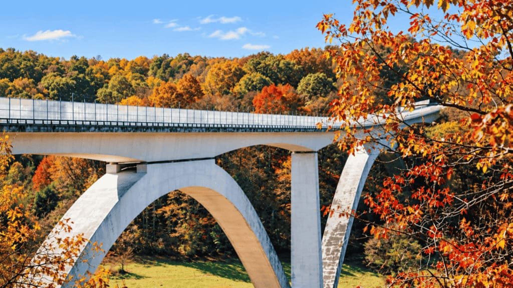
Separately, in Williamson County, Tennessee, the Double Arch Bridge at milepost 437–440 is closed to through traffic from April 2026 through May 2027 while NPS replaces the bridge’s temporary safety barrier with a permanent one. A signed detour runs via Highways 96 and 100. Visitors can still reach the parkway’s northern end by driving in from the Northern Terminus to Big Tree Overlook and back.
If you’re planning a trip, don’t rely on an older itinerary or trip report that assumes the full Parkway is open. Check the NPS road and site status page a few days before you leave, since construction phases and detour routes shift as work progresses.
Route Breakdown
Natchez to Tupelo
This southern stretch carries most of the Parkway’s signature stops. Just north of Natchez, Emerald Mound is one of the largest Native American ceremonial mounds in the country, and an easy walk from the parking area. Further along, the Sunken Trace preserves a short stretch of the original trail, worn several feet below the surrounding ground by centuries of foot and horse traffic. Rocky Springs, once a town of several thousand people, is now a ghost town site with a still-standing church, a cemetery, and a two-mile loop trail through what’s left of the settlement.
Tupelo to the Alabama Line
Tupelo marks the roughly halfway point and the Parkway’s visitor center and headquarters. It’s also Elvis Presley’s birthplace, and the small house where he was born sits a short drive from the Parkway itself. This middle stretch is where the current construction closure falls, so budget extra time for the detour if you’re driving straight through rather than treating Tupelo as an overnight stop.
Alabama to Nashville
The Tennessee section holds two of the Trace’s most-photographed spots: the Meriwether Lewis site, where the Lewis and Clark explorer died and is buried, and the Double Arch Bridge at Birdsong Hollow, a curved concrete span that rises 155 feet above the valley floor and carries the Parkway itself — currently closed to through traffic for barrier construction, with a signed detour onto Highways 96 and 100. The road ends a short drive from downtown Nashville.
Best Stops Worth the Detour
Emerald Mound — One of the largest Native American ceremonial earthworks in the US, with a short, flat walk from the parking area. Budget 20–30 minutes. Best for history and archaeology.
Sunken Trace — A preserved section of the original trail, worn into a trench by generations of travelers. Budget 15 minutes. Best for a quick, tangible sense of the Trace’s history.
Rocky Springs — A former town reduced to a church, a cemetery, and cisterns, connected by an easy 2-mile loop trail. Budget 45–60 minutes if you walk the loop. Best for a quiet, atmospheric stop.
Double Arch Bridge — The bridge itself is closed to through traffic from April 2026 through May 2027 while NPS replaces its temporary safety barrier with a permanent one, so plan on the detour via Highways 96 and 100 if you’re driving north or south past it. The Highway 96 pull-off viewing spot is unaffected and still the best vantage point. Budget 15–20 minutes. Best for photography.
Tupelo / Elvis Presley Birthplace — A small house-museum a short drive from the Parkway, plus the visitor center itself. Budget 1–2 hours if you tour the birthplace site. Best for music history.

How Many Days Do You Need?
2 days — Possible if you’re mainly interested in the drive itself rather than stopping often. This pace suits travelers who’ve driven the Trace before or who are treating it as a way to get from Nashville to the Gulf Coast rather than a destination in its own right.
3 days — The best fit for a focused Trace road trip. Enough time to visit the major stops without cramming every day.
4 days — A relaxed pace with room for short hikes, more time in Natchez and Nashville at either end, and a buffer for the construction detour or bad weather.
3-Day Itinerary
Day 1: Start in Natchez, stop at Emerald Mound, then Sunken Trace and Rocky Springs before overnighting near Jackson or at Rocky Springs Campground.
Day 2: Continue north through the construction detour toward Tupelo, visiting the visitor center and Elvis’s birthplace, then overnight in Tupelo.
Day 3: Cross into Alabama and Tennessee, stopping at Meriwether Lewis and the Double Arch Bridge pulloff, before finishing in Nashville via the signed detour around the bridge’s construction closure.
4-Day Itinerary
Day 1: Natchez to Rocky Springs, with time for Emerald Mound and Sunken Trace along the way. Overnight at Rocky Springs Campground or nearby Jackson.
Day 2: Rocky Springs to Tupelo, working around the current detour. Overnight in Tupelo, with time to visit the birthplace site and visitor center.
Day 3: Tupelo into Alabama and Tennessee, with a stop at Jeff Busby (once reopened) or the high point of the Parkway, continuing to Meriwether Lewis. Overnight near Meriwether Lewis Campground or in Hohenwald.
Day 4: Finish with the Double Arch Bridge pull-off and the run into Nashville via the bridge’s detour route, with the afternoon free to explore the city.
Adjust the exact overnight points against the current detour before you leave — the added drive time can shift where it makes sense to stop for the night.
Where to Camp
| Campground | Location | Fee | Best For |
|---|---|---|---|
| Rocky Springs | Milepost 54.8, Mississippi | Free | Southern leg, first-come first-served |
| Jeff Busby | Milepost 193.1, Mississippi | Free | Central route, near the Parkway’s high point |
| Meriwether Lewis | Milepost 385.9, Tennessee | Free | Northern leg, near the Lewis gravesite |
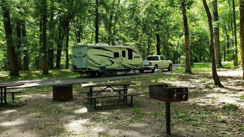
All three NPS campgrounds on the Trace are free and first-come, first-served, with no reservations. None offer RV hookups, though all can accommodate RVs up to a reasonable size. Confirm each campground’s open/closed status against the current NPS road-status page before you go, since campgrounds near active construction sections have closed temporarily in the past.
Where to Stay Without Camping
You don’t need to camp to do the Trace. Natchez and Nashville both work well as overnight bases at either end, and Tupelo is a practical midpoint with a normal range of hotels. Smaller towns along the route (Kosciusko, Hohenwald, Franklin) also sit close enough to the Parkway to serve as a base for a night.
Fuel, Food, and Cell Service
There are no gas stations, restaurants, or other commercial services directly on the Parkway — that’s by design, to preserve the drive’s character. Plan fuel stops in the towns along or near the route rather than waiting until the tank runs low, since exits to services aren’t always frequent. Cell service is inconsistent along much of the route, especially in wooded sections, so download offline maps and let someone know your general plan before you set out on a long stretch.
Best Time to Drive
Spring (March–May) brings dogwood and redbud blooms and comfortable temperatures — a strong choice if scenery is the priority.
Fall (October–November) brings color changes, particularly in the Tennessee and Alabama sections, along with cooler, more comfortable weather for the walking stops.
Summer is workable but comes with Mississippi and Alabama heat and humidity that can make the short walks at Rocky Springs or Sunken Trace less pleasant.
Which season is “best” depends on what you’re prioritizing — spring wildflowers, fall color, or simply avoiding the summer heat at the walking stops.
What Kind of Road Trip Is This?
The Natchez Trace isn’t a thrill-seeking drive. There are no dramatic elevation changes, hairpin turns, or cliffside views. It’s a drive built around scenery, history, and a slower pace — short walks, quiet stops, and a genuine sense of moving through several centuries of American history in one trip. Knowing that going in helps set the right expectations.
Who Should (and Shouldn’t) Drive It
Good fit: history travelers, photographers, campers and RV travelers, couples looking for a low-key drive, and families who enjoy frequent short stops over long stretches of highway.
Less of a fit: travelers who want a different city every night, nightlife, or a high density of major attractions packed close together. The Trace’s stops are spread out and quiet by design.
Driving Intensity: Low to Moderate
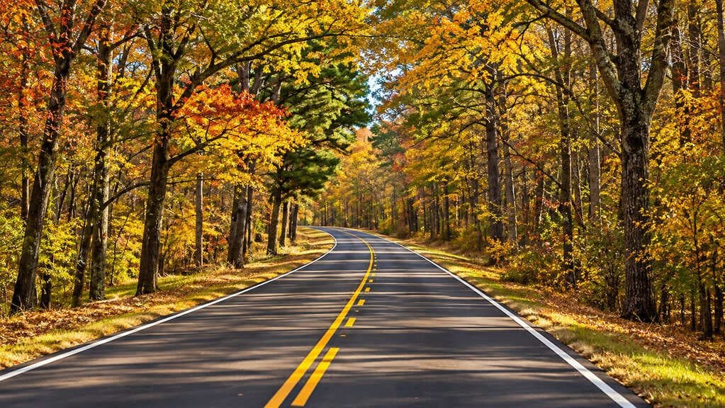
The road itself is easy — a 50 mph speed limit, no commercial traffic, and gentle curves throughout. What raises the intensity slightly is the current construction detour, the lack of services directly on the route, and the need to plan fuel and overnight stops more deliberately than on a normal highway.
Common Mistakes
- Assuming the entire Parkway is open, based on an old trip report or itinerary.
- Treating the Trace like a normal high-speed highway rather than a 50 mph scenic road.
- Not fueling up before a long stretch, since there are no gas stations directly on the route.
- Trying to see every historical marker instead of picking a handful of stops to actually walk.
- Underestimating how long the walking stops take, especially Rocky Springs.
- Assuming cell service will be available for navigation the whole way.
- Planning a day-by-day schedule around pre-2026 information that doesn’t account for the current detour.
FAQs
How many days do you need for the Natchez Trace Parkway? Three days is enough for a focused trip with the major stops. Four days allows a more relaxed pace with time for short hikes and camping.
Where does the Natchez Trace Parkway start and end? It runs 444 miles from Natchez, Mississippi, to just outside Nashville, Tennessee, passing through Alabama along the way.
Is the Natchez Trace Parkway free? Yes. There’s no entrance fee or pass required to drive any part of the Parkway.
Can you camp along the Natchez Trace Parkway? Yes. Three NPS campgrounds — Rocky Springs, Jeff Busby, and Meriwether Lewis — sit along the route, all free and first-come, first-served.
Are there gas stations on the Natchez Trace Parkway? No. Fuel up in the towns along or near the route before starting a long stretch, since there are no commercial services directly on the Parkway.
Is the Natchez Trace Parkway RV-friendly? Yes, with normal caution. The road has no tunnels or major grade restrictions, though RVs should still plan fuel and overnight stops carefully given the lack of services on the route itself.
Is the Natchez Trace Parkway open in 2026? Most of it, yes — but two sections are currently closed. A 24-mile stretch between milepost 135 and 159.5 in Mississippi is closed for road construction, and the Double Arch Bridge in Tennessee is closed to through traffic through May 2027 for barrier work. Both have signed detours. Check the NPS road-status page shortly before your trip, since timelines and detour routes shift as work progresses.
PLAN YOUR TRIP YOUR WAY
Build a day-by-day itinerary around your time, pace, interests, and budget.
Use our road trip planner to map a Natchez Trace itinerary around the current construction detour, with stops, campgrounds, and drive times built in.