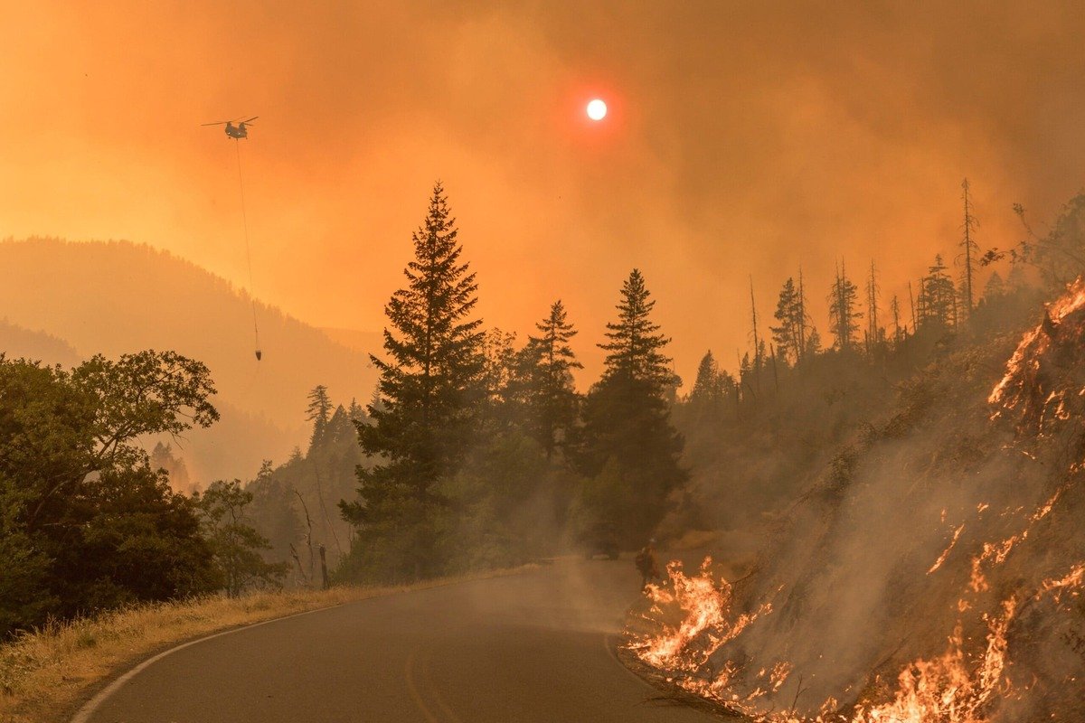
Wildfire is one hazard, but it can disrupt a road trip in three different ways. The road can close. The air can become unsuitable to drive through or to stay in. The place you planned to sleep can become unsafe or unreachable. Each of these is a separate planning problem, with a different question, a different pace of change and a different set of official sources.
This guide is a national planning framework. Wildfire can disrupt travel in many regions, but the examples here lean West, because that’s where most of the scenic routes in our library are and where large fires can affect them. It treats closures, wildfire smoke and evacuations as three problems with three source systems, introduces Wildfire Trip Load, and shows how to build an itinerary that survives a change.
Wildfire Season Road Trip Planning at a Glance
| Problem | The question | Source system | How fast it changes | Planning move |
|---|---|---|---|---|
| Road closures | Can I drive the route? | The agency that controls the road: state DOT or 511, park, forest, county | Within hours | Check each segment and keep an alternate corridor |
| Smoke | Can I see and breathe along this route and at my stop? | AirNow and EPA, the National Weather Service, local air-quality authorities | Within a day, often with wind shifts | Be ready to change the day’s activity or the route |
| Evacuations and services | Can I stay here, get fuel and supplies, and leave? | Local emergency management, the county alert system, the incident management team | Can be very fast | Know your way out, and avoid non-refundable bookings |
For the road problem, our guide to checking road conditions explains how to match the source to the road. This article covers what to add when fire is the hazard.
Why Wildfire Season is a Range, Not a Date
There is no single national wildfire season that tells you whether a road trip will be disrupted. Fire activity depends on drought, fuel conditions, wind, temperature, recent fire and regional weather, and it varies by place and by year. A route that is fine in one August can be closed the next.
The useful question is what is happening along your route now, and how it could change before you get there. Early in the planning stage, that means asking whether the route has an alternate corridor and whether your lodging can change. Closer to the trip, it means watching current fire activity, smoke forecasts and road status. That’s the same idea as in our hurricane season guide: the plan has to survive a change. The National Weather Service‘s fire weather pages also publish national fire-potential outlooks, which help you judge how much margin to build in. They don’t tell you whether a given road is open.
Problem 1: Road Closures
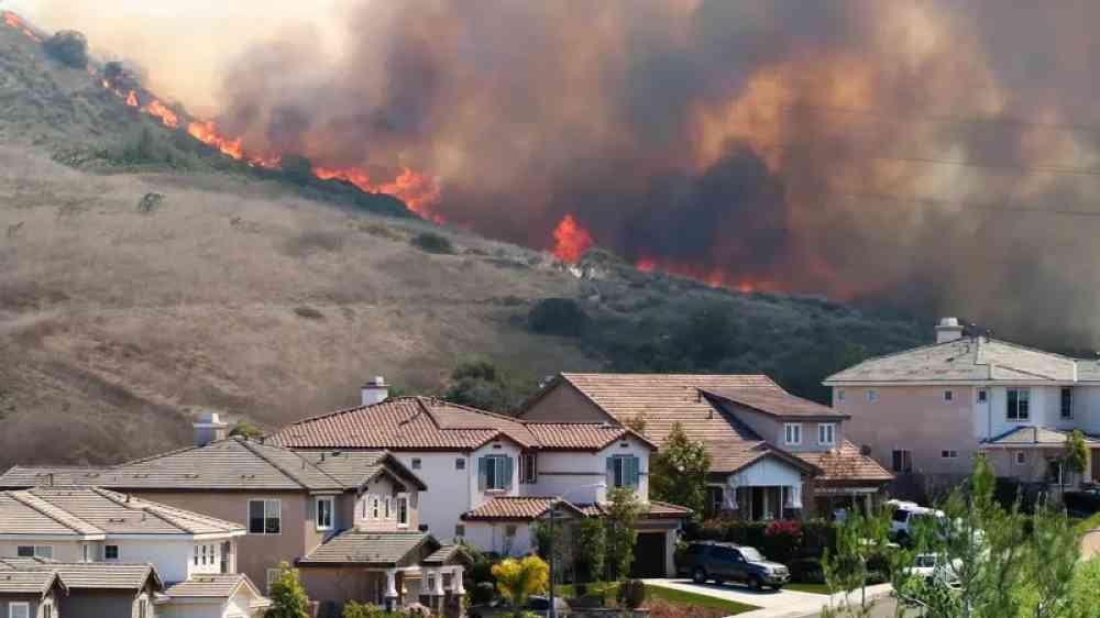
Fires close roads, reopen them, and change traffic patterns on short notice. Oregon’s Department of Transportation says a highway that’s open when you leave can close within the hour as fire behavior changes, and it tells travelers to check TripCheck for closures and delays before leaving.
That makes a one-time check at home the weakest version of the check. The planning questions are these:
- Which agency controls each road on my route? For a state highway it’s the state DOT, and for a park or forest road it’s the park or the forest.
- Is there a second way through? A route with an alternate corridor survives a closure better than a single mountain highway.
- Where are the points past which turning around is hard? Our Beartooth Highway guide calls these commitment points, and the same idea applies to a fire-affected road.
A closure also isn’t always all or nothing. Oregon’s agencies describe temporary closures, reduced speed zones and detours, so read what the agency’s status says about the segment you’ll use. If the status is unclear, treat the road as uncertain and use your fallback, as our road conditions guide explains.
Closure is only one layer. A road can be open while smoke or an evacuation makes the stop unusable, which is why the other two problems get their own sections.
Problem 2: Wildfire Smoke
Smoke affects visibility and air quality, and the two don’t always happen together or in the same place. Oregon’s transportation department says smoke can cut visibility about as fast as dense fog, and that high beams can make it worse by reflecting off the smoke. Oregon officials also advise considering a delay if visibility is poor or the air is unhealthy, and keeping the car’s air conditioning on recirculate in hot, smoky weather.
Smoke doesn’t stay near the fire. The EPA says wildfire smoke can travel hundreds of miles, so a route can be smoky when the nearest fire is far away. The AirNow Fire and Smoke Map combines fire locations, smoke plumes, near-real-time air quality and smoke outlooks for some large fires. It’s a joint EPA and Forest Service tool, and the EPA describes it in its release.
The practical point is that an open road can still be a poor place to be. If the air is bad at your destination, a clear highway doesn’t fix the trip. AirNow’s recommendations change with the air quality level and with who is in the car, so read them for the people you’re traveling with.
Problem 3: Evacuations and Services
This is the problem that most road trip guides skip. It covers where you sleep, where you buy fuel and food, and how you leave if conditions change.
Incident information and evacuation information aren’t the same thing, and no single source holds both. InciWeb, the interagency incident information system the Forest Service describes, carries official announcements on high-visibility or long-running incidents, including evacuations and road closures. State of Arizona material notes that not all active incidents appear there, and that the incident team is responsible for what’s posted. Evacuation orders themselves come from local emergency management.
So an active incident can need four sources at once: the incident management team, local emergency management, the road authority and an air-quality source.
California’s Office of Emergency Services advises signing up for local emergency alerts. It also separates an evacuation warning, which means get ready, from an order, which means leave now. Alert systems are run locally, so check what the county you’re visiting offers.
Services are part of the same problem. Campgrounds, lodging, fuel and charging can close or become hard to reach even when a road is open. Book what you can with flexible terms, and fill the tank or charge before an exposed stretch. Oregon’s agencies advise starting a summer road trip with a full tank or a full charge. If you’re driving an RV or towing, the same advice applies with more force, because a larger vehicle has fewer places to turn around and fewer routes it can take. Our RV road trip guide covers vehicle limits.
Ask your lodging and campground how they handle fire closures and smoke before you book. Their policy decides how much a change will cost, and it’s part of Wildfire Trip Load.
Wildfire Road Trip Load
Trip Load measures what a driving day demands beyond its mileage. Wildfire Trip Load is a Miles & Mapped planning framework, not an official fire-risk rating, and it has four layers:
- Route exposure. How many segments pass through terrain where a fire could close the road, and how many alternatives exist?
- Smoke exposure. How likely is it that smoke affects the route or the stop, and what would you do about it?
- Services exposure. What happens if lodging, fuel or food disappears?
- Flexibility. How easily can you change the day, the route or the overnight?
There’s no score to calculate. The questions are what matter: how exposed is the route, how exposed is the destination, what happens if services fail, and how easily can the plan change? For the mileage side of the same idea, see how many miles to drive in a day.
What kind of route are you taking?
Routes differ in how a fire affects them. These are planning archetypes, not universal risk classes.
| Route character | Wildfire planning concern | Planning response |
|---|---|---|
| Coastal or town-dense | Smoke can drift in, and alternate roads may exist | Flexible lodging and a second route |
| Mountain or forest | Closure and evacuation exposure can be high | Check every agency, and identify your exits |
| Remote desert | Few services and few alternate routes | Fuel early, carry supplies, and have a strong fallback |
| Urban or interstate | More route options, but smoke and traffic can spread the disruption | Watch the DOT and air quality, and keep an alternate corridor |
Take a mountain route like the Beartooth Highway. It crosses several agencies’ jurisdictions and has points past which turning around is costly, so a closure changes the whole day, and our guide treats that as a commitment-point problem. A coastal route through a string of towns is different: the road may close, but there are places to stop and other roads to try. A remote desert route can have the fewest services, so a closure or smoke day there leaves you with the least room to adjust.
Our guides to desert road trip timing and winter road trips cover the other seasonal limits that can stack on top of fire.
Build a Flexible Itinerary
A rigid itinerary is what gets ruined, not the trip, the same lesson as in the hurricane guide. These choices keep a plan flexible:
- Prefer refundable or changeable lodging for the nights that depend on an exposed road.
- Leave a buffer day, or a day that can be dropped.
- Choose routes with an alternate corridor where you can.
- Decide your fallback before you need it.
Your smoke-day plan
If the road stays open but the air gets bad, don’t automatically cancel the trip. Ask:
- Can you relocate to a place with better air?
- Can you move the day’s activity indoors?
- Can you reverse the route?
- Can you take a lower-exposure route?
- Should you skip the destination?
A road can be open while the experience is still unsuitable.
Your Daily Wildfire Check
Follow the lifecycle of the trip. This is a workflow, not a rule.
- Before booking: check whether your route has a history of seasonal fire disruption and whether it has an alternate corridor.
- Several days before: check current fire activity, smoke forecasts and road status.
- The day before: check every major segment and the destination.
- The morning you leave: recheck closures, smoke and evacuation information.
- During the trip: repeat the check before entering an exposed or remote section.
- At a commitment point: check again before you reach the place where turning around gets hard.
The National Weather Service issues Fire Weather Watches and Red Flag Warnings for critical fire weather. They’re written mainly for land and fire managers, so treat them as a sign that conditions can change quickly, not as a status report on a road.
What if a Fire Starts Near Your Route?
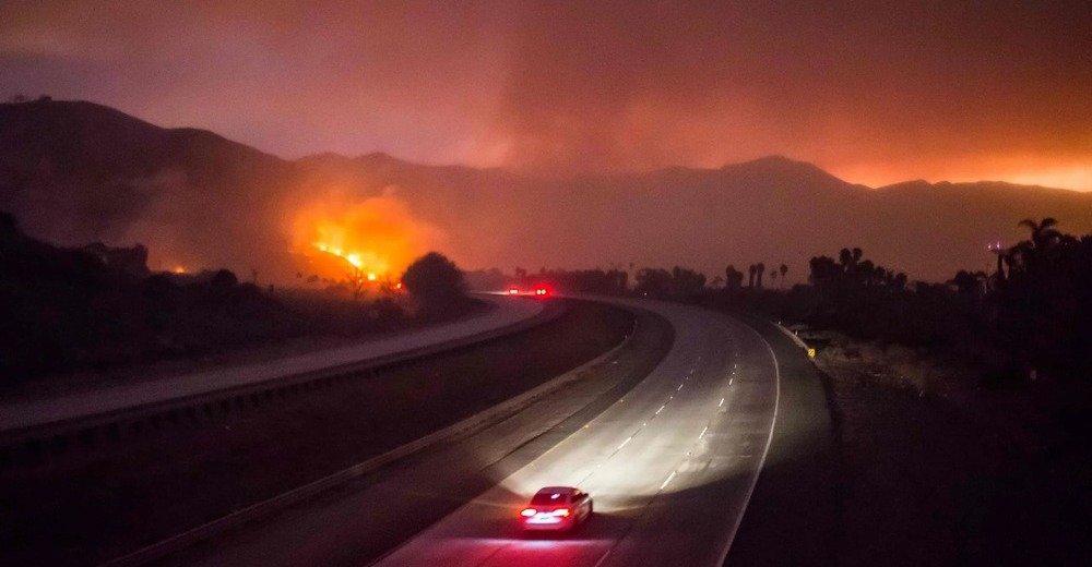
This guide covers planning, not emergency response. If a fire starts near you, follow your local officials and official emergency guidance. In short:
- Follow local evacuation orders, and leave when told to.
- Monitor official emergency alerts.
- Don’t wait for a road closure if officials issue evacuation instructions.
- Follow the routes the authorities designate.
- Don’t use a navigation app to decide whether a route is safe.
Common Mistakes
- Treating wildfire as one hazard and checking only the road.
- Checking once at home and not again on the road.
- Assuming a fire far away won’t affect the air.
- Relying on one incident website for every fire and every evacuation.
- Booking non-refundable lodging for nights that depend on an exposed road.
- Starting a remote stretch without fuel or charge.
- Using a navigation app to judge whether a road is safe.
FAQs
Can a wildfire close a highway on short notice? Yes. Oregon’s transportation department says roads near fires can close and reopen with little warning, so check again on the day you drive.
How far can wildfire smoke travel? The EPA says smoke can travel hundreds of miles. Check air quality along your route and at your stop, not only near the fire.
Where do I find evacuation information? From local emergency management and your county’s alert system. Incident websites may carry evacuation announcements for some fires, but they don’t cover every incident.
Does InciWeb list every wildfire? No. Official material notes that not all active incidents appear there.
Should I cancel a road trip because of smoke? Not automatically. If the road is open, you may be able to change the activity, the route or the day. If air quality is hazardous or visibility is poor, consider delaying.
What is a Red Flag Warning? It’s a National Weather Service alert for critical fire weather. It signals conditions that favor fast fire growth, and it’s written mainly for land and fire managers.
How is this different from checking road conditions? Road conditions are one layer. Wildfire also affects air quality, evacuations and services, each with its own source. Our road conditions guide covers matching the source to the road.
PLAN YOUR TRIP YOUR WAY
Build a day-by-day itinerary around your time, pace, interests, and budget.
Plan the route, then decide what you’d do if a road closed, the air turned bad or a stop became unreachable. Start with the Miles & Mapped trip planner, then check each problem through the source that controls it.