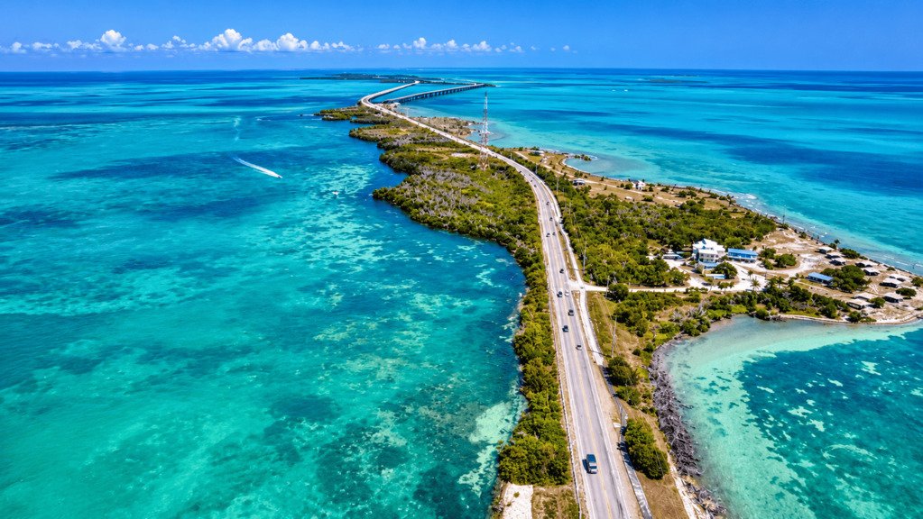
The Overseas Highway isn’t just the scenic way to visit the Florida Keys. The highway is the infrastructure that makes the trip work. U.S. 1 is the primary road connection linking the Florida mainland with the island chain, running 113 miles from Florida City to Key West across 42 bridges.
Understanding how the route itself is organized, not just which stops to make, is what actually makes a Florida Keys road trip easy to plan.
Overseas Highway Road Trip at a Glance
| Planning factor | What to know |
|---|---|
| Route | Florida City to Key West, via U.S. 1 |
| Length | About 113 miles, 42 bridges |
| Navigation system | Mile markers (MM), counting down to 0 at Key West |
| Road character | Mostly two-lane, island-hopping via a chain of bridges |
| Main planning issue | A single main road connects the whole chain |
| Recommended time | 1 day for a drive-through, 2-4+ days to actually explore |
Understanding Florida Keys Mile Markers
Florida Keys addresses are commonly described using mile markers rather than street numbers. The numbers decrease as you travel toward Key West, where the count ends at MM 0 — a higher number means you’re farther north, closer to the mainland. Key Largo sits in the upper-numbered range near MM 100–106. Businesses and attractions routinely advertise their location by mile marker rather than a street address, so this is often more useful for planning a day than the address itself.
The practical payoff is grouping stops by nearby mile marker rather than by name. If two stops sit at MM 82 and MM 80, they naturally belong in the same stretch of your day. A stop at MM 30 belongs to a different section of the trip entirely, and planning around that avoids unnecessary backtracking up and down the highway.
| Area | Approximate mile-marker range | Planning character |
|---|---|---|
| Upper Keys | MM 106–80 | Closest to the mainland |
| Middle Keys | MM 80–40 | Marathon and the Seven Mile Bridge |
| Lower Keys | MM 40–0 | Bahia Honda through Key West |
This is the core skill for planning and navigating an Overseas Highway trip, more useful day to day than any single stop on the list below.
How the Overseas Highway Is Organized
Upper Keys: Key Largo to Islamorada
The closest section to the mainland, and usually the first day of a Keys road trip. Key Largo anchors the northern end with easy mainland access and a strong focus on diving and snorkeling, while Islamorada continues the Upper Keys with a similar water-activity focus and a slightly more laid-back pace. This section is best for a shorter Florida Keys trip, an easy first or last overnight near the mainland, or anyone whose focus is snorkeling and diving over a longer drive south.
Middle Keys: Marathon and the Seven Mile Bridge
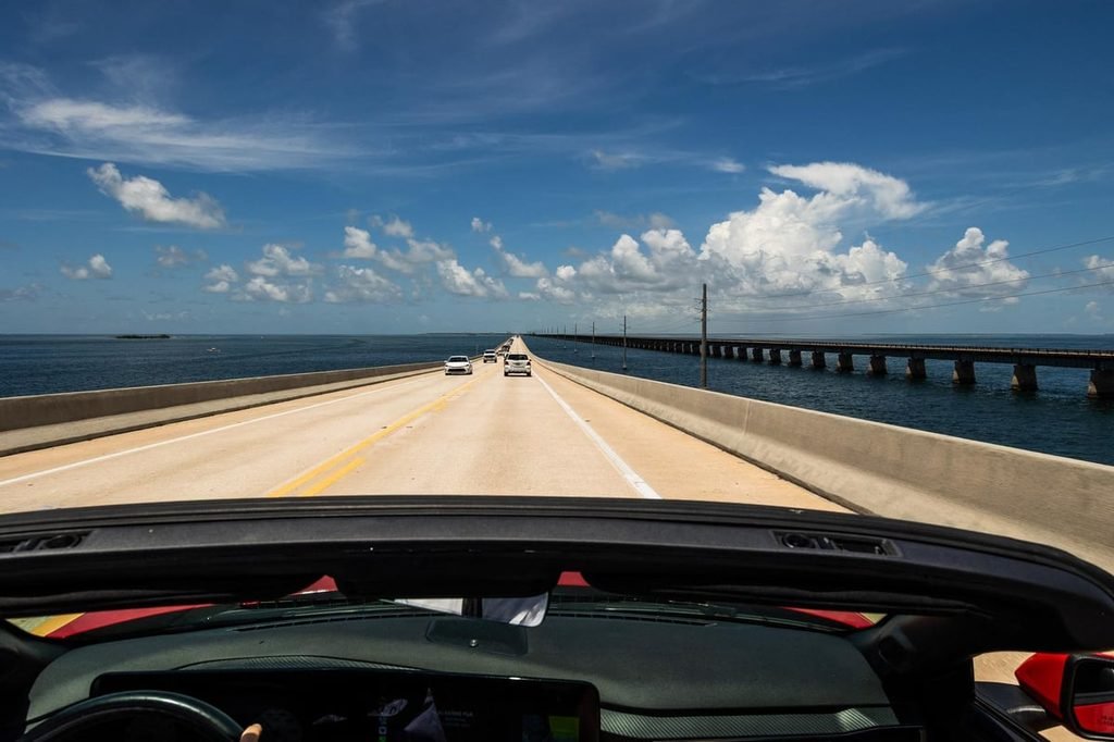
Marathon marks the central Keys and the transition point before the highway’s signature crossing. The current Seven Mile Bridge, built in 1982 and carrying all vehicle traffic between roughly MM 40 and MM 47, is the longest bridge on the route and a natural highlight of the drive itself. This section works well as a central base for exploring in both directions, or simply as the point where the trip’s character noticeably shifts.
Lower Keys: Bahia Honda to Key West
A more elongated stretch with a different character than the Upper and Middle Keys — more natural areas and beaches, leading to Key West as the highway’s endpoint and the trip’s natural destination. This is the section for a slower, more scenic pace, and for positioning yourself close to Key West without actually staying there.
Best Stops Along the Overseas Highway
John Pennekamp Coral Reef State Park (Key Largo) — the trip’s first major stop for most travelers, a good introduction to the Keys’ underwater scenery without needing to wait until Key West.
Islamorada’s waterfront — a natural break in the Upper Keys, useful for food, fuel, and a slower pace before continuing south.
The Seven Mile Bridge (near MM 40-47, Marathon) — worth slowing down for regardless of whether you stop, since it’s one of the drive’s defining moments.
Old Seven Mile Bridge / Pigeon Key — the historic bridge alongside the current one, reopened in 2022 as a 2.2-mile pedestrian and cycling trail (closed to vehicles) leading toward Pigeon Key. A worthwhile stop if you want to actually get out and walk a piece of the old route rather than just driving past it.
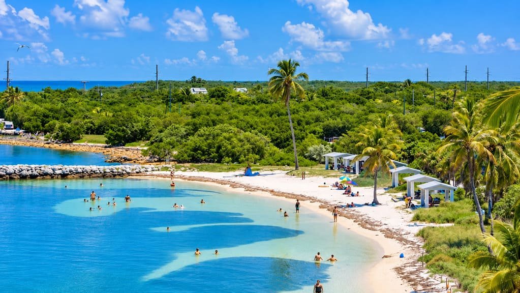
Bahia Honda State Park — one of the best beach stops on the whole route. Allow several hours if you’re planning to swim or spend real time on the sand rather than just stopping for a viewpoint.
Key West — the highway’s endpoint and, for many travelers, the actual destination the drive has been building toward.
How Much Time Should You Spend on the Overseas Highway?
The 113-mile distance doesn’t tell you much about how long the trip actually takes. 113 miles here isn’t the same as 113 miles of mainland highway — bridges, island communities, parking, activities, traffic, and weather all add time the raw mileage doesn’t capture. How much time you need depends less on distance and more on which kind of trip you’re taking.
Drive Through or Stay and Explore?
If you’re driving to Key West and treating the highway mainly as the way there, prioritize fewer stops, the major viewpoints, one or two meaningful breaks, and reaching your accommodation with daylight left.
If the highway itself is the trip, prioritize the Upper Keys, Islamorada, Marathon, the Seven Mile Bridge, and Bahia Honda, with a genuinely slower pace between them.
If Key West is the main destination, treat the Overseas Highway primarily as your access route and put more of your available days toward Key West itself rather than the drive down.
None of these is the “correct” way to do it. The question worth answering before you plan the days is which of these three you’re actually doing.
| Trip length | Best approach |
|---|---|
| 1 day | Drive-through to Key West with a few selected stops |
| 2 days | Upper and Middle Keys, then Key West |
| 3 days | More stops, a slower pace throughout |
| 4+ days | Explore multiple Keys rather than simply adding more stops |
Treat these as a starting point rather than a rule — the right length still depends on which of the three trip types above you’re actually planning.
Where Should You Stay?
| Base | Best for | Trade-off |
|---|---|---|
| Key Largo | Short trips, mainland access | Farther from Key West |
| Islamorada | An Upper Keys-focused trip | Less central to the rest of the chain |
| Marathon | Exploring in both directions | Less destination-oriented than Key West |
| Lower Keys | A slower, southern-focused trip | Farther from the mainland |
| Key West | A destination-heavy trip | Most of your time concentrated at one end |
The best choice depends on whether you’re moving through the Keys day by day or using one island as a home base for day trips in both directions.
The Single-Road Reality
U.S. 1 is the primary road connection linking the Florida mainland with the Florida Keys and connecting the islands along the chain. A disruption on the main corridor, whether from weather, an incident, or heavy traffic, can affect multiple parts of the itinerary at once, so route flexibility looks different here than it does on a mainland road trip with several parallel alternatives to fall back on.
This is a textbook example of the constrained-route planning problem discussed in our Hurricane Season Road Trips guide, which uses the Overseas Highway specifically as its example of a route with limited ways out. The takeaway isn’t about emergency-planning specifics — it’s simply that this isn’t a route with many parallel alternatives if conditions change. That’s not a reason to avoid the drive. It’s a reason to build in more flexibility than you would on a typical mainland route, particularly if you’re traveling during hurricane season.
Best Time to Drive the Overseas Highway
| Season | What to expect | Planning consideration |
|---|---|---|
| Winter | Warm, popular | Higher demand and prices |
| Spring | Warm, generally favorable | A strong shoulder-season option |
| Summer | Hot, humid, afternoon thunderstorms | Build in weather flexibility |
| Fall | Shoulder-season potential | Hurricane-season flexibility still matters |
See our Hurricane Season Road Trips guide for how to plan around that part of the year rather than avoiding it outright. Choose your season based on weather, crowds, price, and how much flexibility you want built in, rather than assuming there’s one universally best month.
What to Prepare Before You Go
Fuel up when you have the chance rather than assuming a station is always close by — services thin out in stretches of the Middle and Lower Keys. Check current bridge and road conditions before you leave rather than assuming the route is unchanged from your last trip or a blog post. Parking fills up fast at popular stops, especially the Old Seven Mile Bridge’s small lot, so plan for that rather than expecting a spot on arrival — don’t build an itinerary that assumes immediate parking at every stop. Download offline maps in case of weak signal on the longer bridge sections. The sun is intense and exposure is real even on days that don’t feel especially hot, so plan for that on any stop involving time outside the car. Book accommodations and any major activities that require reservations in advance, especially in winter, and keep cancellation flexibility where practical in case plans shift. Check current weather before you leave and again during the trip, particularly if you’re traveling anywhere near hurricane season, and keep some margin in your schedule rather than booking every hour of every day.
Who Is This Road Trip a Good Fit For?
This suits travelers who want island scenery, water activities, and a genuinely different pace than a mainland drive, whether that’s a quick pass-through to Key West or a slower multi-day exploration. It’s a tougher fit for anyone with a completely rigid schedule and no flexibility, given the route’s single-road structure, or for a trip planned entirely around the busiest hurricane-season months without any contingency built in.
Common Mistakes
- Treating 113 miles as a simple, quick point-to-point drive.
- Ignoring the mile-marker system and navigating purely by street names.
- Trying to stop at every well-known spot rather than picking a manageable number.
- Underestimating how much parking time popular stops actually require.
- Assuming every island offers the same range of services.
- Booking accommodation without considering which direction you’re actually driving.
- Not checking current road and bridge conditions before a trip.
- Treating the Keys like a mainland road network with abundant alternate routes.
- Building a completely rigid itinerary during hurricane season.
- Treating Key West as a quick stop when it deserves real time of its own.
FAQs
How long does it take to drive the Overseas Highway? The drive itself takes around 3-4 hours without stopping, but that’s a poor guide to an actual road trip — budget a full day for a drive-through with a few stops, and several days if you want to actually explore.
Where does the Overseas Highway start and end? It runs from Florida City on the mainland to Key West, following U.S. 1 the entire way.
What are Florida Keys mile markers? A navigation system used throughout the Keys that counts down from the Florida City area to MM 0 in Key West — the primary way locals and most businesses describe locations along the route.
How many days do you need for a Florida Keys road trip? It depends on the kind of trip: a single day works for a drive-through, two to three days suits a road-trip experience with several stops, and four or more makes sense if Key West or a specific Key is the main destination.
Is the Seven Mile Bridge open to cars? The current Seven Mile Bridge, built in 1982, carries all vehicle traffic. The historic Old Seven Mile Bridge alongside it reopened in 2022 as a pedestrian and cycling trail and is closed to vehicles.
Can you drive the Overseas Highway during hurricane season? Yes, but it’s worth real planning given the route’s single-road structure — see our Hurricane Season Road Trips guide for how to build in the right flexibility.
Where should you stay along the Overseas Highway? It depends on whether you’re moving through the Keys or basing yourself in one spot — see the “Where Should You Stay” section above for how each island fits a different kind of trip.
PLAN YOUR TRIP YOUR WAY
Build a day-by-day itinerary around your time, pace, interests, and budget.
Use our trip planner to build a route around how much time you have, which Keys matter most to you, and the kind of trip you’re actually taking.