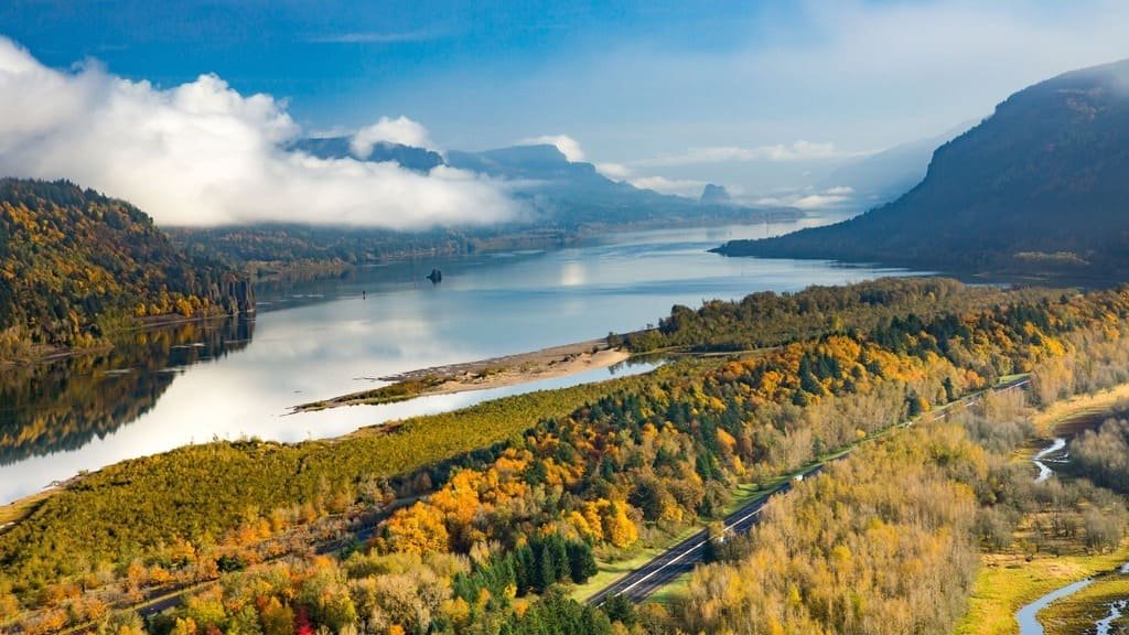
There are two ways to drive the Columbia River Gorge east from Portland, and they’re not the same road trip. I-84 gets you through the gorge quickly along the river. The Historic Columbia River Highway, built in 1913 and considered the first planned scenic drive in the country, climbs above the river through waterfall country, one hairpin turn and stone overlook at a time. Which one you take, and when, now depends partly on a parking permit system that didn’t exist a few years ago.
The gorge itself runs about 80 miles between Troutdale and The Dalles, cutting through the Cascade Range with basalt cliffs on both sides and more than 70 named waterfalls on the Oregon side alone. Multnomah Falls is the one everyone comes for, and it’s also the one with the most planning to get right.
Quick Facts
| Fact | Details |
|---|---|
| Location | Columbia River Gorge, Oregon and Washington |
| Length | Roughly 80 miles, Troutdale to The Dalles |
| Main routes | Historic Columbia River Highway (US 30) or I-84 |
| Road type | Historic two-lane scenic highway/interstate |
| Multnomah Falls permit (2026) | Required at the I-84 lot only, 9 am–6 pm, May 22–Sept 7 |
| Other waterfall fees | Separate Oregon State Parks day-use fee at three stops |
| Recommended time | 2 hours to a full day, depending on stops |
Do You Need a Permit? 2026 Rules
There are three separate systems in play here, and mixing them up is the single easiest planning mistake to make.
| Location | What you need |
|---|---|
| Multnomah Falls — I-84 Exit 31 lot | $2 Timed Use Permit, required 9 am–6 pm, May 22–Sept 7, 2026 |
| Multnomah Falls — Historic Highway lot | No permit required, but the lot is small and fills up by mid-morning |
| Latourell Falls, Bridal Veil Falls, Angel’s Rest | Oregon State Parks day-use parking fee ($10 in-state / $12 out-of-state), separate from the Multnomah system |
The $2 Multnomah Falls permit and the Oregon State Parks parking fees are not the same system. A permit for one doesn’t cover the other, and having one doesn’t mean you’re set for the whole corridor.
The Multnomah Falls permit is booked through Recreation.gov and gives you a one-hour arrival window, not a limit on how long you can stay once parked — but it also doesn’t guarantee a space. The Exit 31 lot has 186 spots and runs first-come, first-served even for permit holders. Outside the 9 am–6 pm window, or outside the May 22–September 7 dates, no permit is needed at all. A limited number of free same-day permits are also available in person at the Gateway to the Gorge Visitor Center in Troutdale and the Cascade Locks Historical Museum, for anyone who didn’t book ahead.
As of this writing, both historic viaducts on the Historic Highway near Multnomah Falls have reopened after a two-year restoration project — the west side in 2025, the east side in May 2026 — so the road is currently open along its full length near the falls. Road work in the gorge shows up periodically, though, so check ODOT’s TripCheck before you go rather than assuming last year’s route is unchanged.
Choosing Your Route
Historic Columbia River Highway
This is the drive if the drive itself is the point. Stone guardrails, tunnels, and overlooks built into the cliffside connect most of the corridor’s major waterfalls directly. It’s slower, narrower, and built for a different era of car — comfortable, but not a route for someone in a hurry.
I-84
The interstate runs along the river and gets you through the gorge fast, with direct exits to Multnomah Falls and a few other stops. It’s the practical choice if you’re short on time or just passing through toward Hood River or beyond.
Which Route Should You Choose?
Take I-84 if you mainly want to get through the gorge, you’re short on time, you already have a Multnomah Falls permit for your arrival window, or you want the simpler drive. Take the Historic Highway if the waterfalls and viewpoints are the actual destination, you have more time to spend, and you’re comfortable with a slower, more constrained road. There isn’t a single correct route — it depends on what kind of day you’re planning.
Best Stops
A natural progression running east from Portland: Crown Point → Latourell Falls → Bridal Veil Falls → Multnomah Falls → Wahkeena Falls → Horsetail Falls → Rowena Crest.
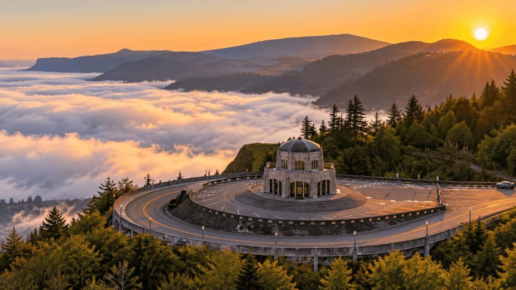
Vista House at Crown Point — A domed 1918 overlook 733 feet above the river, built as a rest stop for early motorists and now the first big view most people hit on the Historic Highway. Inside there’s a small museum and gift shop, and the parking area itself offers a wide look back over the gorge toward Portland. Budget 20–30 minutes, more if you want to walk the short paths around the overlook.
Latourell Falls — A 224-foot drop close to the road, with a short paved walk to the lower viewpoint in a few minutes from the parking area. A longer 2.3-mile loop trail continues to an upper viewpoint for anyone with more time. Now requires the separate Oregon State Parks parking fee, and the lot is small enough to fill up on busy weekends.
Bridal Veil Falls — A quieter stop than Multnomah, with a half-mile round trip trail down to the base of the falls through a mix of forest. Also covered by the Oregon State Parks fee rather than the Multnomah permit system.
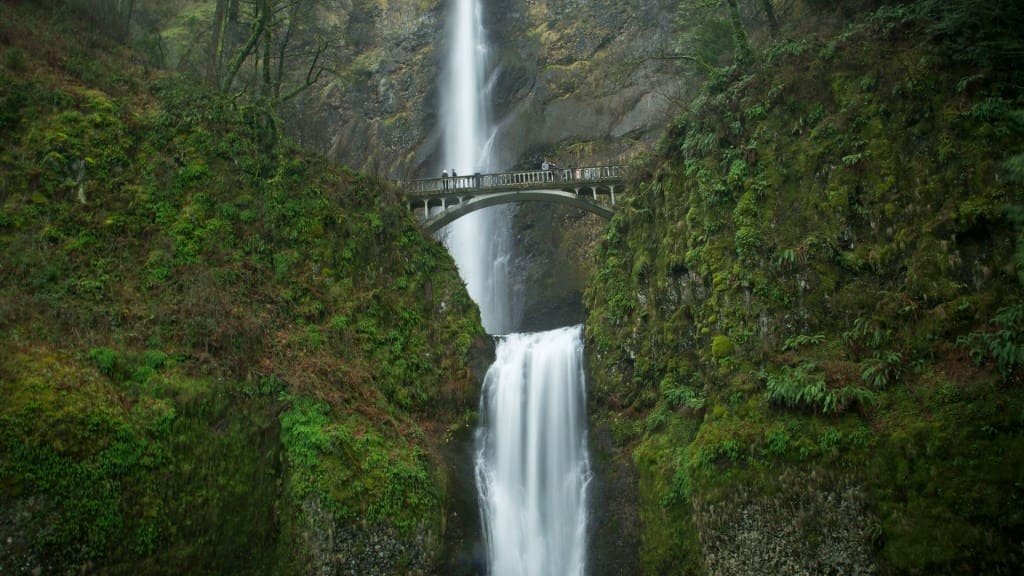
Multnomah Falls — The corridor’s centerpiece, at 620 feet the tallest in the gorge, with the Benson Bridge crossing partway up the falls. A paved path leads from the lodge to the bridge in about ten minutes, with a longer trail continuing to the top for those who want the full hike. Requires the permit system described above if you’re parking at the I-84 lot, and even with a valid permit the historic lodge building and viewing area get genuinely crowded in summer.
Wahkeena Falls — A short walk from Multnomah Falls along the Historic Highway, with a steeper but less crowded trail up to the falls themselves. No permit required here, and it’s a good alternative stop if the main Multnomah lot is full.
Horsetail Falls — Right off the highway with minimal walking required to see it from the road, making it one of the easiest stops to fit in even on a tighter schedule. A longer loop trail connects it to nearby Ponytail Falls for anyone who wants to extend the stop.
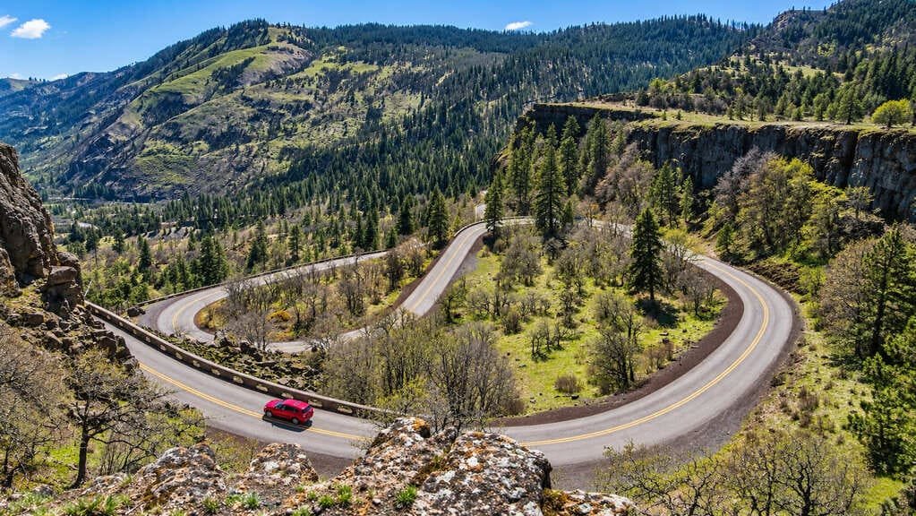
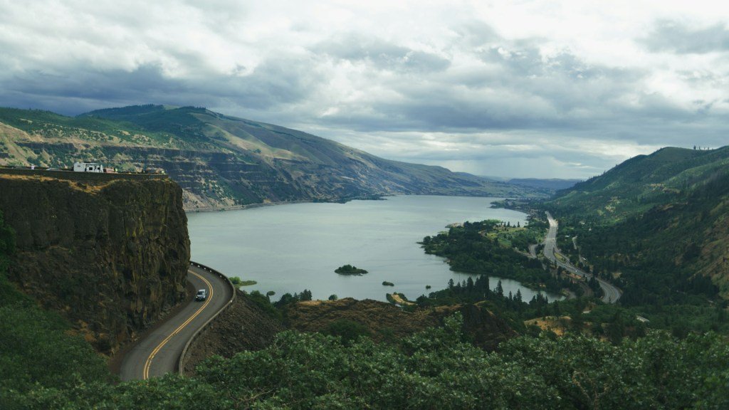
Rowena Crest — Further east, past the forested section of the gorge, with a sweeping view over the Columbia and the drier, more open landscape that marks the transition toward the gorge’s eastern end. The old highway’s switchbacks are visible from the overlook, and it’s a natural place to turn around if you’re not continuing on toward Hood River or The Dalles.
How Long Do You Need?
| Road Trip style | Suggested time |
|---|---|
| Quick pass-through | 1–2 hours |
| Scenic drive with a major viewpoint or two | 3–4 hours |
| Waterfalls plus the full Historic Highway | 5–7 hours |
| Full gorge day with hikes | A full day |
A gorge drive can look short on a map, but waterfalls, viewpoints, parking, and pedestrian crossings between lots and trailheads add up fast. Treat these as planning ranges, not fixed schedules — the actual time depends on how many stops you make and how busy the lots are that day.
Best Time to Drive the Columbia River Gorge
- Spring brings high water and dramatic waterfall flow, along with wildflowers on some of the shorter trails.
- Summer is the busiest season and the only time the Multnomah Falls permit system applies — plan around it or expect crowded lots.
- Fall offers lighter crowds once the permit window ends in early September, with color starting to turn at higher elevations.
- Winter can bring genuinely beautiful ice formations at some waterfalls, but also fog, wind, and occasional road closures — check conditions before committing to a winter trip.
Best Time of Day
- Before 9 am avoids both the Multnomah Falls permit window and the heaviest crowds at every stop.
- 9 am–6 pm during the permit period requires the Timed Use Permit for the I-84 lot specifically — everywhere else in the corridor is unaffected by this rule.
- After 6 pm, the permit requirement no longer applies for the day, though daylight, parking availability, and individual attraction hours still matter.
Extend the Drive: Washington Side
SR-14 runs along the Washington side of the gorge and makes a good alternative or extension if Oregon-side parking isn’t working out. Cape Horn offers a sweeping view back across the river, and Beacon Rock, a striking volcanic monolith with a switchback trail to the top, is a worthwhile stop in its own right. This isn’t the main event for most visitors, but it’s a solid option if you want to see the gorge from the other side or need a plan B when the Oregon lots are full.
What to Prepare Before You Go
- Book your Multnomah Falls permit in advance through Recreation.gov if you’re visiting during the 2026 permit period and plan to use the I-84 lot
- Check ODOT’s TripCheck for current road and construction conditions before you leave
- Bring cash or a card for the separate Oregon State Parks parking fee at Latourell, Bridal Veil, and Angel’s Rest
- Pack layers — the gorge funnels wind and temperatures can shift quickly between stops
- Download offline maps for stretches with weak cell coverage
Who This Drive Is Best For
This suits scenic drive travelers, waterfall chasers, photographers, and anyone building a Portland day trip or a longer Pacific Northwest road trip. It’s less ideal for anyone with no flexibility around parking availability, or a traveler hoping to see every named waterfall in a single afternoon — the corridor rewards picking a handful of stops rather than trying to hit them all.
Common Mistakes
- Assuming every Multnomah Falls parking area requires the same permit.
- Confusing the $2 Multnomah Falls Timed Use Permit with the separate Oregon State Parks parking fees.
- Assuming a valid permit guarantees a parking spot.
- Treating the Historic Highway as a fast through-route rather than the slower scenic drive it is.
- Following an old itinerary without checking current road conditions first.
- Trying to see every waterfall in the corridor without allowing time for parking and walking between them.
FAQs
Do I need a permit to drive the Columbia River Gorge? No permit is needed to drive through the gorge itself. A permit is only required to park at the Multnomah Falls I-84 Exit 31 lot during the 2026 permit period (9 am–6 pm, May 22–September 7).
Is the Historic Columbia River Highway open? As of this writing, yes, including the two viaducts near Multnomah Falls that were closed for restoration through 2025 and early 2026. Check ODOT’s TripCheck before your road trip since road conditions can change seasonally.
How much does it cost to visit Multnomah Falls? $2 for the Timed Use Permit if you’re parking at the I-84 lot during the permit period. The Historic Highway lot doesn’t require this permit but has very limited space.
Do I need a permit for other Columbia River Gorge waterfalls? Latourell Falls, Bridal Veil Falls, and Angel’s Rest require a separate Oregon State Parks day-use parking fee, not the Multnomah Falls permit. Other stops, including Wahkeena and Horsetail Falls, currently require neither.
How long does it take to drive the Columbia River Gorge? A straight pass-through takes 1–2 hours. Plan a half day to a full day if you want to include several waterfalls and viewpoints.
Which side of the gorge should I drive, Oregon or Washington? The Oregon side has the Historic Highway and most of the well-known waterfalls. The Washington side (SR-14) is a good alternative or extension, with Cape Horn and Beacon Rock as its highlights.
PLAN YOUR TRIP YOUR WAY
Build a day-by-day itinerary around your time, pace, interests, and budget.
Build the gorge into a larger Pacific Northwest itinerary with our planner, timed around the permit windows, your available days, and whether you want the fast route or the scenic one.