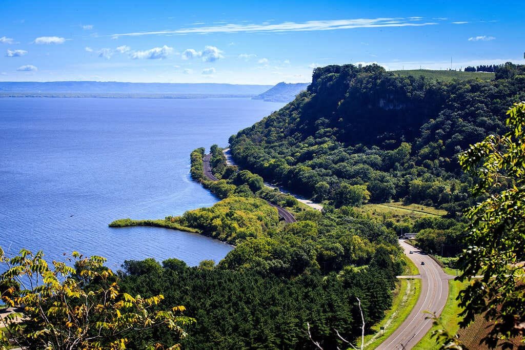
The Loess Hills National Scenic Byway runs 220 miles down the western edge of Iowa, along bluffs made of wind-blown soil that stand above the Missouri River Valley. The hills are up to 15 miles wide and nearly 200 miles long, and they are among the few places in the world with this kind of formation.
The byway starts at Akron in the north, passes Sioux City, and ends near Hamburg, at the Missouri state line. Along the way are prairie preserves, state parks, nature centers, and Council Bluffs.
There are 185 miles of optional loops, some of them gravel. You can see the byway in a day, but the loops, overlooks, and state forests reward a longer stay.
Route Details: Loess Hills National Scenic Byway
Mile markers below are my estimates of distance from Akron.
Akron (0 miles)
Akron is a small town in Plymouth County in northwest Iowa and the north end of the byway. It sits close to I-29, so it’s easy to reach.
Sioux City (28 miles)
Sioux City is the byway’s northern hub. Stone State Park is inside the city, the Dorothy Pecaut Nature Center has a nature playscape for kids, and the Lewis and Clark Interpretive Center and Sergeant Floyd Monument cover local history. Sioux City has a 150 kW fast charger and other DC fast stations.
Loess Hills Wildlife Area (70 miles)
Near Castana, the Loess Hills Wildlife Area protects 3,500 acres of the hills in their natural state. It is a good stop for hiking and birding.
Loess Hills State Forest and Preparation Canyon (90 miles)
Near Pisgah, the Loess Hills State Forest covers 10,000 acres and has a visitor center and nature center. Preparation Canyon State Park has 344 acres of hike-in campsites and ridgetop views, and Utah-bound Mormons rested here in 1853. A wheelchair-friendly overlook looks across the hills.
Little Sioux and Murray Hill (105 miles)
Murray Hill Scenic Overlook sits northeast of Little Sioux on F20. It is a short, quiet stop for views of the hills.
Missouri Valley and DeSoto (125 miles)
Missouri Valley has the Loess Hills Lavender Farm and the DeSoto National Wildlife Refuge nearby. The town has fast charging funded through the state’s settlement program.
Honey Creek and Hitchcock Nature Center (145 miles)
Hitchcock Nature Center has trails through prairie and woods, a visitor center, and the 45-foot observation tower. It is one of the best viewpoints on the byway.
Council Bluffs (165 miles)
Council Bluffs is the byway’s biggest city. The Union Pacific Railroad Museum, the Western Historic Trails Center, the General Dodge House, and the Lewis and Clark Monument are all here. It has a 150 kW Hy-Vee charger and a 180 kW Shell Recharge site, and the 63-mile Wabash Trace Nature Trail starts in town.
Glenwood and Tabor (180-195 miles)
South of Council Bluffs, Highway 275 goes through Glenwood and Tabor. The Todd House Museum in Tabor was a hub of the Underground Railroad.
Hamburg and Waubonsie State Park (220 miles)
The byway ends near Hamburg at the Missouri line. Waubonsie State Park, close to town, covers nearly 2,000 acres of forested loess ridges with hiking trails.
Use the trip planner to build a day-by-day itinerary based on your available time and starting point.