Pacific Coast Highway runs about 655 miles along the California coast from San Francisco to San Diego, passing through redwood groves, fishing towns, and cliffside stretches with ocean views for most of the drive. Most of the route is two lanes, and cell service drops out for long stretches through Big Sur, so it’s worth downloading offline maps before leaving San Francisco.
The drive can be done in a long day, but the road narrows and curves enough through certain sections that rushing isn’t really an option — most people spend 4 to 7 days covering the full route. Stops range from small beach towns to a Gilded Age estate to a stretch of coastline with almost no services at all, so fuel and food planning matters more here than on a typical highway trip. The best conditions are late spring through early fall, though fog is common along the coast even in summer.
Route Details: Pacific Coast Highway
San Francisco to Half Moon Bay (30 miles)
Leave the city on Highway 1 south, passing Pacifica’s cliff trails at Mori Point. Half Moon Bay has pumpkin farms along Highway 92 and a lighthouse at Pillar Point that’s a quick stop off the main road. If you’re driving in fall, the pumpkin stands along Highway 92 get busy on weekends.
Santa Cruz and Monterey (75 miles)
Santa Cruz’s beach boardwalk is the last classic amusement pier on the West Coast, with a wooden roller coaster dating to 1924. From there, the drive continues to Monterey, where the aquarium sits on Cannery Row and the 17-Mile Drive loops through Pebble Beach’s golf courses and cypress groves — there’s a toll to enter, currently around $12 per car, refundable with a meal purchase at some restaurants inside.
Big Sur (90 miles)
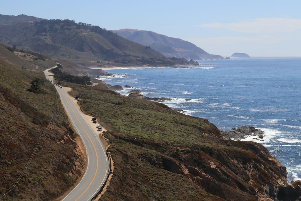
This is the section most people picture when they think of PCH. Bixby Bridge, about 13 miles south of Carmel, is the most photographed spot on the route — pull off early in the morning to avoid the crowds at the main viewpoint. McWay Falls, a short walk from the parking lot at Julia Pfeiffer Burns State Park, drops straight onto a beach that’s closed to foot traffic, so you’re viewing it from the bluff above. Gas and food options thin out through here; fill your tank in Carmel before heading in. Budget at least half a day for this stretch alone, since the road narrows and curves enough that rushing isn’t really an option.
Hearst Castle and Cambria (60 miles)
Hearst Castle, William Randolph Hearst’s hilltop estate above San Simeon, requires a separate ticketed tour bus from the visitor center — you can’t drive up yourself. Tours run about 1 to 2 hours depending on which wing you choose, and tickets are worth booking ahead in summer. Cambria, a few miles south, is a small town built around a single walkable Main Street with local shops and restaurants, a good spot to stretch your legs after the castle tour.
Santa Barbara (100 miles)
The road pulls inland a bit here before reaching Santa Barbara, known for its red-tile-roofed Spanish colonial buildings downtown and the Santa Barbara Mission. It’s also close to the Santa Ynez wine region if you want to add a short detour inland. Because it’s roughly the midpoint before the final push to San Diego, it works well as an overnight stop.
Los Angeles to San Diego (150 miles)
Past Santa Barbara, the highway runs through more built-up areas, but there are still good stops: Malibu’s beaches, the cliffside village of Laguna Beach, and La Jolla’s coastal cove just north of San Diego. Traffic through the LA area can slow this stretch down considerably, especially on weekday afternoons, so plan around rush hour if you can.
Use the trip planner to build a day-by-day itinerary based on your available time and starting point.