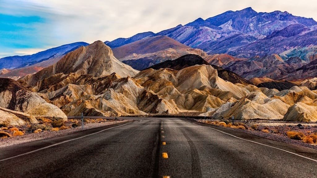
Death Valley Scenic Byway runs 81.5 miles along Highway 190, cutting through the largest national park in the Lower 48 and some of the most extreme terrain in the country. It became a National Scenic Byway in 1998.
The road passes through Death Valley National Park’s 3.3 million acres of salt flats, sand dunes, and badlands, dropping below sea level at points along the way. Death Valley holds the record for the hottest reliably recorded air temperature on Earth, and Badwater Basin, just off the byway, sits at 282 feet below sea level, the lowest point in North America.
Despite the name and the extremes, the drive itself is straightforward: paved the whole way, well signed, with three gas stations spaced along the route. The challenge is the heat, not the road, which is why timing the trip for cooler months matters more here than on almost any other byway on this list.
The landscape changes constantly along the drive, from the golden badlands of Zabriskie Point to the colorful mineral deposits of Artists Palette to the wind-sculpted dunes near Stovepipe Wells, with side roads branching off toward canyons, craters, and abandoned mining sites for anyone with extra time.
Route Details: Death Valley Scenic Byway
Death Valley Junction and the eastern entrance (0 miles)
The byway begins near Death Valley Junction, about 13 miles east of the park’s official eastern entrance. This stretch of Highway 190 gives the first views of the valley floor opening up ahead, with the Amargosa Range framing the approach.
Zabriskie Point (15 miles)
Zabriskie Point is the most photographed overlook in the park, looking out over the golden, eroded badlands of the Furnace Creek formation. It’s popular at both sunrise and sunset, when the light brings out the deepest color in the hills, and short connector trails lead down into Golden Canyon and Gower Gulch for those who want a closer look.
Furnace Creek (20 miles)
Furnace Creek is the park’s main hub, with a visitor center, lodging, and the park’s most reliable services, including its main gas station. It’s also home to what limited EV charging exists in the park, though not all of it has stayed consistently operational.
Badwater Basin detour (35 miles)
A short detour south on Badwater Road leads to Badwater Basin, the lowest point in North America at 282 feet below sea level. A quarter-mile boardwalk leads out onto the basin’s famous salt polygons, a strange, cracked landscape that’s one of the defining images of the park.
Artists Drive and Artists Palette (30 miles)
Artists Drive is a one-way scenic loop off the main byway, winding past Artists Palette, a hillside streaked with pink, green, and purple mineral deposits from volcanic ash. It’s a quick, easy add-on that rewards slowing down for the color alone.
Stovepipe Wells and the Mesquite Flat Sand Dunes (45 miles)
Stovepipe Wells is the park’s second service hub, with a general store, gas station, and the park’s other cluster of EV chargers. Just outside town, the Mesquite Flat Sand Dunes rise up to 100 feet and are one of the most accessible dune fields in the park, an easy walk from the road.
Emigrant Canyon and Father Crowley Point (65 miles)
West of Stovepipe Wells, the byway climbs into Emigrant Canyon before reaching Father Crowley Point, an overlook above Rainbow Canyon with sweeping views back over the valley. It’s a good stop for stretching the legs before the final descent out of the park.
Panamint Springs (81.5 miles)
The byway ends near Panamint Springs, just past the park’s western boundary. Panamint Springs Resort has the last gas station before continuing toward Lone Pine and the Eastern Sierra, and it’s a natural stopping point before heading on to Mount Whitney or Highway 395.
Use the trip planner to build a day-by-day itinerary based on your available time and starting point.