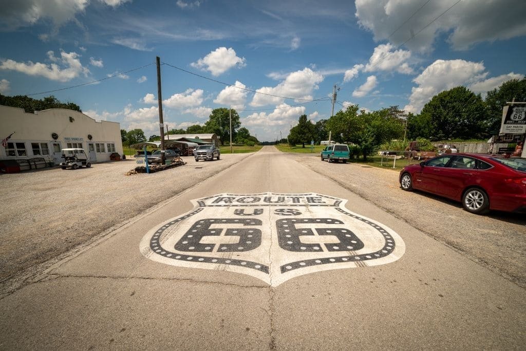
Route 66 stretches 2,448 miles from Chicago to Santa Monica, crossing eight states and following what’s left of the original highway that opened in 1926. Much of the road was replaced by Interstates after decommissioning in 1985, so today’s drive follows a patchwork of frontage roads, historic alignments, and marked “Historic Route 66” signs rather than one continuous highway. What survives is a string of small towns built around the road’s mid-century peak: neon motel signs, diners that have run since the 1940s, and roadside attractions built to catch drivers’ attention from the highway.
The full drive takes about 40 hours behind the wheel, but most people spend 10 to 14 days working through it at a slower pace. Expect long, flat stretches through the Plains states broken up by short, memorable stops rather than constant scenery.
Route Details: Route 66
Chicago to St. Louis (300 miles)
Route 66 begins at Grant Park in Chicago, marked by a sign at Adams and Michigan. The drive south through Illinois passes small towns like Pontiac, home to several Route 66 murals and a museum dedicated to the road, and Springfield, where the Cozy Dog Drive-In claims to have invented the corn dog on a stick in 1946. Crossing into Missouri, the road runs into St. Louis, where the Gateway Arch sits a short detour off the main route.
St. Louis to Tulsa (380 miles)
Missouri’s stretch of Route 66 passes through the Ozarks, including the town of Cuba with its collection of large outdoor murals. In Kansas, the route clips a short 13-mile corner of the state through Galena, once a mining town and now home to a rusted tow truck said to have inspired the character Mater in the movie Cars. Crossing into Oklahoma, the road passes through Tulsa, where the Blue Whale of Catoosa, a roadside attraction built in the 1970s, sits beside a small pond just outside town.
Tulsa to Amarillo (350 miles)
Oklahoma’s stretch includes Oklahoma City and the Route 66 Museum in Clinton, which covers the road’s full history decade by decade. The drive continues into the Texas Panhandle, where Amarillo is home to the Cadillac Ranch, ten vintage Cadillacs buried nose-down in a field and covered in decades of spray paint from visitors. Bring your own can if you want to add to it.
Amarillo to Albuquerque (300 miles)
Crossing into New Mexico, the route passes through Tucumcari, a town with a strip of restored neon motel signs from the road’s mid-century heyday. Albuquerque’s Central Avenue follows the old alignment through downtown, lined with diners and motor courts that have operated since the 1940s and 50s.
Albuquerque to Flagstaff (325 miles)
West of Albuquerque, the road climbs through pine forests toward Flagstaff, passing the Petrified Forest National Park and the Painted Desert, where fossilized logs from 200 million years ago are scattered across colorful badlands. Winslow, Arizona, made famous by the Eagles’ song “Take It Easy,” has a corner downtown built around the lyric, with a flatbed Ford parked nearby.
Flagstaff to Santa Monica (390 miles)
The final stretch drops out of Flagstaff’s pine forests into the Mojave Desert, passing through Seligman, a small town credited with helping preserve Route 66 as a historic road in the 1980s after the interstate bypassed it. Past the desert, the route enters Los Angeles and ends at the Santa Monica Pier, where a sign marks the official end of the road.
Use the trip planner to build a day-by-day itinerary based on your available time and starting point.