The Coulee Corridor Scenic Byway crosses about 150 miles of central Washington, from Othello in the south to Omak in the north. The Federal Highway Administration designated it a National Scenic Byway in 2005.
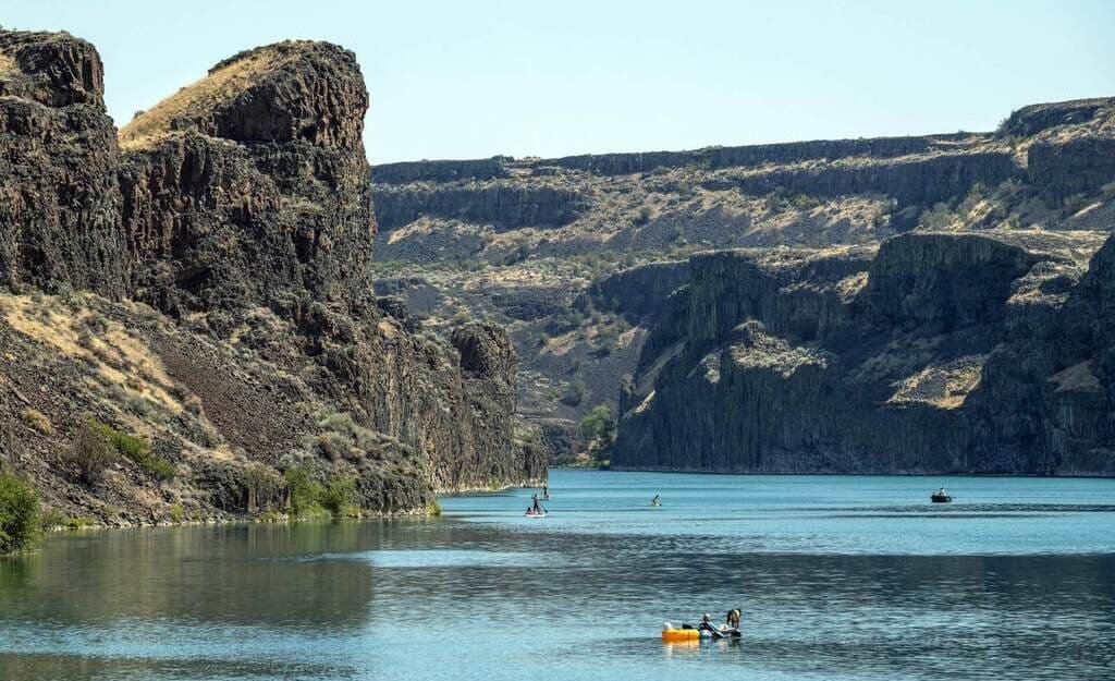
The landscape looks dry, but water made it. Ice Age floods scoured the basalt and carved the coulees, cliffs, and lakes that the road now passes. Later, the same terrain made a good site for Grand Coulee Dam.
The byway follows Washington State Routes 17 and 155 plus a short stretch of US 2. Along the way, it passes Moses Lake, Soap Lake, Banks Lake, and Dry Falls, then crosses the Colville Indian Reservation on the way to Omak.
Towns are spaced well apart, so plan for fuel and food in Moses Lake, Coulee City, and Grand Coulee.
Route Details: Coulee Corridor Scenic Byway
Mile markers below are approximate distances from Othello.
Othello (0 miles)
The byway starts in Othello, a farm town in the Columbia Basin. Each spring the town hosts a sandhill crane festival, and the nearby Columbia National Wildlife Refuge has sagebrush flats, small lakes, and basalt cliffs from the same flood system that shaped the rest of the route.
Potholes and Moses Lake (26 miles)
Moses Lake is one of the larger cities on the byway and the last easy place for a full meal or a hotel before the desert canyon country. Potholes State Park sits nearby, and the area is popular with anglers and boaters.
Soap Lake and Lake Lenore Caves (50 miles)
Soap Lake is a small town on a mineral-rich lake with a long history as a health destination. North of town, Lake Lenore Caves State Park Heritage Site holds shallow caves in the basalt walls that Native people used as temporary shelters and storage while hunting and gathering in the coulee.
Dry Falls (65 miles)
Sun Lakes-Dry Falls State Park is the geological centerpiece of the drive. Dry Falls was once a waterfall four times the size of Niagara. The cliff is now dry, 400 feet high and 3.5 miles long, and it was carved by Ice Age floods about 15,000 years ago. The Dry Falls Visitor Center covers the story with exhibits and a short video.
Coulee City and Banks Lake (70 miles)
Coulee City sits at the south end of Banks Lake, a 27-mile-long reservoir known for fishing and boating. It makes a good base for the Dry Falls area, and the byway then turns north along the lake on Route 155.
Steamboat Rock State Park (85 miles)
About 15 miles before the dam, Steamboat Rock State Park rises from the water of Banks Lake as a flat-topped basalt butte. The park has three campgrounds, a swimming beach, and hiking trails up the rock.
Grand Coulee Dam (98 miles)
Grand Coulee Dam was built between 1933 and 1942, stands 550 feet tall, and is the largest hydropower producer in the country. It supplies irrigation to roughly half a million acres of farmland. The visitor center runs tours, and Crown Point State Park across the bridge has a free overlook and picnic area.
Colville Reservation and Omak (150 miles)
Past the dam, the byway runs east then north across the Colville Indian Reservation through Nespelem. The Colville Confederated Tribes Museum covers the history of the tribes that live there, and a memorial to Chief Joseph stands nearby. His gravesite is not open to visitors, in keeping with Nez Perce wishes. The byway ends in Omak, where it connects to the Okanogan Trails Scenic Byway.
Use the trip planner to build a day-by-day itinerary based on your available time and starting point.