The Historic Columbia River Highway was the first scenic highway built in the United States, engineered between 1913 and 1922 to showcase the Columbia River Gorge rather than simply get travelers from one place to another.
Samuel Lancaster, the engineer who designed it, worked with road enthusiast Sam Hill to build what became known as the King of Roads, winning National Historic Landmark status in 2000 and earning recognition as a National Scenic Byway- All-American Road in 1999. The original highway ran 74 miles from Troutdale to The Dalles, though Interstate 84’s construction later bypassed and, in places, destroyed sections of it.
Today, about 40 miles remain open to cars, concentrated in two main stretches: the famous Waterfall Corridor between Troutdale and Ainsworth State Park, and a separate eastern section from Mosier to The Dalles through orchard and plateau country. The gaps in between are covered by I-84 or by the Historic Columbia River Highway State Trail, a car-free path for cyclists and walkers built on abandoned sections of the original road.
What makes the drive remarkable is density: more waterfalls, cliff-top viewpoints, and historic engineering in a short stretch than almost anywhere else in the country, all built before the automobile had fully taken over American road design.
Route Details: Historic Columbia River Highway
Troutdale (0 miles)
The byway begins in Troutdale at exit 17 off I-84, billed as the Gateway to the Gorge. A walkable historic downtown gives a last stop for food and fuel before the road follows the Sandy River upstream and starts climbing toward the Gorge’s cliff-top views.
Corbett and the Portland Women’s Forum Viewpoint (8 miles)
The highway winds uphill through the small community of Corbett before reaching the Portland Women’s Forum State Scenic Viewpoint, the first cliff-top panorama of the Gorge and a popular early stop for photos looking back toward Crown Point.
Crown Point and Vista House (11 miles)
Crown Point rises more than 700 feet above the Columbia River, with the 1918 Vista House perched dramatically at its edge. It’s one of the most recognizable landmarks on the entire highway and a near-mandatory stop.
The Waterfall Corridor (14-20 miles)
This roughly six-mile stretch holds an extraordinary concentration of waterfalls: Latourell, Shepperd’s Dell, Bridal Veil, Wahkeena, Multnomah, Oneonta, and Horsetail Falls are all accessible directly from the road or a short walk. Multnomah Falls, at 620 feet, is the tallest in Oregon and the most visited natural attraction in the state, so expect crowds at peak times.
Oneonta Tunnel and Ainsworth State Park (20 miles)
The restored Oneonta Tunnel marks the end of the fully continuous drivable stretch from Troutdale. Ainsworth State Park, just past it, has camping and trail access, and is where many day-trippers turn back toward Portland.
Cascade Locks and Hood River (via I-84, 35-60 miles)
Past Ainsworth, travelers typically pick up I-84 to continue east, passing Cascade Locks and reaching Hood River, a windsurfing and orchard town with the Gorge’s strongest services and EV charging along this stretch.
Mosier and the Twin Tunnels Trail (65 miles)
The historic highway reconnects at Mosier, the eastern end of the restored Twin Tunnels Trail, a rehabilitated 4.5-mile segment between Hood River and Mosier that mixes drivable road with trail sections.
Rowena Loops (68 miles)
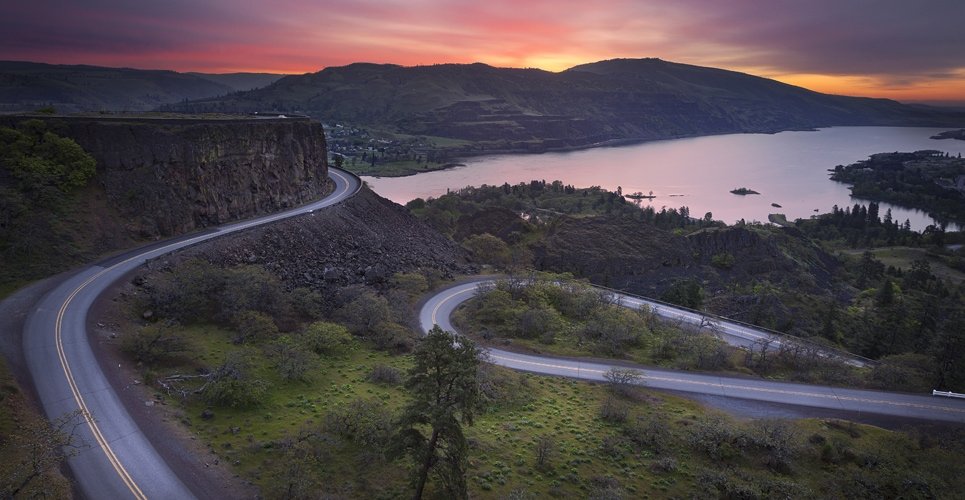
The byway makes a dramatic switchback descent down the Rowena Loops, a stretch so visually striking it’s been featured in car commercials. The Rowena Crest viewpoint above the loops gives one of the best panoramic views of the Columbia River on the entire drive.
The Dalles (74 miles)
The byway ends in The Dalles, a Native American gathering place for more than 11,000 years and later a staging area for Oregon Trail pioneers preparing for the dangerous trip down the Columbia’s rapids. The Columbia Gorge Discovery Center and Museum serves as the official interpretive center for the National Scenic Area, a fitting final stop to close out the drive’s history.
Use the trip planner to build a day-by-day itinerary based on your available time and starting point.