The Grand Rounds National Scenic Byway loops about 50 miles through Minneapolis, linking nearly every major park and lake in the city into one continuous, drivable parkway system.
The idea dates back further than the automobile itself. Landscape architect Horace W.S. Cleveland proposed an encircling parkway connecting the city’s parks in 1883, and the Minneapolis Board of Park Commissioners formally adopted the name Grand Rounds in 1890. The Minneapolis Park and Recreation Board has been building out the vision ever since, and the Federal Highway Administration designated it a National Scenic Byway in 1998, specifically recognizing it as the country’s premier urban scenic byway.
The route strings together six distinct districts: the Chain of Lakes, Minnehaha, the Mississippi River gorge, the Downtown Riverfront, Northeast Minneapolis, and Theodore Wirth Park. It also provided the key link completing the national Great River Road, tying Minneapolis directly into that much longer Mississippi River route.
Unlike most byways on this list, the Grand Rounds is built for more than driving. Over 100 miles of paved trails run alongside the parkways, making it one of the best urban corridors in the country for walking and cycling as much as for a scenic drive.
Route Details: Grand Rounds National Scenic Byway
Theodore Wirth Park (0 miles)
The byway’s western anchor is Theodore Wirth Park, the city’s largest park, with a wildflower garden and golf course. The parkway here connects to Victory Memorial Parkway heading north and to the Chain of Lakes district heading south, making it a natural starting point for the loop.
Cedar Lake Parkway and the Chain of Lakes (8 miles)
Heading south, Cedar Lake Parkway crosses Interstate 394 and leads into the Chain of Lakes, the byway’s best-known section. The loop circles Lake of the Isles, Lake Calhoun (Bde Maka Ska), and Lake Harriet, the last of which has a well-known rose garden and a bandshell with regular summer concerts.
Minnehaha Parkway and Minnehaha Falls (18 miles)
After crossing Hiawatha Avenue, the route becomes Minnehaha Parkway, following Minnehaha Creek east toward Lake Nokomis and Lake Hiawatha before reaching Minnehaha Park. The park’s 53-foot waterfall is one of the most-visited natural features in the city.
Mississippi River Gorge and the Downtown Riverfront (28 miles)
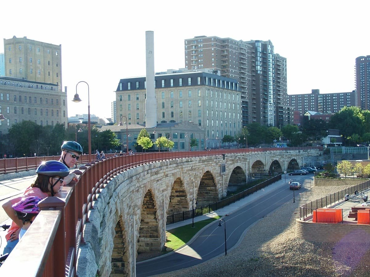
The byway follows West River Parkway along the Mississippi River gorge, passing the west bank of the University of Minnesota before reaching downtown. The Mill City Museum, the historic 1883 Stone Arch Bridge, and the downtown riverfront make this one of the most historically dense stretches of the loop.
Boom Island and Nicollet Island (35 miles)
Continuing north along the river, the byway passes Boom Island Park and Nicollet Island Park, both set within the Mississippi, before beginning its eastward turn through Northeast Minneapolis.
Northeast Minneapolis (40 miles)
The byway follows St. Anthony Parkway to Stinson Parkway, then south to Ridgway Parkway, cutting through Northeast Minneapolis. This stretch has historically been one of the loop’s less complete sections, with ongoing city projects to close remaining gaps in the parkway system.
Victory Memorial Parkway (46 miles)
Victory Memorial Parkway runs along the city’s northwestern and northern edge, connecting Northeast Minneapolis back toward the Theodore Wirth Park area. The Minneapolis Park and Recreation Board began acquiring land for this stretch in 1910.
Back to Theodore Wirth Park (50 miles)
The loop closes back at Theodore Wirth Park, completing the circuit around roughly three-quarters of the city.
Use the trip planner to build a day-by-day itinerary based on your available time and starting point.