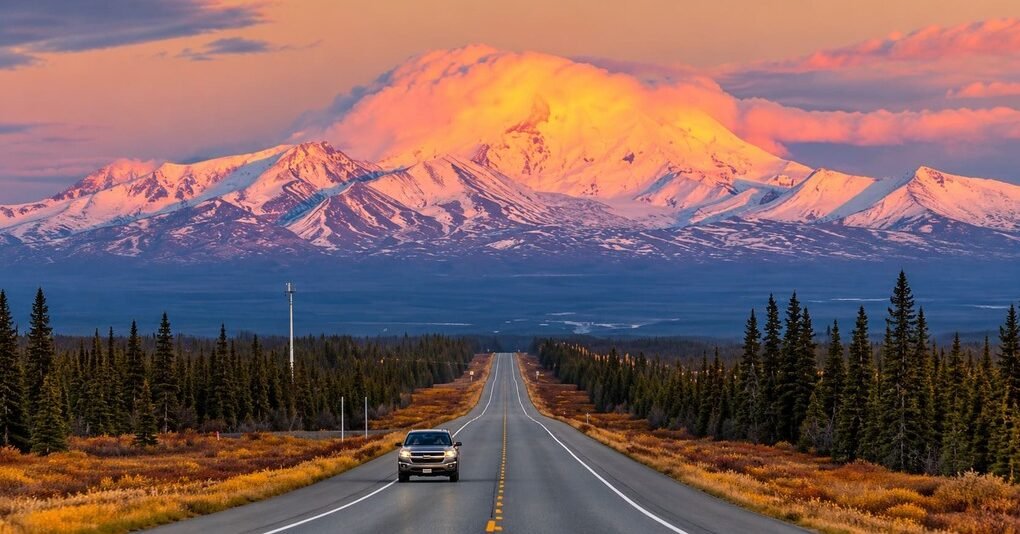
The Glenn Highway National Scenic Byway runs 135 miles from Anchorage to Glennallen, following a path shaped by ancient glaciers and passing more visible ice than almost any other road in the United States.
The Glenn Highway began as the Palmer Road, built to reach the agricultural community of Palmer, and took its current name after Captain Edwin Glenn, who led an Army expedition through the area in the 1890s searching for a gold rush route. Construction reached Glennallen in 1945, connecting to the newly built Alaska Highway and linking Alaska’s road network to the rest of North America for the first time. Until the Parks Highway opened in 1971, this was the only road between Anchorage and Fairbanks.
The route follows Knik Arm out of Anchorage before climbing into the Chugach Mountains and tracking the Matanuska River for more than half its length. Along the way it passes Wrangell-St. Elias National Park, home to the largest collection of glaciers of any national park in the country, and the Matanuska Glacier itself, one of the most accessible glaciers in Alaska by car.
The highway carries real weight beyond scenery, too, since it remains one of only two road links between Anchorage and Alaska’s Interior, which means it sees serious daily traffic alongside its tourist reputation.
Route Details: Glenn Highway National Scenic Byway
Anchorage (0 miles)
The byway begins in Anchorage, Alaska’s largest city, where the Anchorage Museum of History and Art gives a good orientation to the state before heading out. Anchorage has the route’s strongest EV charging and the last major services before the drive moves into smaller communities.
Eagle River and the Chugach foothills (15 miles)
The highway climbs into the Chugach Mountains past Eagle River, a stretch known for heavy traffic during Anchorage’s commuting hours and, during storms, drive times that can stretch well beyond normal. This section sets up the shift from city to the wide, open valley views ahead.
Palmer (42 miles)
Palmer began in the 1930s as a Depression-era farming colony and still anchors the agricultural Matanuska Valley. Independence Mine State Historical Park, a former gold mining complex in the mountains above town, is a worthwhile detour for anyone with extra time.
Sutton (56 miles)
Sutton grew up around a railroad that once hauled coal from nearby Chickaloon to Anchorage. The town today is a quieter stop along the highway, marking the transition from farmland back toward mountain terrain.
Matanuska Glacier viewpoint (102 miles)
The Matanuska Glacier is the highway’s signature stop, visible directly from the road and close enough that guided walks and even helicopter tours operate nearby for a closer look. It’s one of the most accessible glaciers in the state without requiring a flight or boat.
Mendeltna and Nelchina (115 miles)
Past the glacier, the highway continues through Mendeltna and Nelchina, where views open up toward the Nelchina Glacier and the broader landscape of Wrangell-St. Elias National Park, home to the largest collection of glaciers of any national park in the country.
Glennallen (135 miles)
The byway ends in Glennallen, which began as a construction camp during the highway’s original 1940s build and grew into a permanent community at the junction with the Richardson Highway. It has the route’s other confirmed EV charging and is the natural jumping-off point for continuing toward Valdez, Tok, or Wrangell-St. Elias.
Use the trip planner to build a day-by-day itinerary based on your available time and starting point.