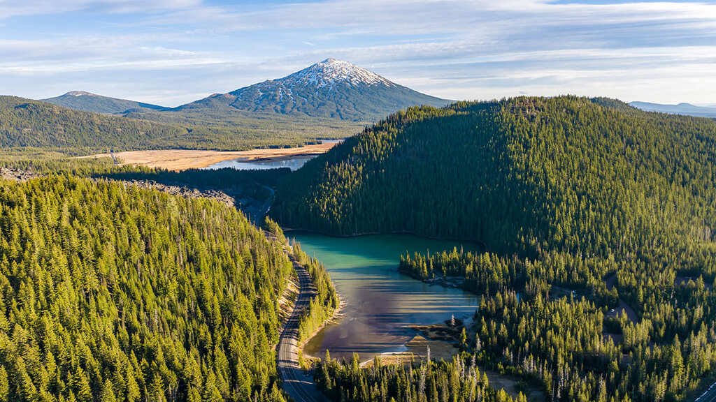
The Cascade Lakes Scenic Byway starts at the edge of Bend and climbs straight into the volcanic backbone of central Oregon. In 66 miles, it passes more than a dozen lakes, all set against Mount Bachelor, Broken Top, and the Three Sisters.
The road follows what was once Century Drive, a route used by early explorers and trappers including Kit Carson, John C. Fremont, and Nathaniel Wyeth before it became a paved forest highway. In the 1960s, it took on a stranger role: NASA sent Apollo astronauts to train along it, since the volcanic terrain resembled the lunar surface closely enough to be useful practice ground.
That volcanic and glacial history is what produced the more than 150 lakes scattered through this stretch of the Deschutes National Forest, from broad, boat-friendly Elk Lake to the striking turquoise of Devils Lake. Most sit within a short walk or paddle of the road.
The byway is seasonal, closed by snow from late fall through spring most years, which keeps the peak drive tightly windowed to summer and early fall.
Route Details: Cascade Lakes Scenic Byway
Bend to the Deschutes National Forest boundary (4.5 miles)
The byway begins at the southern edge of Bend on Century Drive (Highway 372) and reaches the Deschutes National Forest boundary after about 4.5 miles. This first stretch is the last chance for fuel, food, and a coffee run — there’s nothing resembling a town again until the far end of the route.
Mt. Bachelor (22 miles)
Mt. Bachelor Ski Area sits directly on the byway and dominates the early views west. In summer, the mountain runs its chairlift for hikers and mountain bikers who want an easier route to alpine terrain than climbing from the base. The peak itself, at over 9,000 feet, is the tallest landmark along the whole drive.
Todd Lake and Sparks Lake (25 miles)
Todd Lake is the first in the chain of alpine lakes the byway is named for, a shallow, easily accessible lake framed by Broken Top and South Sister. A short walk beyond the small parking area leads to a footbridge and lake loop trail. Nearby, Sparks Lake draws paddlers for its still water and reflection views of the surrounding peaks, and it’s a popular put-in for canoes and kayaks.
Devils Lake (28 miles)
Devils Lake’s turquoise color comes from its shallow depth and low nutrient content, closer to a Rocky Mountain glacial lake than what visitors typically expect from Oregon. It sits close enough to the road that the highway noise is noticeable, but the color and setting still make it one of the most photographed stops on the byway.
Elk Lake (33 miles)
Elk Lake is the byway’s recreation hub, with a resort, boat rentals, and enough open water for waterskiing and sailing in the summer months. It’s the most developed stop on the route and a reasonable place to break for lunch or rent gear for the afternoon.
Cultus Lake, Crane Prairie, and Davis Lake (40-55 miles)
South of Elk Lake, the byway passes a string of quieter lakes and reservoirs — Cultus Lake for swimming and camping, Crane Prairie Reservoir for fishing (it’s known locally for trophy trout), and Davis Lake, which draws far fewer visitors than the lakes closer to Bend and rewards travelers looking for solitude.
Highway 58 junction near Crescent and Odell Lakes (66 miles)
The byway ends where Forest Route 46 meets Highway 58, close to Crescent Lake and Odell Lake, both full-service recreation areas with resorts and campgrounds. From here, travelers typically either continue south toward Klamath Falls or loop back north on Highway 58 and Highway 97 to return to Bend.
Use the trip planner to build a day-by-day itinerary based on your available time and starting point.