
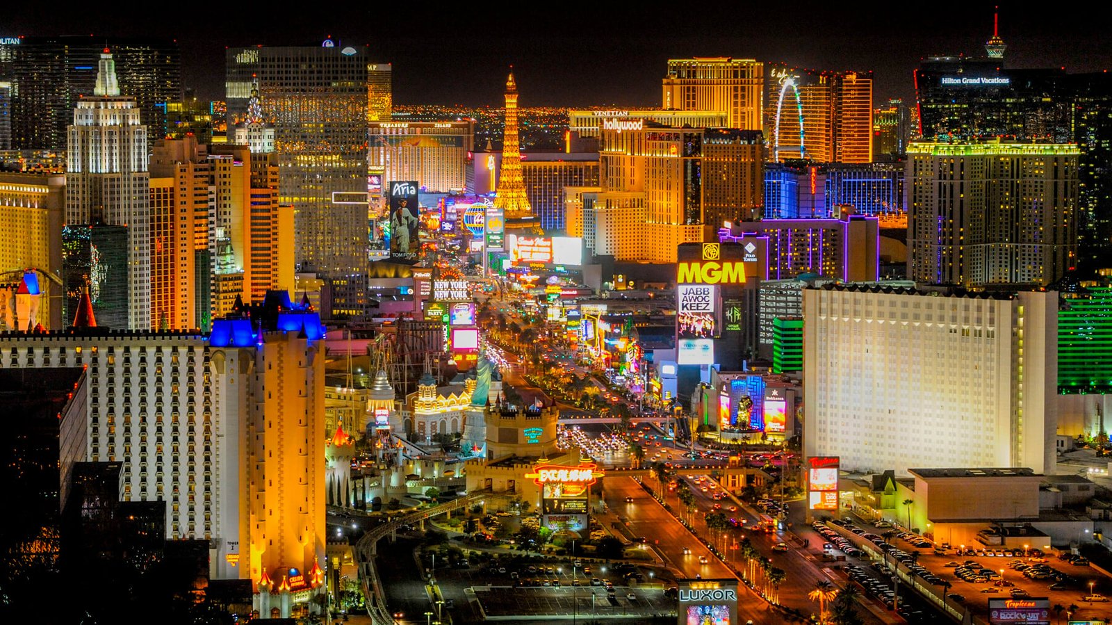
The Las Vegas Strip Scenic Byway is the only stretch of road in the country designated a scenic byway specifically for its neon. Nevada named it America’s first nighttime scenic byway in 1995, and the Federal Highway Administration made it an All-American Road in 2000, putting a four-mile stretch of casino frontage in the same federal category as mountain highways like the San Juan Skyway and Oregon’s Hell’s Canyon Scenic Byway.
The designated segment runs from Sahara Avenue south to Russell Road, covering the Strip’s major resort corridor. A separate 3.4-mile stretch north of Sahara, through the boulevard’s older motels, chapels, and downtown, earned its own National Scenic Byway status in 2009.
What makes it a byway rather than just a busy street is the sheer density of neon and architecture, all built to be seen from a moving car. The road corridor requires signs to stay lit and well maintained to keep the federal designation, which effectively writes Vegas’s visual identity into transportation policy.
It’s a different kind of byway than anything else on this list — no mountains, no rivers, just four miles of the most photographed road in the country, best experienced slowly and after dark.
Route Details: Las Vegas Strip Scenic Byway
Stratosphere and the Las Vegas Strip’s north end (0 miles)
The Strip byway begins near the Stratosphere, the only major Strip resort actually located within Las Vegas city limits — everything south of it technically sits in the unincorporated communities of Winchester and Paradise. This is where the boulevard shifts from its downtown character into the dense resort corridor most visitors picture as “the Strip.”
The Welcome to Fabulous Las Vegas sign (1 mile)
The Welcome to Fabulous Las Vegas sign, built in 1959, sits along this stretch and remains one of the most-photographed roadside markers in the country. It marks the informal southern gateway to the Strip’s classic era, even though the modern resort corridor extends well past it.
Central resort corridor: Bellagio, Caesars Palace, the Venetian (2 miles)
The middle of the byway holds the highest concentration of major resorts — Bellagio, with its choreographed fountain shows on the lake out front, Caesars Palace, and the Venetian with its canal and gondola rides. This stretch is where traffic slows most and where the Strip’s nighttime lighting is at its most concentrated.
Mandalay Bay and the Las Vegas Strip’s south end (4 miles)
The southern end of the byway runs past Mandalay Bay and the newer resort development toward Russell Road, marking the end of the federally designated All-American Road segment. South of here, the boulevard continues but loses its scenic byway status.
Downtown segment: Sahara Avenue to Washington Avenue (separate 3.4-mile stretch)
North of Sahara Avenue, a separate National Scenic Byway designation covers the boulevard through what was the original Las Vegas Strip, where the city’s first hotels and casinos opened in the early to mid-20th century. This stretch holds vintage neon signs relocated from the Neon Museum’s collection, along with older motels, wedding chapels, and bars that predate the megaresort era.
Fremont Street Experience (downtown)
Continuing north into downtown Las Vegas, the boulevard passes the Fremont Street Experience, a pedestrian corridor under a canopy of LED lighting, along with the Old Las Vegas Mormon Fort State Historic Park and the Neon Museum, which preserves retired casino signage as outdoor exhibits. This is the historic core of the city, distinct in character from the modern Strip a few miles south.
Use the trip planner to build a day-by-day itinerary based on your available time and starting point.