The Historic Bluff Country Scenic Byway runs 88 miles along Minnesota State Highway 16, from La Crescent on the Mississippi River west to Dexter near Interstate 90, cutting through the Driftless Area of southeastern Minnesota.
Ice Age glaciers never flattened this corner of the state, leaving behind steep limestone bluffs, deep river valleys, and hundreds of sinkholes that make the landscape look nothing like the rest of southern Minnesota. The Federal Highway Administration designated the route a National Scenic Byway in 2003, following an earlier Minnesota state scenic byway designation.
The drive follows the Root River for much of its length before the river empties into the Mississippi, passing through small towns including Preston, Lanesboro, Whalan, Rushford, and Houston. Many of these towns installed EV charging specifically to serve travelers on this byway, making it one of the more EV-friendly rural drives on this site.
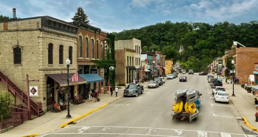
Beyond the scenery, the route passes working Amish farms, trout streams that draw anglers from across the Midwest, and well-preserved small-town downtowns that have leaned into tourism without losing their working character.
Route Details: Historic Bluff Country National Scenic Byway
La Crescent (0 miles)
The byway begins in La Crescent on the Mississippi River, where Highway 16 heads west into the bluffs. La Crescent has the route’s first confirmed EV charging, with two Level 2 chargers at the La Crescent Area Event Center.
Hokah and Houston (10 miles)
Hokah, whose name means root in a regional language and reflects both its history and its riverfront setting, marks the entry into the Root River valley proper. Houston, a bit farther west, installed its own EV charger in 2023 and is also home to the International Owl Center.
Rushford and Caledonia (25 miles)
Rushford is a town filled with parks and trails along the river, with a rich Amish-tourism presence including sightseeing tours. Caledonia, a short distance off the main route, is another of the small towns that added charging specifically to serve Highway 16 travelers.
Lanesboro (40 miles)
Lanesboro is the heart of the byway, often called the bed-and-breakfast capital of Minnesota. The Root River runs straight through downtown past the Stone Dam, built in 1868 and listed as a historic site, and the Lanesboro Historic Preservation Museum covers the town’s history through artifacts and memorabilia. Lanesboro has two Level 2 chargers at the Poetry Parking Lot.
Whalan and the Amish backroads (48 miles)
West of Lanesboro, the byway passes through Whalan, another small historic district along the Root River Trail. The stretch between here and Preston is where Old Order Amish farms are most visible, with roadside stands selling baskets, quilts, and homemade jams.
Preston (55 miles)
Preston calls itself the Trout Capital of Minnesota and is home to the National Trout Center, with a large trout statue near the visitor information booth. The town has three separate EV charging locations, including a fast charger installed through a partnership between Preston Public Utilities and the Southern Minnesota Municipal Power Agency.
Fountain and Forestville (65 miles)
Near Fountain, the byway passes close to the Historic Forestville Townsite, an early settlement founded in 1853, now preserved as a living-history site within Forestville/Mystery Cave State Park, which also holds one of Minnesota’s largest cave systems.
Spring Valley (75 miles)
Spring Valley is another of the byway’s EV-equipped towns, with charging installed through the same regional utility partnership as Preston. It’s a good last stop for food or a charge before the final stretch to Dexter.
Dexter (88 miles)
The byway ends in Dexter, near the junction with Interstate 90. It’s a quiet close to a drive that spent its length tracing bluffs, rivers, and small towns, with the interstate offering an easy connection onward in either direction.
Use the trip planner to build a day-by-day itinerary based on your available time and starting point.