
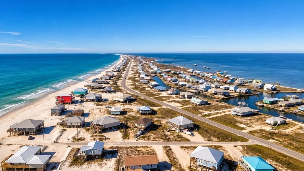
Alabama’s Coastal Connection Road runs about 130 miles around Mobile Bay, from Grand Bay near the Mississippi border to Daphne on the bay’s eastern shore.
The route circles nearly the entire bay, crossing the mouth of it by ferry between Dauphin Island and the Fort Morgan Peninsula. That crossing passes near Fort Gaines and Fort Morgan, two Civil War-era forts that faced each other during the 1864 Battle of Mobile Bay.
Much of the drive runs along working waterfronts, protected wildlife refuges, and Gulf Coast beach towns, with Bayou La Batre known locally as the seafood capital of the state. It’s the longest of Alabama’s designated scenic byways, and it received National Scenic Byway status in 2009 after being designated at the state level five years earlier.
Most people spend 3 to 4 days on the route, splitting time between beaches, wildlife refuges, and the ferry crossing itself.
Route Details: Alabama’s Coastal Connection Road
Grand Bay to Bayou La Batre (20 miles)
The route begins near Grand Bay, close to the Mississippi state line, and heads south toward Bayou La Batre, known locally as the seafood capital of Alabama, where shrimp and oyster boats still unload catch at the town’s docks. A few miles north, Bellingrath Gardens and Home has 65 acres of gardens with different blooms depending on the season, azaleas in spring and camellias in winter among them.
Bayou La Batre to Dauphin Island (25 miles)
The road continues to Dauphin Island, a barrier island connected to the mainland by bridge. The island holds the Dauphin Island Audubon Bird Sanctuary, 137 acres of forest, marsh, and dune habitat used by migrating birds, along with the Dauphin Island Sea Lab’s public aquarium, which includes a touch pool and a boardwalk over living marsh.
Dauphin Island to Fort Morgan Peninsula (ferry crossing, about 40 minutes)
The Mobile Bay Ferry carries vehicles across the mouth of the bay to the Fort Morgan Peninsula, a crossing that runs on a set schedule and depends on weather conditions. Fort Gaines, on Dauphin Island, and Fort Morgan, at the peninsula’s tip, faced each other during the 1864 Battle of Mobile Bay, where Union Admiral David Farragut gave the order later remembered as “damn the torpedoes, full speed ahead.”
Fort Morgan Peninsula to Gulf Shores and Orange Beach (25 miles)
This stretch runs along Alabama’s main Gulf Coast beaches, with white sand comparable to the Florida Panhandle. Gulf State Park, just outside Gulf Shores, has more than 28 miles of paved trails through wetlands and coastal forest, part of the Hugh S. Branyon Backcountry Trail system, along with three learning centers focused on the park’s ecology.
Orange Beach to Daphne (35 miles)
Heading north along the bay’s eastern shore, the route passes through Elberta, Foley, and Magnolia Springs before reaching Fairhope and Daphne. Weeks Bay National Estuarine Research Reserve, one of only 27 such reserves in the country, sits along this stretch, protecting a mix of freshwater and saltwater habitat where the Fish and Magnolia Rivers meet the bay.
Use the trip planner to build a day-by-day itinerary based on your available time and starting point.