
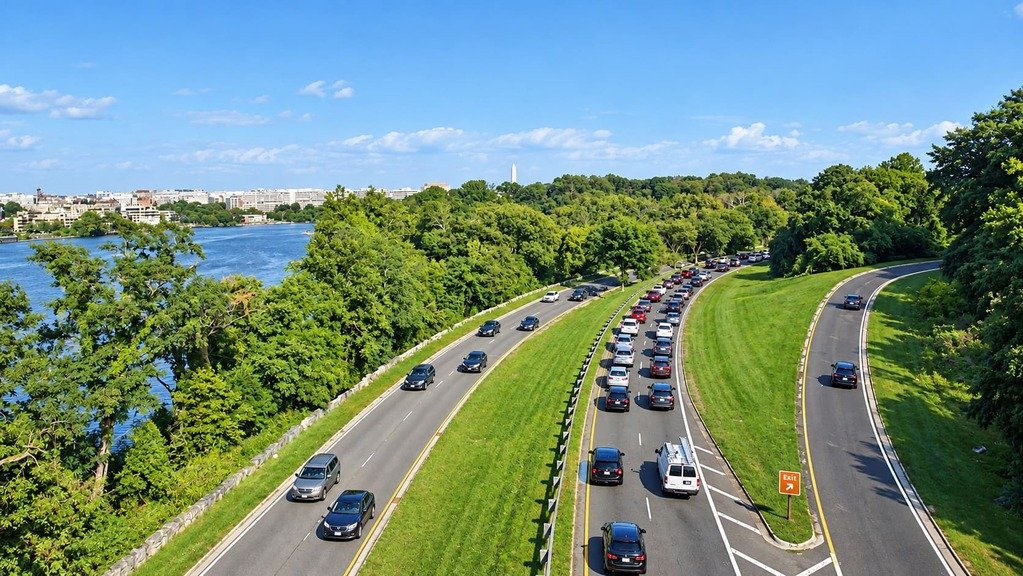
The George Washington Memorial Parkway runs about 25 miles along the Potomac River in Virginia, from George Washington’s Mount Vernon estate north to the Capital Beltway, built specifically to connect the first president’s home to the national capital in a way worthy of the connection.
The idea dates to the 1880s, when Alexandria residents first proposed a dedicated road to Mount Vernon. Congress authorized the project in 1930 under the Capper-Cramton Act, and the first section opened in 1932, timed to George Washington’s 200th birthday. It was proclaimed, at the time, America’s Most Modern Motorway.
The parkway grew out of the City Beautiful movement’s early-20th-century planning philosophy, designed as a continuous landscaped drive rather than a conventional highway, with the Potomac River as a constant companion. It links Arlington National Cemetery, Old Town Alexandria, and Great Falls Park along the way, alongside sweeping views of the Washington Monument and other national monuments across the river.
It’s one of the shortest routes on this site, but also one of the most historically dense, built entirely around the idea that the drive itself should be part of the experience of visiting these places.
Route Details: George Washington Memorial Parkway
Mount Vernon (0 miles)
The parkway begins at Mount Vernon, George Washington’s plantation home, which drew sightseers even during his lifetime and continued to grow in popularity with each generation after his death. It’s the parkway’s namesake site and a natural starting point for the drive north.
Fort Hunt Park (5 miles)
Fort Hunt Park preserves the remains of a Spanish-American War-era coastal defense installation, later used during World War II for a secret intelligence operation interrogating German prisoners. It’s a quieter stop along the parkway’s southern stretch, with picnic areas along the river.
Old Town Alexandria (10 miles)
The parkway runs along the waterfront through Old Town Alexandria, one of the best-preserved 18th-century districts on the East Coast, with cobblestone streets and colonial-era architecture just steps from the water. It’s one of the most popular stops for a longer break during the drive.
Reagan National Airport and Gravelly Point (14 miles)
The parkway passes directly alongside Ronald Reagan Washington National Airport, and Gravelly Point, a riverside park just north of the runway, has become a well-known spot for watching planes take off and land at close range, with Washington’s monuments visible across the water.
Arlington National Cemetery and the Pentagon (16 miles)
This stretch of the parkway runs past Arlington National Cemetery and the Pentagon, two of the most visited and significant sites in the national capital region. It’s a solemn, monument-dense section of the drive before the route curves north along the river.
Theodore Roosevelt Island (18 miles)
Theodore Roosevelt Island sits in the Potomac just off the parkway, a wooded memorial island reachable by a pedestrian bridge, with trails leading to a large memorial plaza honoring the conservationist president. It also marks the southern end of the Mount Vernon Trail’s parallel bike path.
Chain Bridge and the transition north (20 miles)
Near Chain Bridge, the parkway continues north while the Maryland side of the original route, renamed the Clara Barton Parkway in 1989, splits off across the river. The Virginia side continues through wooded, undulating terrain built in stages between 1930 and 1965.
Great Falls Park (25 miles, via connecting roads)
Though technically reached via the Capital Beltway and Georgetown Pike rather than the parkway’s main line, Great Falls Park is the natural extension of a trip up the parkway, where the Potomac River drops through a dramatic rocky gorge. It’s one of the most popular add-on stops for anyone finishing the drive at the Beltway.
Capital Beltway (25 miles)
The Virginia section of the parkway ends at the Capital Beltway (I-495) near McLean, where the original Mount Vernon-to-Great Falls vision set out in the Capper-Cramton Act effectively concludes.
Use the trip planner to build a day-by-day itinerary based on your available time and starting point.