
The Copper Country Trail runs 47 miles up US 41 through the Keweenaw Peninsula, a narrow finger of land pointing northeast into Lake Superior at the top of Michigan’s Upper Peninsula. It starts at the Portage Lake Lift Bridge, which links the twin cities of Houghton and Hancock, and ends at Copper Harbor at the peninsula’s tip.
For about 150 years, this was the center of a copper mining boom that pulled roughly 12 billion pounds of metal out of the ground. In the 1800s, the region produced about three-quarters of the nation’s copper, and the mines drew immigrants from Finland, Cornwall, Italy, and other parts of Europe.
Copper is no longer mined at scale, but the mines, company towns, and mining-era downtowns are still there. Many have been preserved as museums or kept as working small towns.
The drive combines that history with forest, lake shoreline, and a long list of short side trips to lighthouses, waterfalls, and beaches.
Route Details: Copper Country Trail
Mile markers below are approximate distances from the Lift Bridge.
Portage Lake Lift Bridge, Houghton and Hancock (0 miles)
The byway starts at the Portage Lake Lift Bridge, a double-decked lift bridge that spans the waterway between Houghton and Hancock. Both towns have preserved downtowns with restaurants and shops, and Houghton is home to Michigan Technological University. Keweenaw Brewing Company is a common first stop.
Quincy Mine, Hancock (2 miles)
The Quincy Mine sits just minutes from the bridge, on the hillside above Hancock. Visitors can tour the surface buildings and ride down into part of the mine, and the massive hoist house is a landmark of the copper era.
McLain State Park (10 miles)
A short spur off the byway leads to McLain State Park, a beach and campground on Lake Superior. It is a popular place for sunset views and for a swim on warm days, though the water stays cold year-round.
Calumet (14 miles)
Calumet was once a major mining town and now contains much of Keweenaw National Historical Park. The Calumet Theatre, more than 110 years old, still hosts performances, and the Coppertown USA Mining Museum covers the local mining story. The surrounding downtown has been kept largely intact.
Delaware Mine and Central Mine (35 miles)
Farther north, the Delaware Mine offers underground tours of a working-era copper mine. Nearby, Central Mine is a preserved mining village with a small collection of buildings and a church on the hillside, one of the better ghost town stops on the peninsula.
Eagle River and Eagle Harbor spurs (40 miles)
Short spur roads lead to Eagle River, with its waterfall and beach, and to Eagle Harbor, a small village with a lighthouse on Lake Superior. Both are worth adding to the drive if time allows.
Copper Harbor (47 miles)
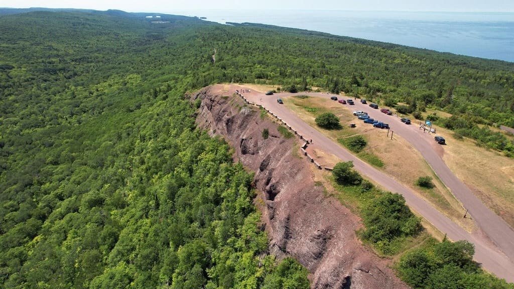
The byway ends at Copper Harbor, the northernmost mainland point in Michigan and a village that fills up with mountain bikers and hikers in summer. Fort Wilkins State Park preserves an 1840s military fort with restored buildings and costumed interpreters. Brockway Mountain Drive, a scenic road above the village, gives wide views over the lake and is open seasonally.
Use the trip planner to build a day-by-day itinerary based on your available time and starting point.